
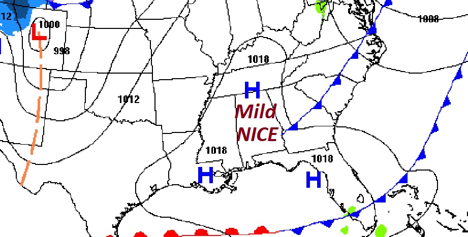
Good Morning! Our new week will start quiet. Today looks like a nice day for late November. It will be the nicest day this week. Enjoy, because a significant storm system will bring a severe weather threat to our state by Tuesday night/Wednesday, followed by sharply colder air behind the front. Here’s my brief forecast discussion.
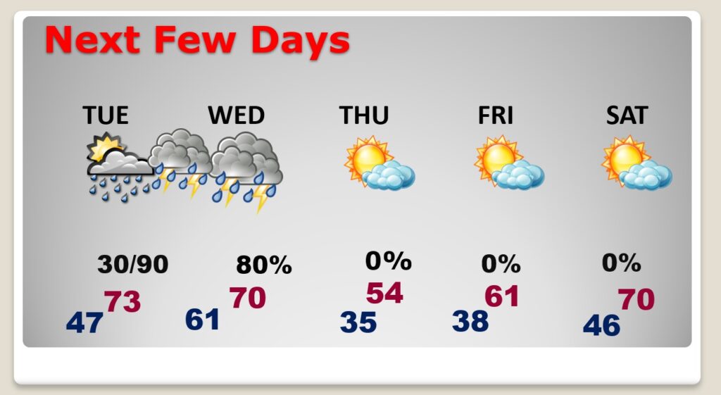
TODAY: Windy at times today. Southwest winds gusting as high as 30 mph. Clouds early. Becoming mostly sunny. High in the mid 60’s. Mainly clear tonight. Chilly, Low 46.
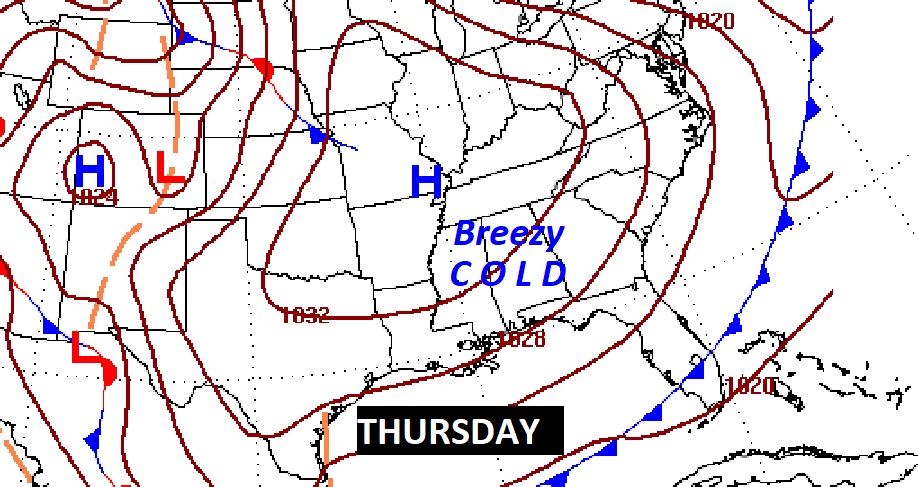
NEXT FEW DAYS: Warmer Tuesday…high in the low to mid 70’s. Small chance of scattered showers and maybe a thunderstorm Tuesday afternoon. Increasing chance of showers and maybe some strong/severe storms Tuesday night and through mid-day Wednesday. Breezy and much cooler Thursday. Expect 30’s Wednesday night. Thursday’s high will barely reach 54. Wind will make it seem cooler. We’ll be storm-free Friday & Saturday. A little warmer Saturday.
SIGNIFICANT STORM SYSTEM: A major storm system will affect the Gulf South Tuesday through Wednesday.
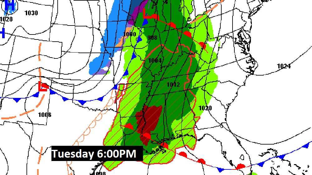
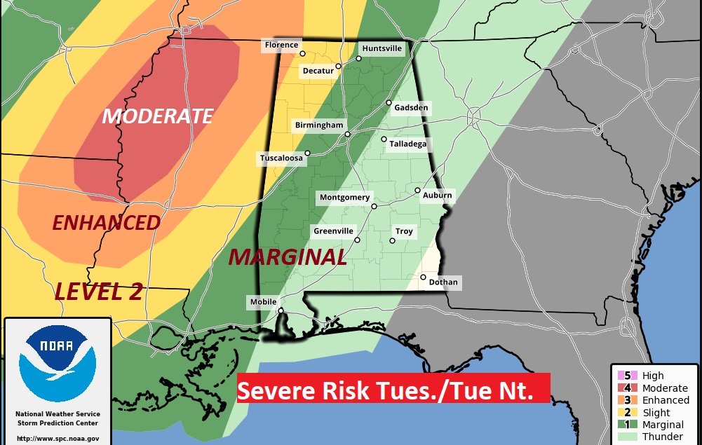
SPC already has a rather significant severe threat already outlined just west of us on Tuesday. There is a LEVEL 4 threat near the Mississippi river. The severe threat spills into Alabama Tuesday night into Wednesday. The BEST news for Alabama: the main severe weather dynamics will start to race away toward the Great Lakes as the front approaches our state. In other words, hopefully the severe weather threat will start to fizzle quickly before the front reaches our doorstep in the wee hours of Wednesday morning. Here’s the Storm Prediction Center’s outlook for Tuesday through 6AM Wednesday. There could be a significant Tornado Outbreak out to the west of us on Tuesday. SPC says there could be some strong long-tracked tornadoes in parts of Mississippi, Arkansas, Tennessee and Louisiana. Of course, we are in the heart of the tornado season.
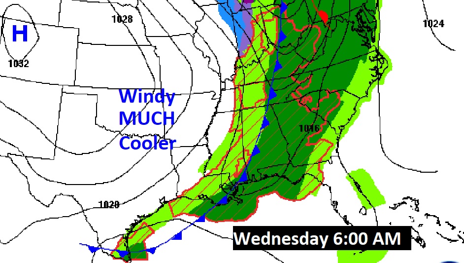
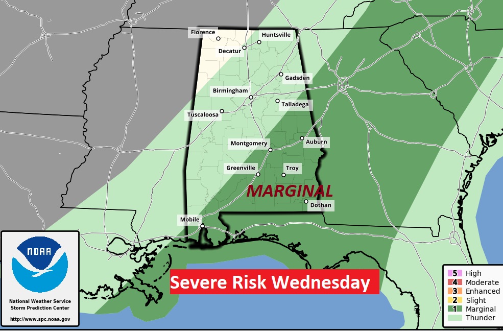
Here’s SPC Severe Outlook starting at 6AM Wednesday. Marginal Severe Weather risk for many of us east of the front.
We’ll know more and more about this storm threat as we get closer to the event. Much cooler air will follow. 30’s Wednesday. Windy and cold Thursday.
Thanks for reading this Blog this morning! This morning we are LIVE on the radio from 6 to 9 on NewsTalk 93.1. Watch us on TV on CBS 8 and ABC 32. I’ll have another update for you in the morning. Have a nice day!
–Rich