
10:30 update:
Unfortunate new escalation of the severe weather threat area eastward, from the Storm Prediction Center. The Level 4 Moderate Risk now covers NW Alabama, with an expansion of the Enhanced Risk in the westerner and west central counties. Plus, the Level 2 threat area has been expanded quite a bit eastward to an Auburn, Troy, Red Level line through tonight until 6AM Wednesday. The tornado threat has increased in Alabama with this update.
EARLY MORNING UPDATE:
Good Morning! All eyes on a significant storm which will affect the southern US today, tonight and Wednesday. There is a dangerous severe weather threat looming for much of the Gulf South, starting this afternoon in states west of us and evolving eastward in the overnight hours. Although the threat level is highest in Mississippi, we are going to have to be ready, and watchful for watches and warnings here in Alabama, especially tonight and early Wednesday. This will include a tornado threat. Here’s my morning forecast discussion.
DANGEROUS STORM SYSTEM: A powerful storm system will bring a dangerous severe weather threat to multiple states across the Gulf south today and tonight. Warm moist Gulf air will be one of the many factors, along with ample instability (CAPE) and very favorable directional shear with altitude. The Severe Weather checklist is particularly disturbing west of Alabama today and tonight. But, even here in Alabama, we’ll need to be ready for multiple watches and warnings in the overnight hours tonight.
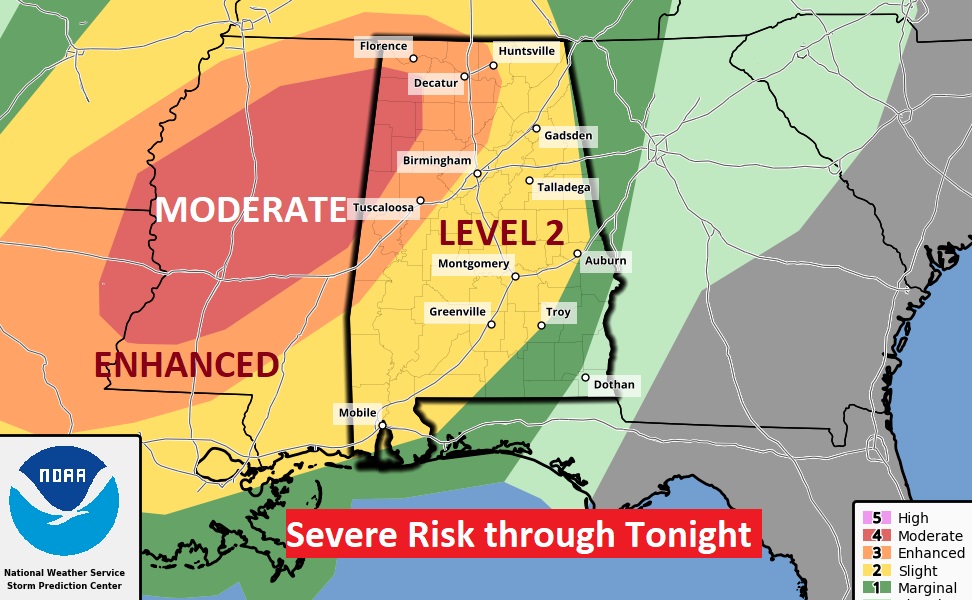
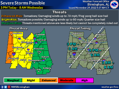
The Severe Weather Outlook from the Storm Prediction Center shows that disturbing Level 4 Moderate threat dominating much of Mississippi. Some strong to violent, long-tracked tornadoes are likely. But, now, the Enhanced risk has eased eastward into far west Alabama. There’s even a Level 2 risk as far east as I-65. All modes of severe weather are on the board including damaging thunderstorm winds, tornadoes and large hail. This outlook is valid through 6AM Wednesday morning.
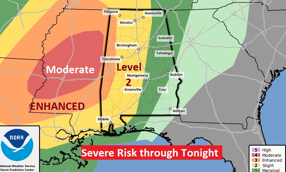
UPDATED TIMELINE: There is a risk for severe weather across Central Alabama from 3 pm Today to 8 am Wednesday. Risks include tornadoes, damaging winds to 70 mph, and hail up to ping pong ball size. #alwx
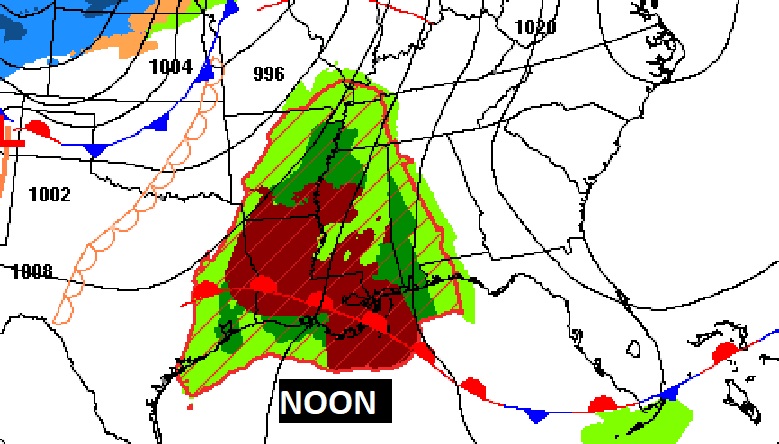
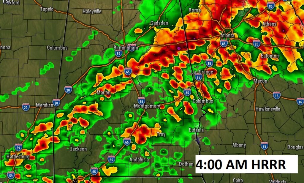
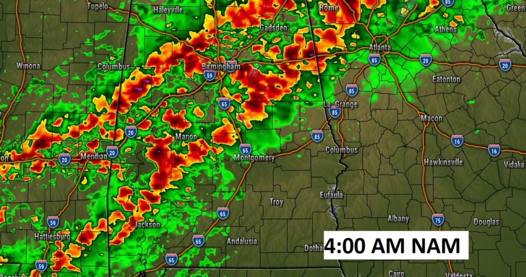
Radar will be quite active with showers and storms beginning late this afternoon and into the evening hours. But, for many of us, the prime threat for severe storms will be in the overnight hours.
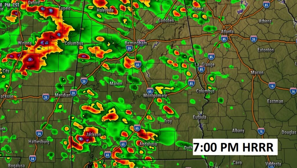
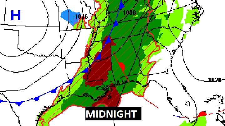
Various high-res models suggest a broken line of strong/severe storms will be marching eastward in the wee hours of the overnight hours tonight. Some of the storms may start to rotate and drop tornadoes. Obviously, the overnight hours are a particularly dangerous time to have a tornado threat. It’s all too common here in Dixie Alley.
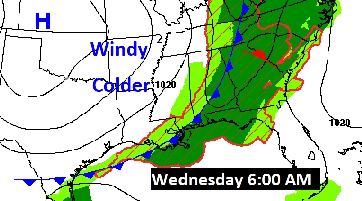
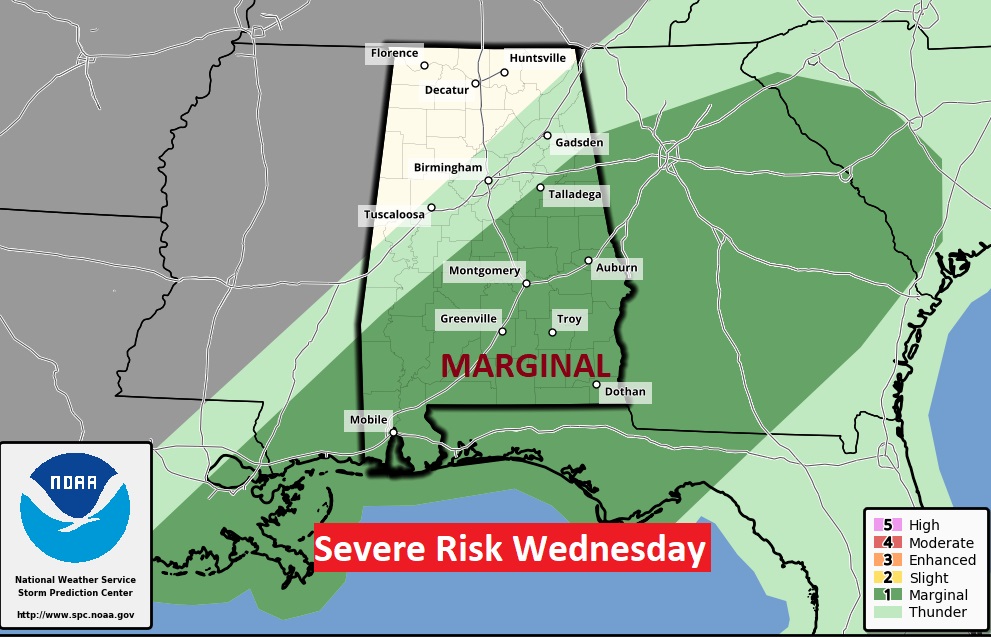
After 6AM Wednesday morning, the Severe Weather Threat continues eastward and covers most of central and southeastern Alabama ahead of the cold front. Marginal Severe Risk.
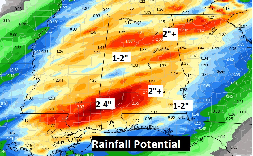
In a convective situation like this, rainfall amounts will vary quite a bit. Some towns could see some locally heavy rainfall amounts.
Much cooler air funnels in Wednesday afternoon, Wednesday night and Thursday.
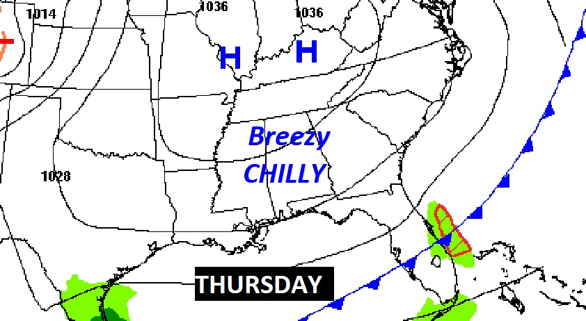
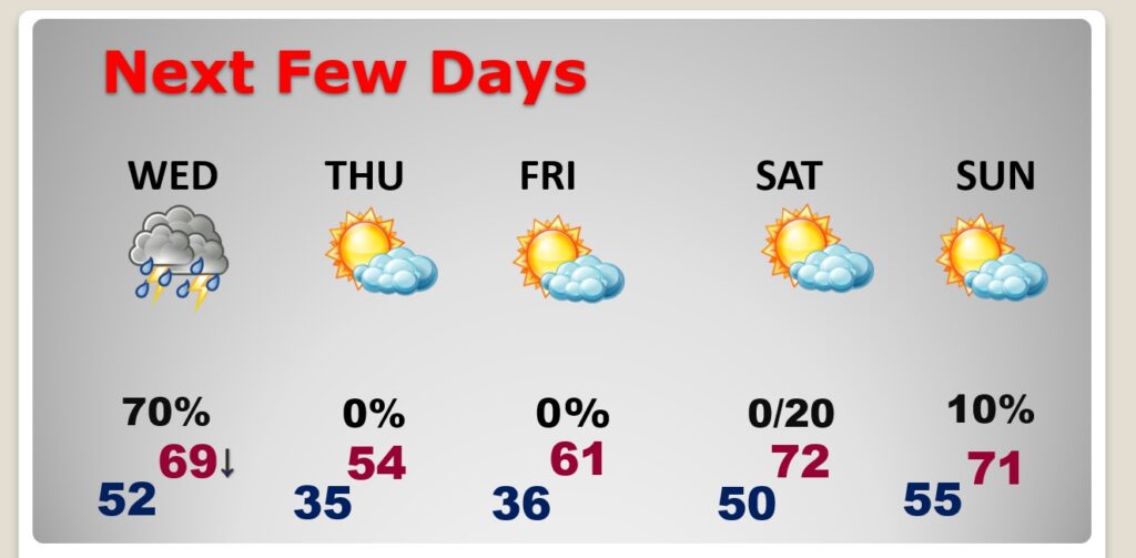
NEXT FEW DAYS: The threat of strong/severe storms will continue Wednesday morning. Breezy and much cooler Wednesday afternoon. Expect 30’s Wednesday night. Thursday’s high will barely reach 54. Wind will make it seem cooler. We’ll be storm-free Friday & Saturday. A little warmer Saturday.
Thanks for reading this Blog this morning! This morning we are LIVE on the radio from 6 to 9 on NewsTalk 93.1. Watch us on TV on CBS 8 and ABC 32. Obviously, there will be no “regular” update tomorrow morning, because I’ll be covering ongoing severe weather. Stay weather aware.
–Rich