
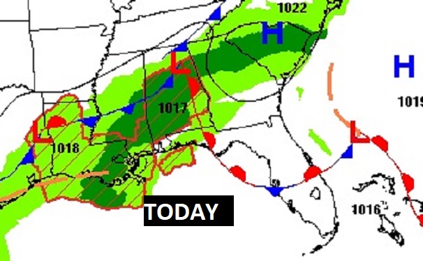
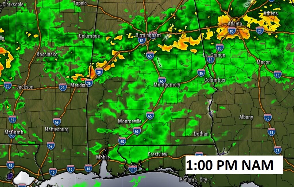
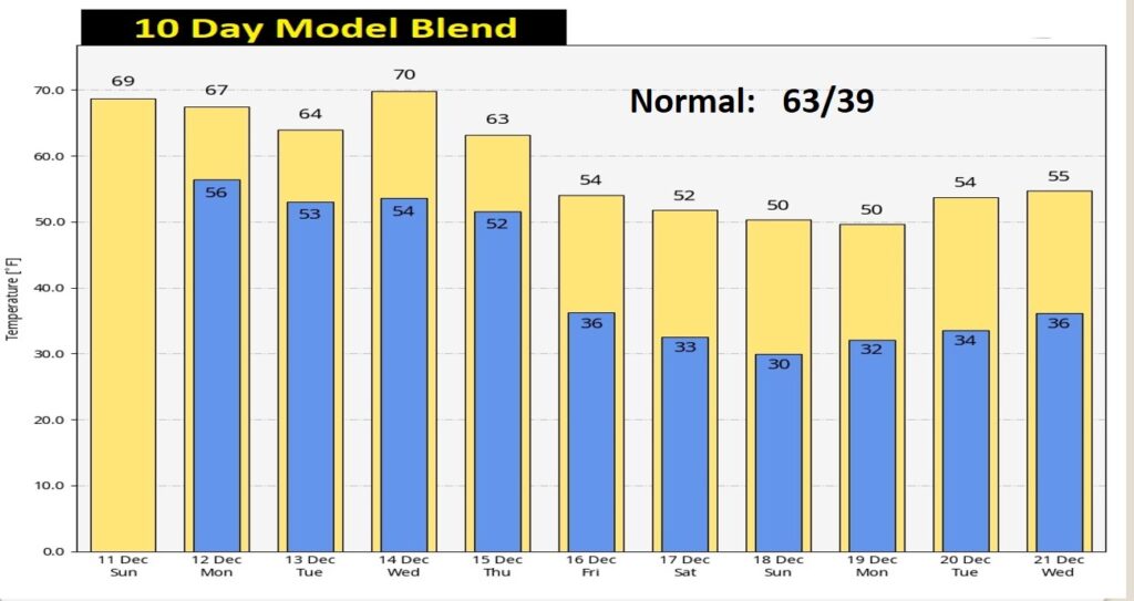
Good Morning! Radar will become active today. It will be wet at times today and into the evening hours tonight. Our temperatures are starting to level off. Monday and Tuesday will be several degrees cooler with a small rain chance.
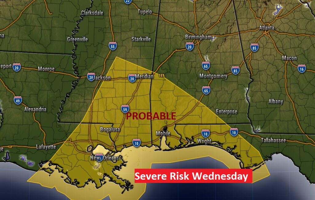
The main storm system this week arrives Wednesday. This system could bring severe weather to parts of Alabama. Much cooler air will follow the storm system, especially by Friday and beyond.
TODAY: Dense fog advisory once again this morning until 9AM. Visibility near or below ¼ mile in spots.
Expect a cloudy day today. Scattered showers are a good bet from time to time today and well into the evening hours tonight. High near 70. SW wind at 5 to 10 mph. Very mild tonight. Low 57.
NEXT FEW DAYS: Small rain chance Monday through Tuesday. It will be quite a bit cooler with highs in the 60’s. (Normal hi/lo 63/39) Showers and storms likely Wednesday. Potential Severe Weather Threat Wednesday, along with locally heavy rainfall. Quite a bit cooler Thursday. And, Much cooler Friday.
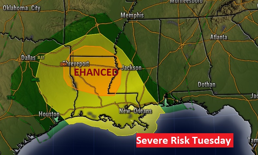
There will be a significant coast to coast storm system crossing our country this week. In some states, this storm will produce blizzard conditions. Across much of the South, Severe Weather will be a significant risk.
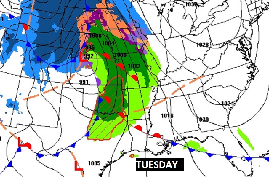
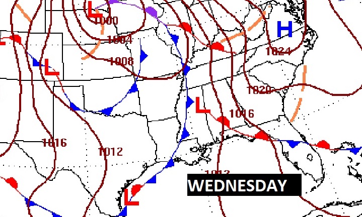
The Storm Prediction Center has outlined a rather significant Severe Risk west of us in Mississippi, Louisiana, Arkansas and Texas on Tuesday, including the threat of tornadoes. On Wednesday, SPC shows the strongest severe weather threat across SE Mississippi and SW Alabama. We’ll continue to watch for any changes in this threat level as we get closer to this event.
Following the two cold fronts late next week, temperatures will turn sharply cooler from about Friday the 16th and beyond.
Thanks for reading this Blog this morning! I’ll have another update for you in the morning. Have a nice day!
–Rich