
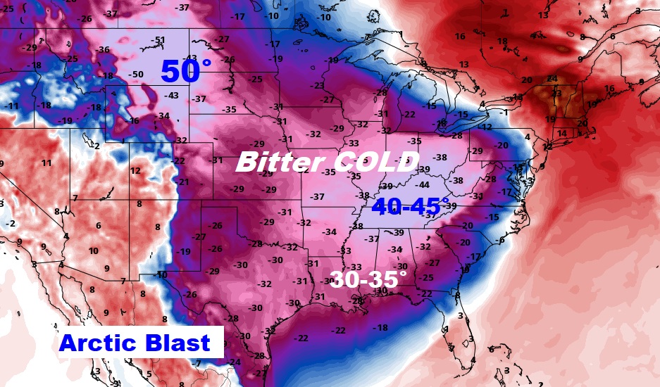
Good Morning! Our Arctic shocker continues. It’s a bitterly cold Christmas Eve. Early this morning, temperatures have already reached the lower teens with Wind Chill approaching zero in spots. It’s likely that most towns will not reach above Freezing today. Winds will make it seem colder all day. Attention Santa: we’re headed back to the teens tonight. Christmas will be quite cold, but not quite as windy. Just before Noon Christmas, we may finally get above freezing for the first time in about 53 hours. The news gets MUCH better next week. We have a major warming trend ahead. We’ll be well into the 60’s by Thursday and quite through New Years Weekend. Here’s my brief forecast discussion.
CLIMATE DATA: Friday’s official high in Montgomery today was 52° at Midnight. We had a 32° temperature drop between midnight and 7am. Low this morning, 20°, windchill 3. High this afternoon was only 27, wind chill max 13. Peak wind gist 39mph. A remarkable day in our weather history.
TODAY: Early morning temperatures in the lower teens with Wind Chill -2 to 4 above. Today will be Blustery, again. Very cold. Breezy. Today’s high may not make it to Freezing. But, gusty northwest winds 10 to 20 will make it seem much colder. It will be mostly sunny today and mostly clear tonight. Wind Chill Advisory and Hard Freeze Warning. Low tonight 17. .
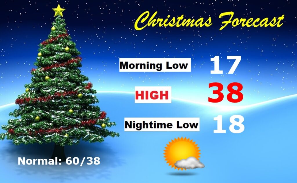
CHRISTMAS OUTLOOK: Last Christmas was warm (77°) This year will be quite cold. Morning low in the mid teens. Morning Wind Chill near 10. Daytime high upper 30’s. Mostly sunny. Not quite as windy. Nighttime low in the mid to upper teens. Normal of 60/38. No snow or ice to worry about, though, so travel will not be a problem.
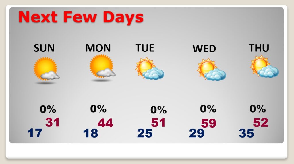
NEXT FEW DAYS:
Monday will be a little better. Sunny and dry. Teens in the morning, and the high will only reach 44. Not quite as cold Tuesday. High 51. Looks like near 60 by Wednesday. Warmer Thursday, with a high mid 60’s. Chance of showers late Thursday night, and a better chance Friday.
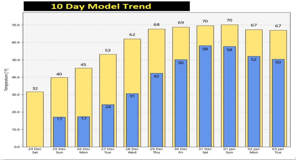
You’ll love the 10 day model temperature trend. By late next week, highs recover to the upper 60’s. We’ll be near 70 December 31 through January 2.
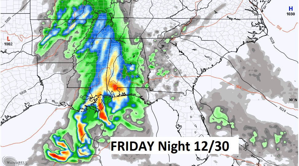
But, we also may have to deal with showers and thunderstorms. Here’s the map for Friday Night 12/30 and 6PM. (Euro model)
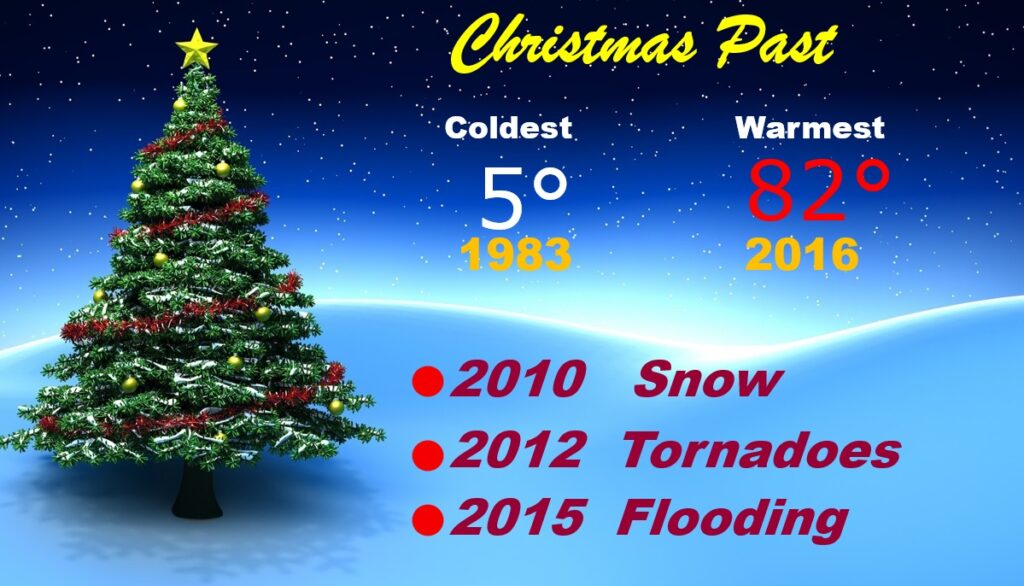
CHRISTMAS PAST: This will be the 45th Christmas I covered for you. The coldest was 5 in 1983. Warmest 82 in 2016. We had snow flurries in 2010. Dozens of tornadoes in 2012. Flooding in 2015. We’ve seen a variety of weather.
Tracking Santa through the years….Fun Times!
Thanks for reading this Blog this morning! I’ll have another update for you in the morning. Merry Christmas!
–Rich