
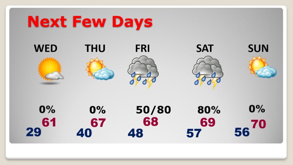
Good Morning! The Cold air will fade quickly. Today, our high will probably reach the lower 50’s. That’s still below normal, but it’s a start. Each day this week will be a little Warmer. We’ll be into the lower 60’s by Wednesday and the upper 60’s on Thursday. Showers and thunderstorms will return to the forecast on Friday and Saturday. Spring-like temperatures are on the way soon. Here’s my brief forecast discussion.
CLIMATE DATA: Yesterday was cold, but not as cold as Christmas weekend. The morning low was 18. The afternoon high was 48. (Normal 60/38). We had about 15-20 minutes of brief, light snow flurries in Montgomery just before Midnight. The flakes melted as they fell, with temperatures above freezing.
TODAY: A good bit of sunshine today and not quite as cold. High 52. East wind at 5 to 10. Low tonight in the upper20’s. Normal: 60/38.
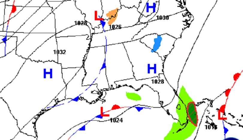
A weak front drifts through the area today. We’ll fall into the upper 20’s tonight.
NEXT FEW DAYS: Each day this week will be a little Warmer. We’ll be into the lower 60’s by Wednesday and the upper 60’s on Thursday. Showers and thunderstorms will return to the forecast on Friday and Saturday.
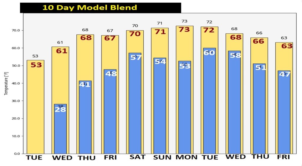
Nice turn-around ahead. By late next week, highs recover to the upper 60’s Thursday through Saturday. We’ll be near or above 70 New Years Day and dry.
Here’s the 10 day Model Temperature trend. Looks like a nice turnaround this week. Expect Spring-temperatures, mid to late week and through the New Years weekend.
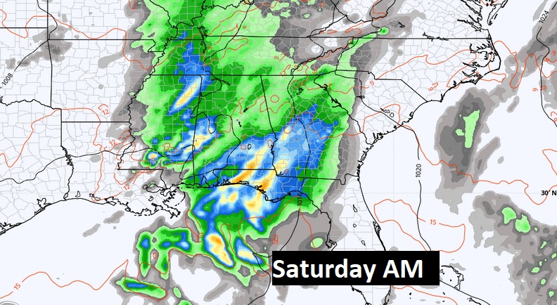
But, we also may have to deal with showers and thunderstorms, starting Friday, through Saturday. Looks like another storm system will affect our area in about a week from now.
Thanks for reading this Blog this morning! This morning we are LIVE on the radio from 6 to 9 on NewsTalk 93.1. Watch us on TV on CBS 8 and ABC 32. I’ll have another update for you in the morning. Have a nice day!
–Rich