
Good Morning! We have a very abbreviated update this morning due to several hours of Severe Weather Coverage that continued overnight. The storm system, which brought the severe weather, will be moving into southeast Alabama this morning. For most of us, the risk of showers and storms will end early. Look for gradual improvement, especially by this afternoon. Cooler days and colder nights are on the horizon, but we should be storm free for the next few days.
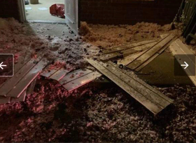
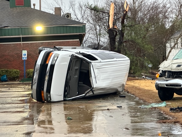
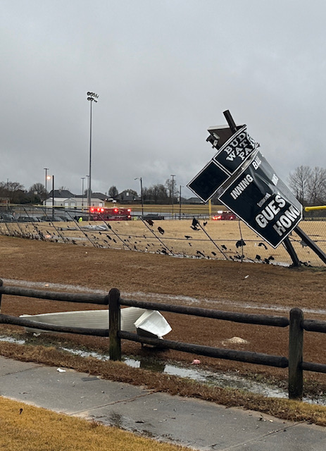
EAST MONTGOMERY TORNADO DAMAGE: A quick hitting tornado touchdown around 3:13 AM this morning….perhaps starting around Bell Rd and Eastwood Glenn and then skirting through the AUM Soccer field area, across Taylor to Halcyon Blvd. Considerable damage to Buddy Watson Park, and several overturned vehicles on Halcyon. EMA Director Christina Thornton says over 50 homes & businesses damaged. First time in 45 years of covering tornadoes here that one touch-downed so close to my house.

TODAY: Risk of showers & storms clears out early. Cloudy in the AM. Gradual clearing later. High near 70. Cooler tonight. Low 46.
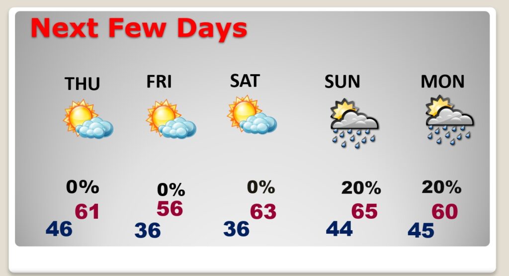
NEXT FEW DAYS: It will be quite a bit cooler Thursday through Saturday. Highs in the 50’s Friday, lows in the 30’s. Dry through Saturday. Small risk of showers Sunday & Monday. No big ticket weather next few days.
Thanks for reading this very brief Blog update this morning! This morning we are LIVE on the radio from 6 to 9 on NewsTalk 93.1. Watch us on TV on CBS 8 and ABC 32. I’ll have another update for you in the morning. Have a nice Day!
–Rich