
Good Morning! We’re in a nice quiet for at least a couple more days. Temperatures will warm up into the mid 60’s today and into the lower 70’s Wednesday & Thursday. But, on the horizon is yet another Severe Weather Threat on Thursday. An approaching storm system will bring showers & strong storms with a damaging wind gusts by Thursday afternoon. Following the storm, sharply colder air will engulf the state by Friday & Saturday. Here’s my brief forecast discussion.
TODAY: DENSE FOG ADVISORY UNTIL 8AM. Patchy fog early. Mostly sunny. Warmer today…high 65. West wind 5 to 10 mph.. Mostly clear, not quite as chilly tonight. Low 43. (Normal: 59/36)
NEXT FEW DAYS: We’ll be in a quiet and rather nice pattern through Wednesday. Wednesday’s high will surpass 70. Showers and thunderstorms Thursday. Severe Weather threat. It will turn sharply colder behind the storm system Friday and Saturday.
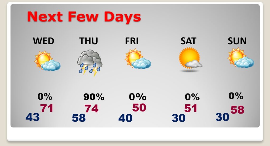
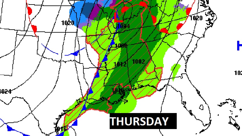
Our next significant storm system will bring a round of showers and storms into the state Thursday. The best chance of showers & strong storms will be Thursday afternoon. .
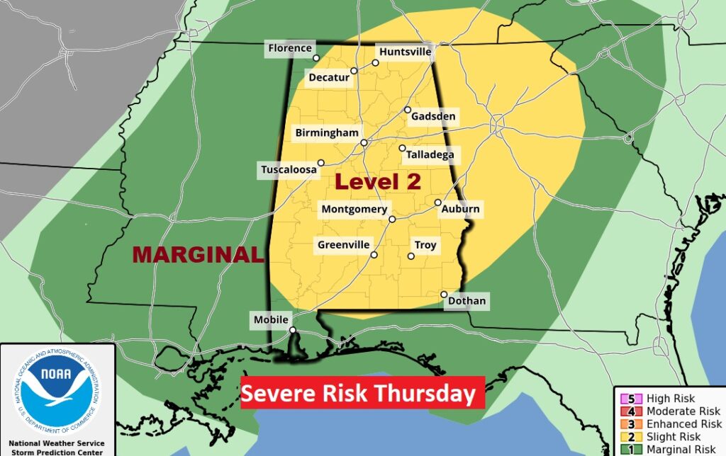
SPC has most of Alabama in a Level 2 Severe Threat Thursday. The main threat would be damaging wind gusts along a strong line of thunderstorms. The tornado threat appears to be small, but not zero.
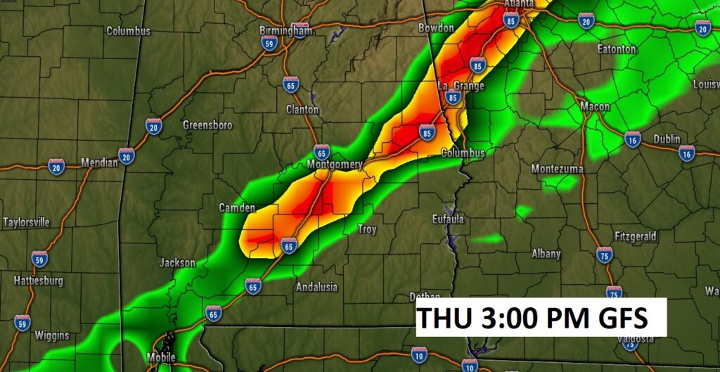
Here’s a GFS Future Radar Snapshot on Thursday afternoon. The greatest threat of damaging wind gusts will be along a squall line. The tornado threat appears to be relatively low, but mot zero.
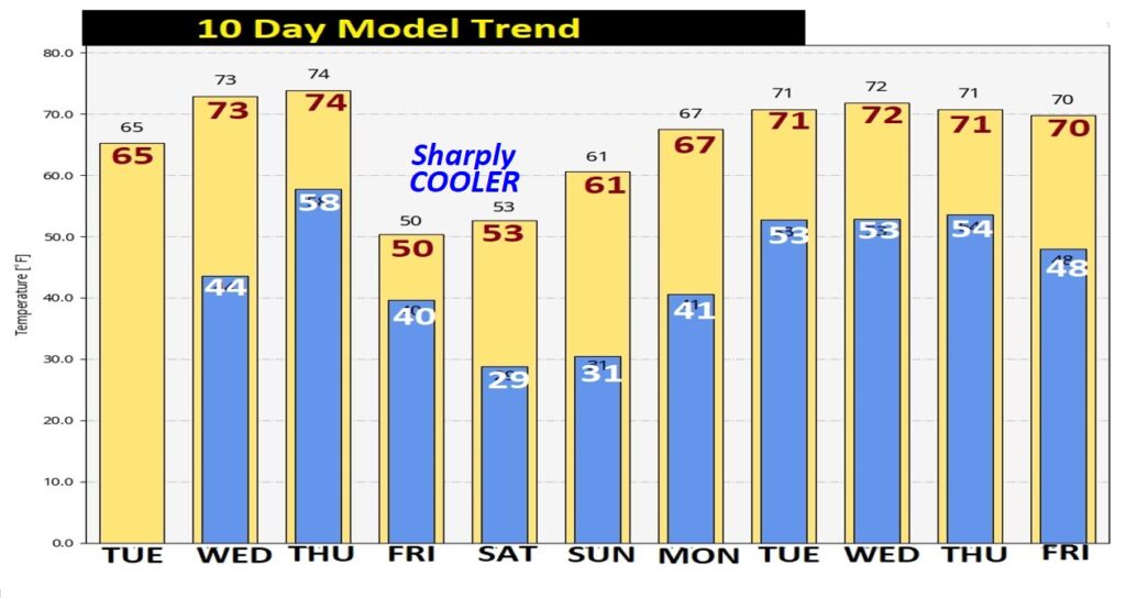
Here’s the 10 Day Model Trend. It will turn sharply colder behind the storm system Friday and Saturday. But the cold won’t last long. Look at the bi temperature rebound next week.
Thanks for reading this Blog this morning! This morning we are LIVE on the radio from 6 to 9 on NewsTalk 93.1. Watch us on TV on CBS 8 and ABC 32. I’ll have another update for you in the morning. Have a nice day!
–Rich