
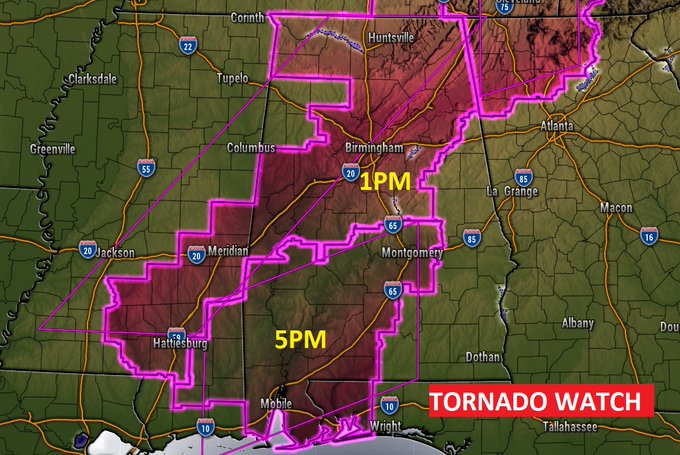
A tornado Watch covers all but the extreme eastern & SE part of the state. In the northern half of the state, the watch goes till 1pm. The South Alabama watch continues until 5PM. Few tornadoes are possible. Scattered wind gusts to 70 mph. Large hail possible. #alwx
EARLY MORNING UPDATE:
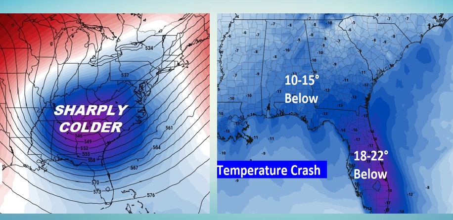
Good Morning. Today’s another good day to stay weather aware. We are now in an elevated Enhanced Severe Risk today. A line of strong/severe storms ahead of a strong cold front will sweep through the state this afternoon. The risk for damaging wind gusts is particularly high with these storms. A few tornadoes are possible, as well. Even outside of thunderstorm areas, winds could gust 30-40 mph, bring down tree limbs and small trees. Following the storm, get ready for a Drastic Temperature Crash. It will turn windy and sharply colder Friday. It will be quite a shock to the system. Temperatures will start a big turnaround by early next week.
Here’s my brief forecast discussion.
TODAY: Wind Advisory in Effect. Very mild for January. High 74. A line of strong/severe storms ahead of a strong cold front will sweep through the state this afternoon. The risk for damaging wind gusts is particularly high with these storms. A few tornadoes are possible, as well. Even outside of thunderstorm areas, winds could gust 30-40 mph, bring down tree limbs and small trees. By late afternoon and early this evening, after the cold front passes, expect a huge temperature plunge. Windy and cold tonight. Low near 40. Wind chill will be a factor.
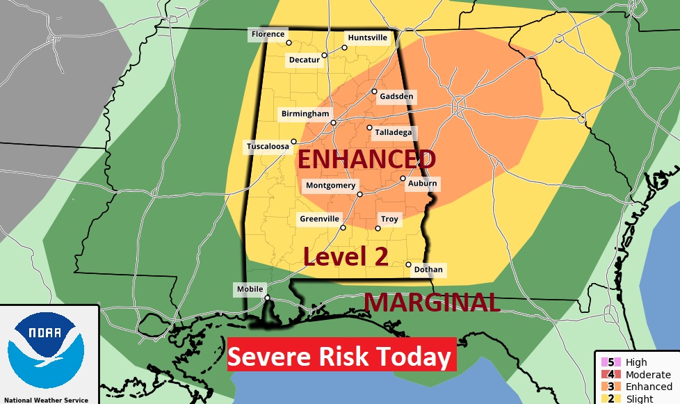
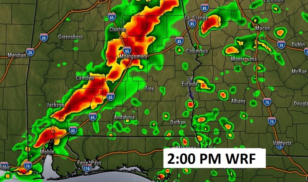
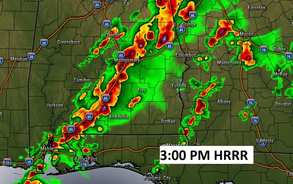
SPC has a big chunk of the state in a Level 3 ENHANCED severe weather threat. The main threat would be damaging wind gusts along a strong line of thunderstorms. The risk for damaging wind gusts is particularly high with these storms. A few tornadoes are possible.
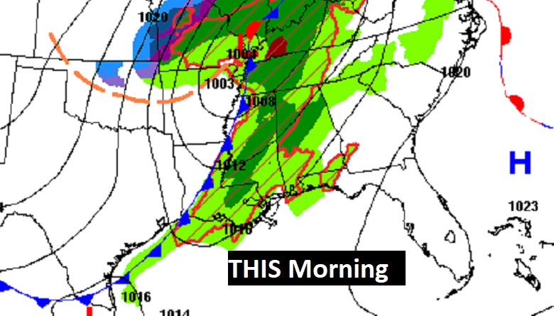
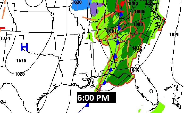
As far as timing, here’s a couple of Hi-Res Model Future Radar snapshots. A line of severe storms will sweep through the state this afternoon. The line if storms will be moving rather quickly. Strong threat of damaging wind gusts. While the tornado threat is not high, a few tornadoes are certainly possible.
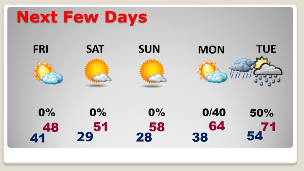
NEXT FEW DAYS: Following the storm, get ready for a Temperature Crash. It will turn windy and sharply colder Friday. We’ll sample some very Cold Air for about two days, before temperatures start to recovery. We’ll be back in the 60’s and perhaps 70’s next week.
.
It will turn windy and sharply colder Friday. Get ready for a Temperature crash. Friday’s high will only be in the upper 40’s. Wind chill by afternoon in the 30’s and then the 20’s after sunset. Low Friday night 29. Cold and Raw Saturday.
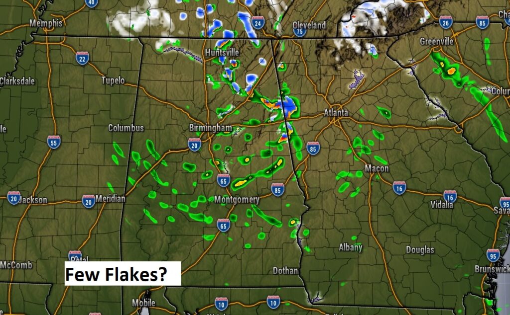
A few novelty flakes of snow late tonight or Friday morning? Perhaps. People will go crazy…but won’t mean ANYTHING.
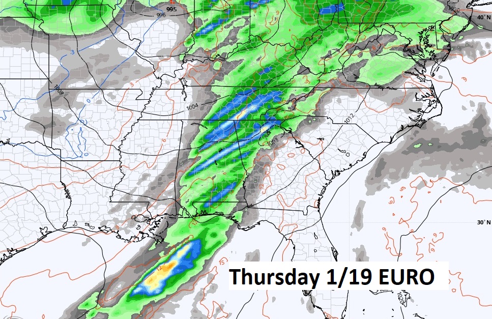
It does not stay cold long…at all. Look for a remarkable warm up next week. We’ll be back in the 60’s and 70’s. Could be another big deal storm system about a week away…NEXT Thursday 12/19.
Thanks for reading this Blog this morning! This morning we are LIVE on the radio from 6 to 9 on NewsTalk 93.1. Watch us on TV on CBS 8 and ABC 32. I’ll have another update for you in the morning. Have a nice day!
–Rich