
12:30 PM:
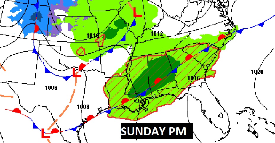
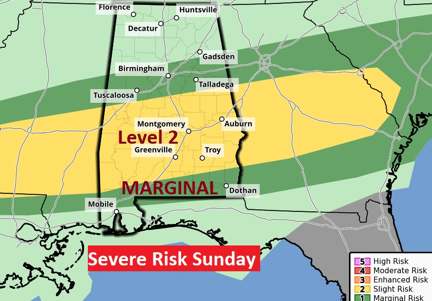
INTERESTING developments. The Storm Prediction Center has included much of central Alabama in a Level 2 severe weather risk focused on the wee hours of Sunday morning with a northward moving warm front. That Level 2 Risk continues through the day Sunday as well. Damaging wind gusts are the main risk, but isolated tornadoes can’t be ruled out.
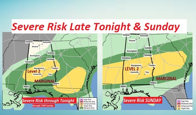
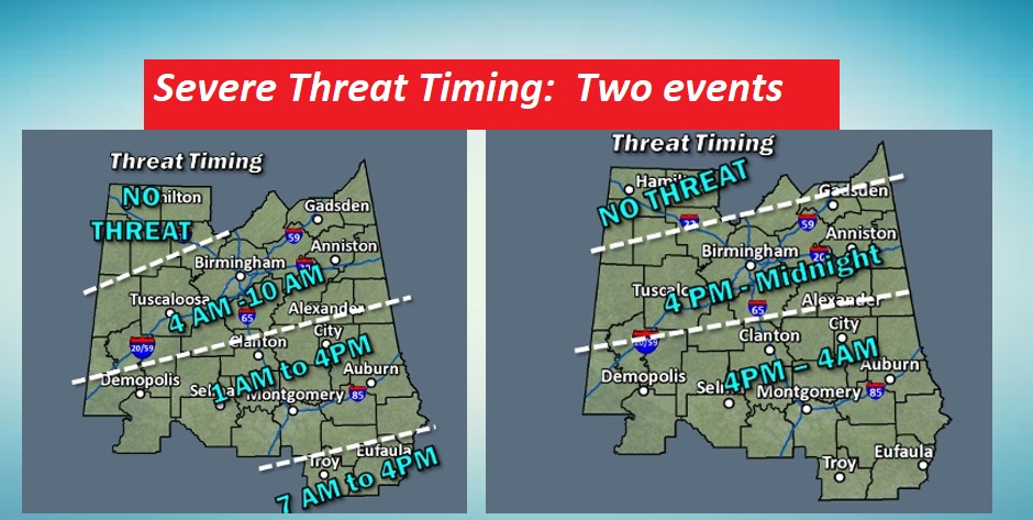
NWS projecting potential timelines on 2 Severe Events which could melt together. #1) late tonight, starting as early as 1AM in Central Alabama, #2) 4PM Sunday till 4AM Monday. Potential for one long threat level. Damaging winds. Low end tornado threat. #alwx
NOT ONLY THAT… But part of central Alabama upgraded to AN enhanced Severe Risk due to Large Hail Potential.
EARLY MORNING UPDATE:
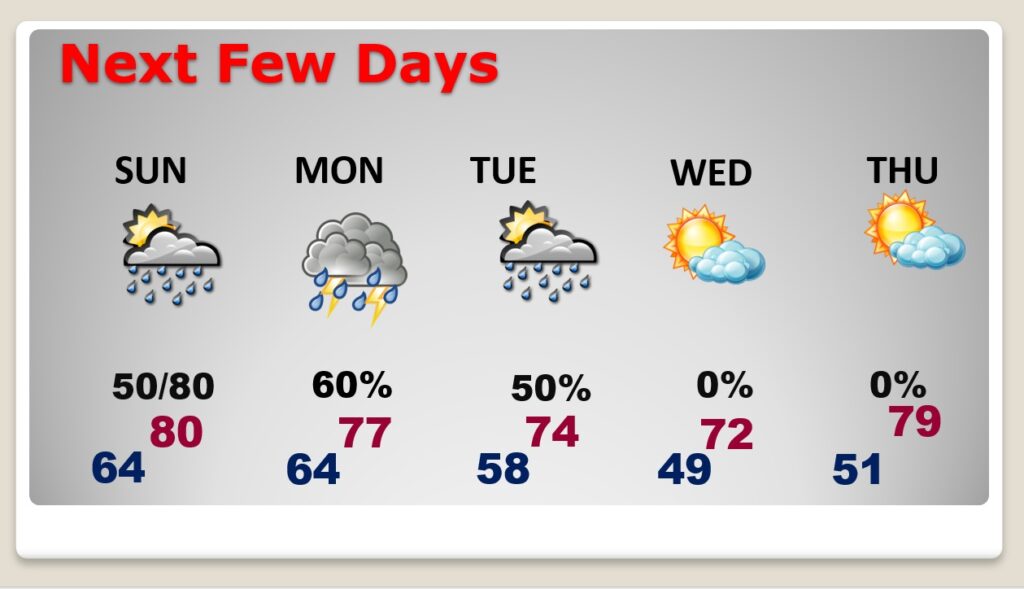
Good Morning! The frontal system which brought the severe storms to our state overnight, will pass out of the area later this morning. The threat for showers/storms will end early. We’ll even see some sun later today. We’re back in the 80’s today. The front will reach South Alabama…then, the front will work it’s way northward, as a warm front, on Sunday, and some of those storms will be strong possibly severe. More scattered showers and storms are expected Monday. We’ll turn a little cooler Tuesday & Wednesday.
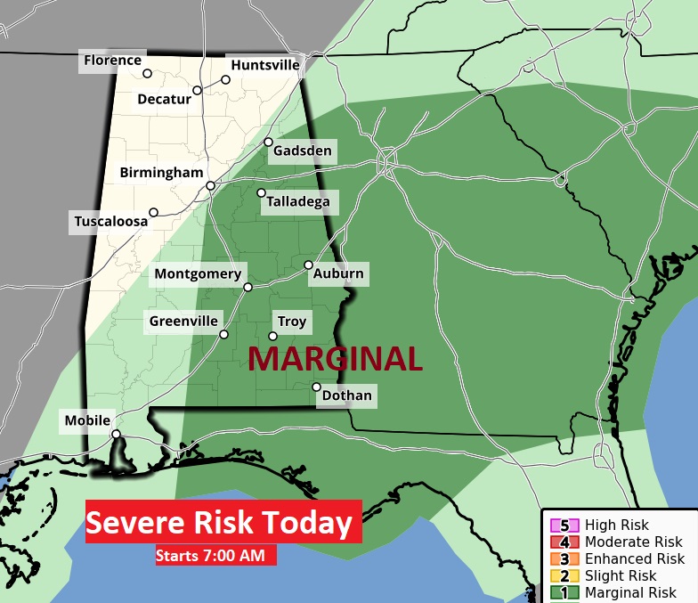
TODAY: The threat for showers/storms will end early. We’ll even see some sun later today. Breezy, very warm again. High in the mid 80’s. Southwest wind 10-15 gusting to 25 mph. Increasing clouds tonight. Dry through the evening hours. Low 64. Risk of showers by the wee hours of Sunday morning.
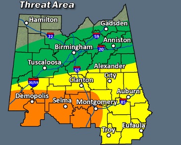
The Marginal Risk area for Severe Storms shifts into Southeast Alabama this morning, and out of the state by mid-day.
SUNDAY: The front in South Alabama, will work it’s way northward, as a warm front. Showers and storms become likely again. Some of these storms will become strong possibly severe. While the tornado risk is relatively small, the greater threat will be for damaging wind gusts and possibly large hail.
NEXT FEW DAYS: We’ll be back to the 70’s Monday & Tuesday. Scattered showers and storms Monday. and Tuesday, Cooler Wednesday. Another warm-up begins Thursday.
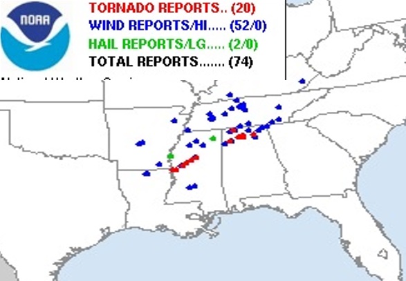
FRIDAY – DEADLY TORNADOES ACROSS THE SOUTH: Violent tornadoes killed 21 in Mississippi Friday night. At least 20 tornado reports across Mississippi and Alabama.
https://www.cnn.com/2023/03/25/weather/us-severe-storms-saturday/index.html
Thanks for reading this Blog this morning! I’ll have another complete update for you in the morning. Have a nice weekend!
–Rich