
Good morning! Today a “cool wedge” will affect much of Alabama. Temperatures will be well below normal. Perhaps lower 70’s in central Alabama and even cooler in some towns. Normal High is 88. It will be a breezy day and Showers and storms will be in plentiful supply. The road to improvement begins tomorrow. Sunshine returns and the warming trend begins. Thursday and Friday, with plenty of sun and temperatures rebounding in the low to mid 80’s. So far, I don’t see any red flags for the Memorial Day weekend. Rain chances are not ZERO, but generally 20% or less. I have the updated forecast through Memorial Day. Here’s my brief forecast discussion.
TODAY: Unusually cool for May. Showers and storms are likely again today and tonight. A “cool wedge”will affect the area today. Breezy and VERY cool. High today 71. Brisk easterly winds 12 to 17+. Low tonight 61.
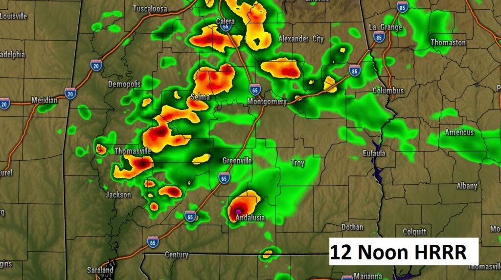
Here’s a Future Radar snapshot at Noon. Showers and thunderstorms.
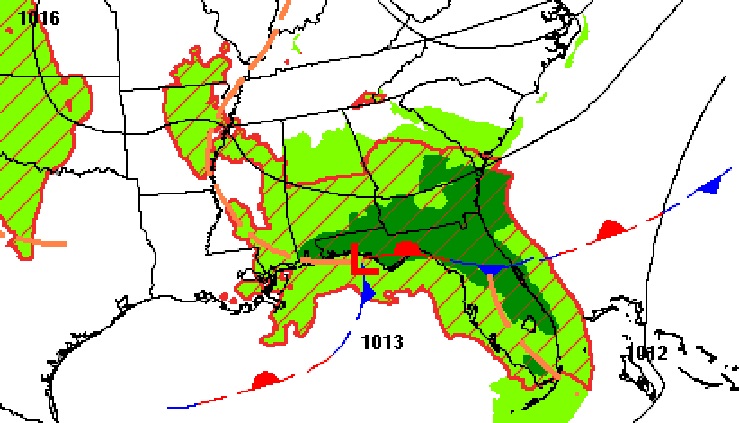
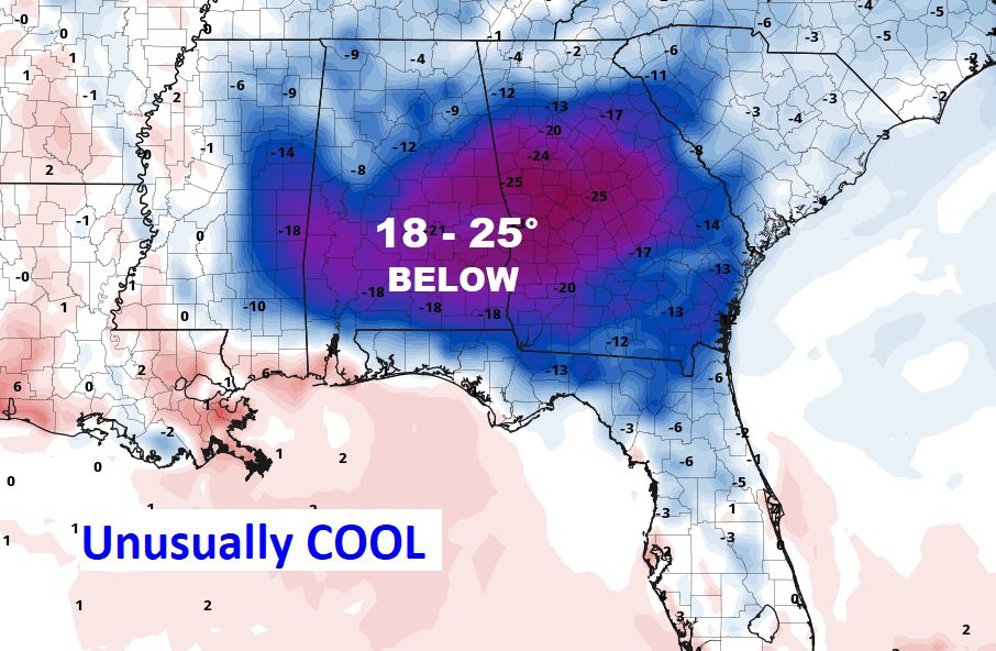
Today’s COOL WEDGE: Today will be different than yesterday, as a “wedge” of much cooler air slides down the Appalachians into Alabama. Temperatures will be much cooler. Lower 70’s in central Alabama and even cooler in some parts of central Alabama with highs in the 60’s. Normal high is 88. In the business we call this Cold Air Damming (CAD.)
NEXT FEW DAYS: Things start to get a lot better by Wednesday and Thursday. Sunshine returns and the warming trend begins. Thursday and Friday, with plenty of sun and temperatures rebounding in the low to mid 80’s.
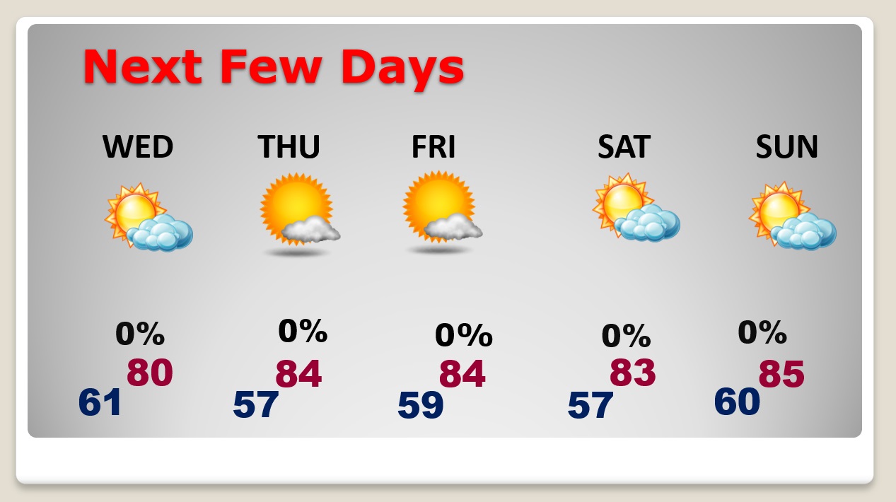
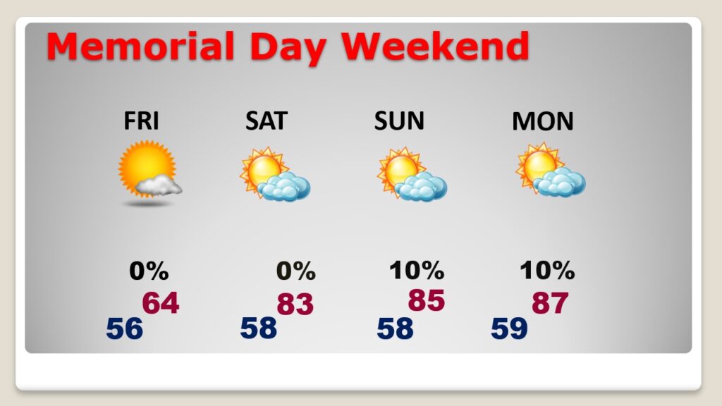
Fingers crossed. So far I don’t see any Red flags for the Memorial Day weekend. Rain chances are realtively LOW Friday through Sunday, mostly 20% or less. But, not zero. We’ll continue to watch it. So far so good.
We’ll focus on the Beach Forecast starting tomorrow.
Hurricane Season begins in 8 days. A series of Safe from The Storm features start tomorrow night on CBS 8 and ABC 323. Riley is up tonight. Tomorrow night is my Special Report.

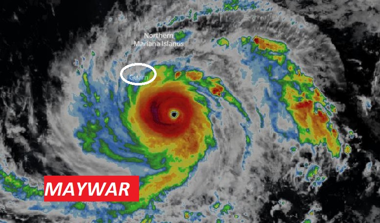
By the way…A super Typhoon is headed for the United States. (well a US Territory) it looks like it could make a direct hit on Guam. Winds now 155 mph and still intensifying. Now about 150 miles away. Maybe 24 hours away from Guam as I type this at 3:30AM.
Thanks for reading this Blog this morning! This morning we are LIVE on the radio from 6 to 9 on NewsTalk 93.1. Watch us on TV on CBS 8 and ABC 32. I’ll have another update for you in the morning. Have a nice day!
–Rich