

Good morning! Today, after a chilly start, we start to turn the corner on the temperature today. The “coolness” will start to fade quickly over the next few days. By Wednesday and Thursday, expect temperatures to recover to the lower 80s, and mid 80’s return on Friday. There is a very small chance of showers late Wednesday and Thursday as a weak front drifts southward through the state. But, I have my doubts. Here’s my brief forecast discussion.
TODAY: Mostly sunny and a little warmer. High near77. (Normal 81) North wind 6 to 12 mph. Clear and still chilly tonight. Low 49.
The moon is at 99.7% brightness. Officially the full moon is at 6:48 PM. Moonrise 7:08 PM. The April full moon is called the “Pink” moon, in reference to wildflowers that bloom this time of year. #alwx
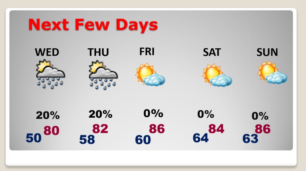
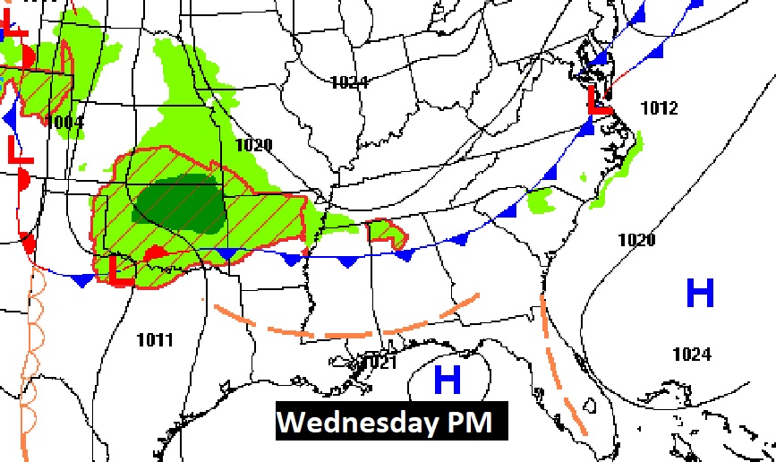
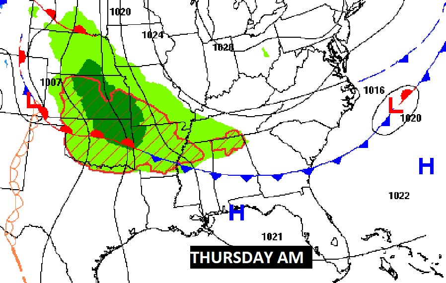
NEXT FEW DAYS: Warming trend begins. By Wednesday and Thursday, expect temperatures to recover to the lower 80s, and mid 80’s return on Friday. There is a very small chance of showers late Wednesday and Thursday as a weak front drifts southward through the state. Looks like a dry/storm-free weekend.
.
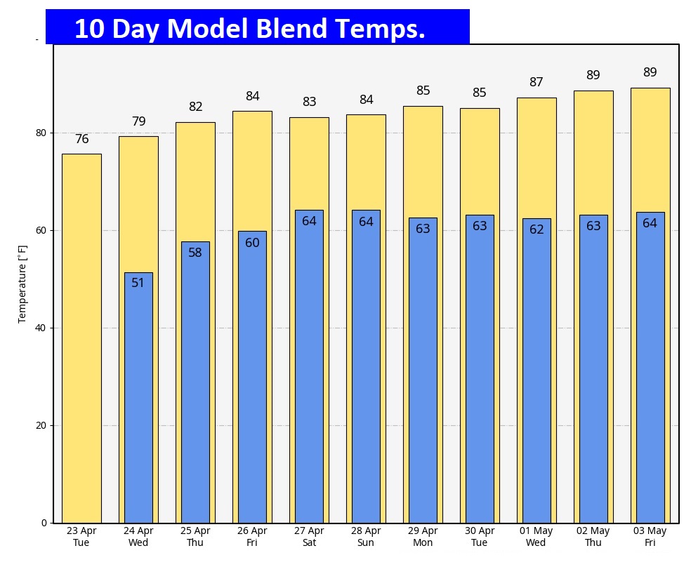
Here’s the 10 day temperature trend. Warmer days ahead.
Could there be a few showers with that southward moving weak front Wednesday night/Thursday? Possible. But I have my doubts.

Thanks for reading the blog. There will be another complete Blog update and video forecast discussion tomorrow morning. This morning, everything is normal including LIVE on the Radio from 6 to 9AM on NewsTalk 93.1 – WACV. Have a nice day!
–Rich