
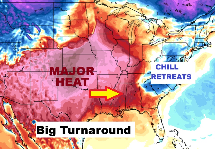
Good morning! The chill is starting to retreat. A major warming trend is on the way. Yesterday’s high recovered to 61. Today we’ll tack on about 10 more degrees. Friday – on the first day of Spring – the temperature will soar to the upper 70’s. We’ll be in the 80’s over the weekend, and Monday, too.. It’s also a storm-free dry forecast for most of the next 8 days, before the next storm system. Here’s my brief video forecast discussion.
TODAY: FROST ADVISORY EARLY. Mostly sunny . High 71. Light wind.
(Normal 72/47)
TONIGHT: Clear and chilly. Low 45
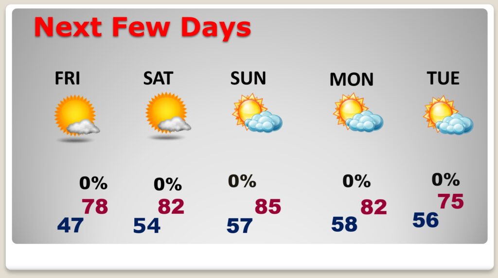
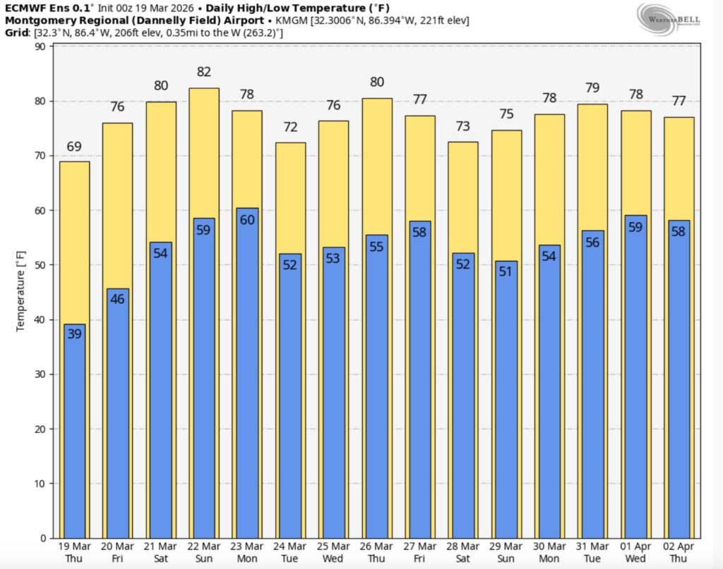
NEXT FEW DAYS: Temperatures are on the re-bound. Upper 70’s Friday. More sun. Lower 80’s Saturday. Still storm-free and dry. Middle 80’s Sunday. Still warm and dry Monday.
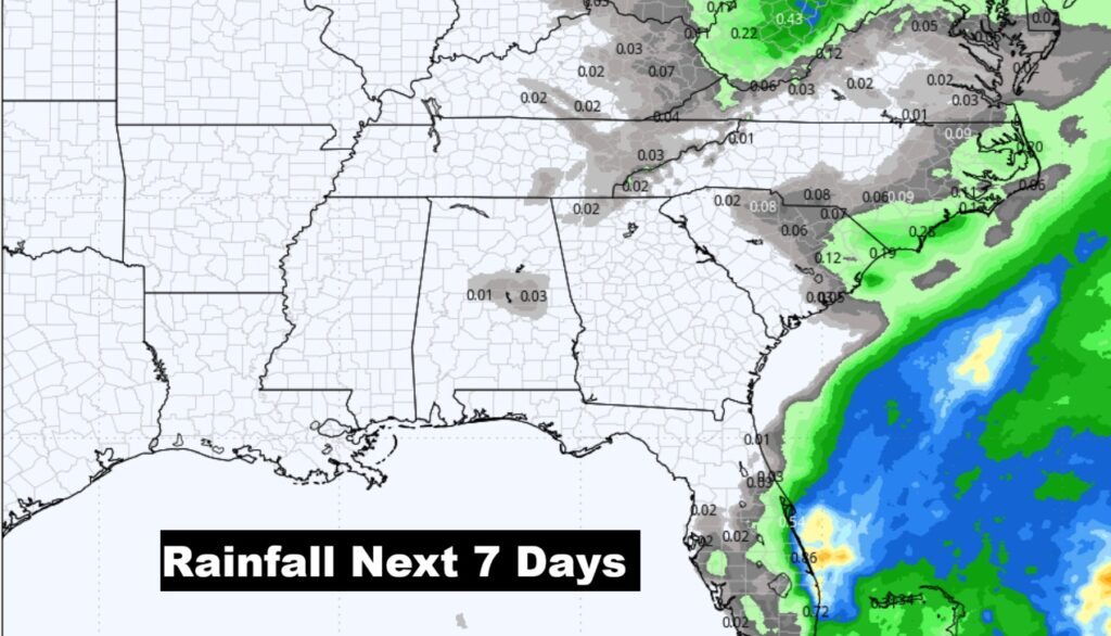
The 7 day rainfall outlook. Not a drop. DRY. New Drought monitor map comes out this morning.
.
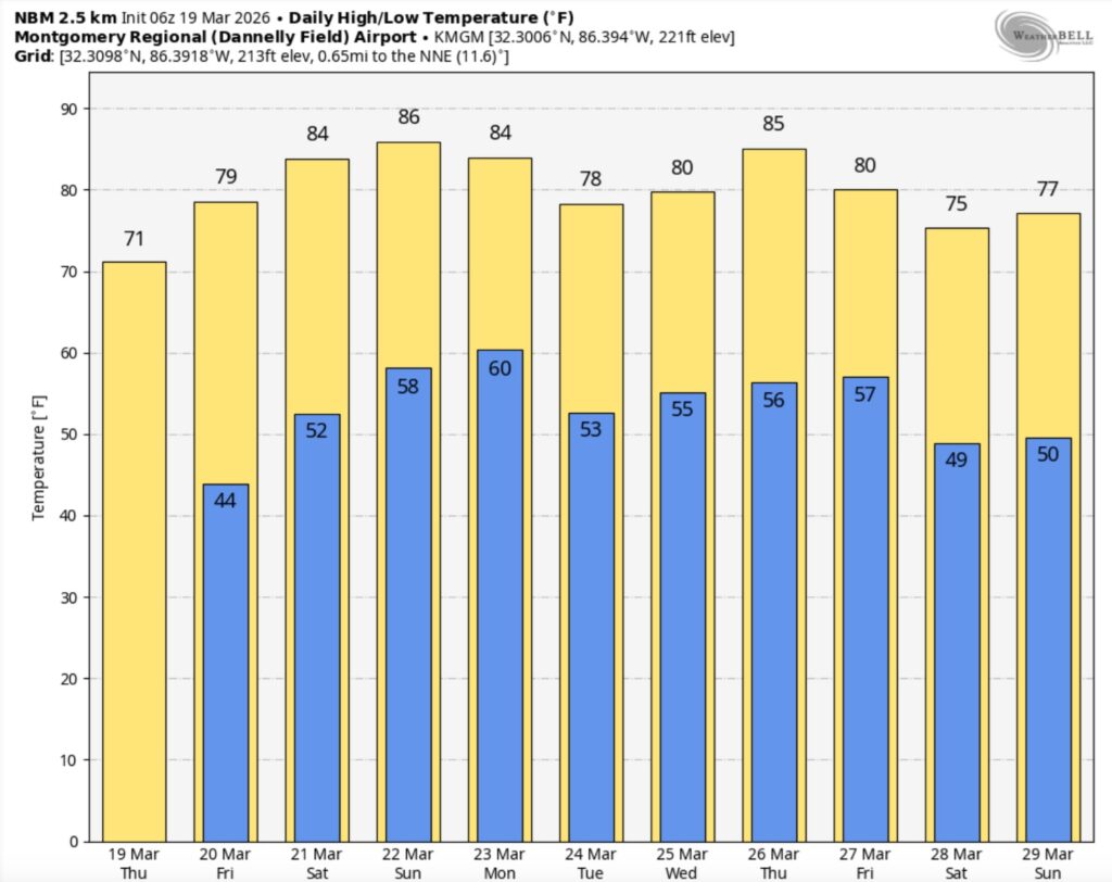
The 10 Day model Blend Temperature Trend. Major warming trend is in our future.
The Euro Ensembles 16 day temperature trend. Extended warmth.
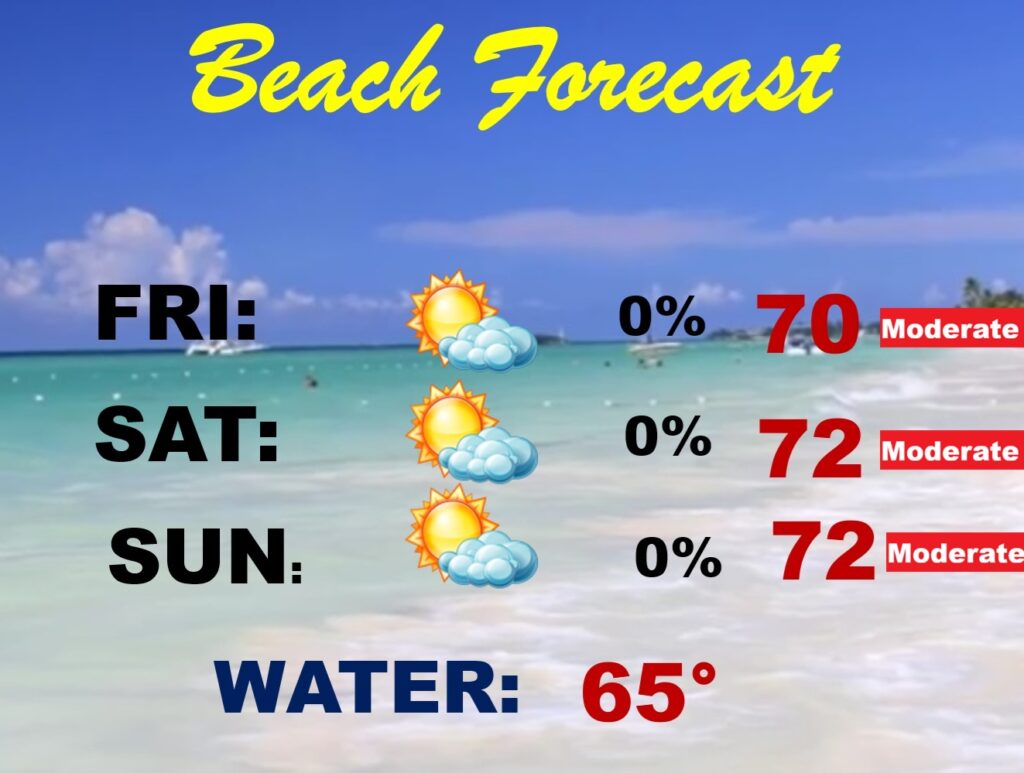
BEACH FORECAST: Not quite as warm as Spring Breakers would like it. Moderate rip current risk.
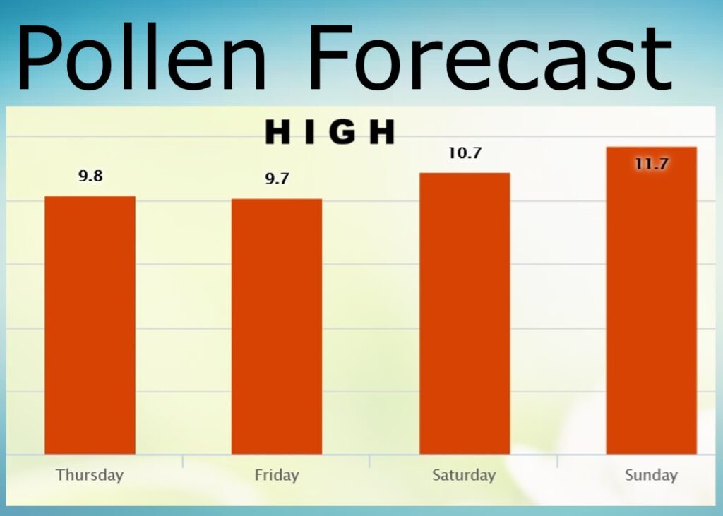
POLLEN FORECAST:
Back to the HIGH range over the weekend.
Today is the Last Day of Winter. Spring officially begins Friday. The equinox is at 9:46 AM CDT.
Thanks for reading this Blog this morning. This morning we are LIVE on the radio from 6 to 9 on NewsTalk 93.1. I’ll have another update for you in the 4 o’clock hour tomorrow morning. Have a nice day.
–Rich