
Good morning! All eyes on our next storm system. Severe weather threat in Alabama begins this afternoon in parts of northwest and west Alabama and spreads southeastward through the overnight hours tonight and Thursday. All modes of severe weather are possible including damaging wind gusts, isolated tornadoes and, to some extent, large hail. The greatest tornado threat will be across north central and western Alabama where there is an Enhanced Risk. There is a potential of excessive rainfall totals – especially between I-85 and I-20. Urban flooding could become a problem. By early Thursday morning, the greatest severe weather threat will have shifted southward to the US 80 – I-85 corridor. On Thursday, the Severe Risk shifts to southeast Alabama. There could be some more scattered showers/storms on Friday and Saturday. And showers and thunderstorms are likely in Mother’s Day Sunday. Here’s my brief forecast discussion.
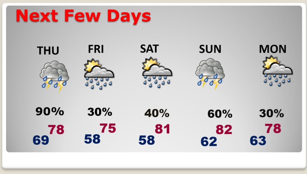
TODAY: Very warm today. Sun/cloud mix. High 88. Risk of some scattered showers and possibly thunderstorms this afternoon and this evening.
(Normal hi/lo 83/58)
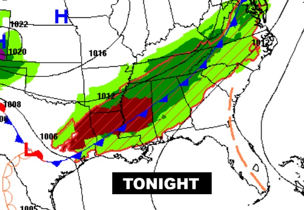
TONIGHT: Showers and thunderstorms increasing in the evening and tonight. Risk of strong/severe storms in the overnight hours and pre-dawn Thursday. Locally heavy rainfall.
Low tonight 69.
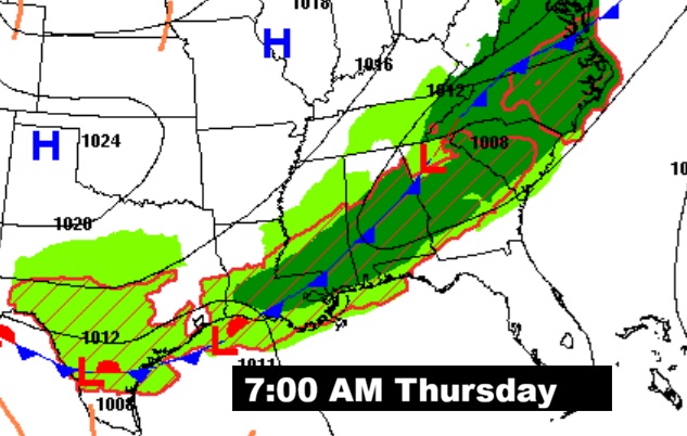
NEXT FEW DAYS: By early Thursday morning, the greatest severe weather threat will have shifted southward to the US 80 – I-85 corridor. On Thursday, the Severe Risk shifts to southeast Alabama. There could be some more scattered showers/storms on Friday and Saturday. And showers and thunderstorms are likely in Mother’s Day Sunday.
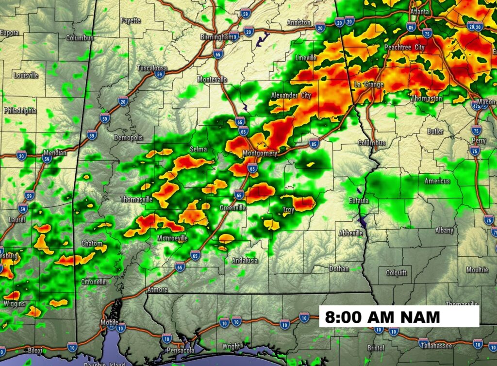
ENHANCED SEVERE THREAT: Severe weather threat in Alabama begins this afternoon in parts of northwest and west Alabama and spreads southeastward through the overnight hours tonight and Thursday. All modes of severe weather are possible including damaging wind gusts, isolated tornadoes and, to some extent, large hail. A Level 3 out of 5 Enhanced risk covers north central and west Alabama.
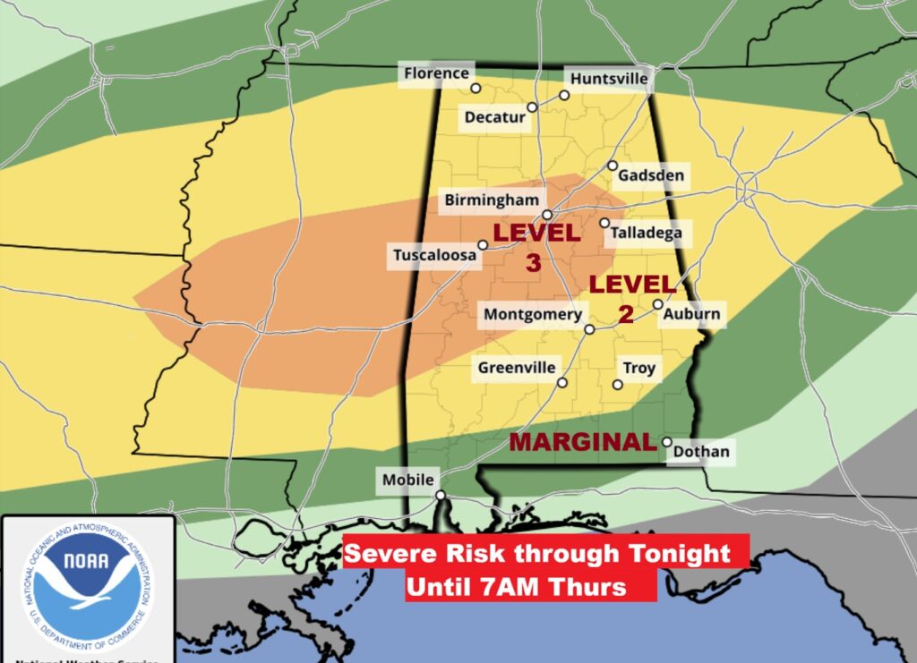
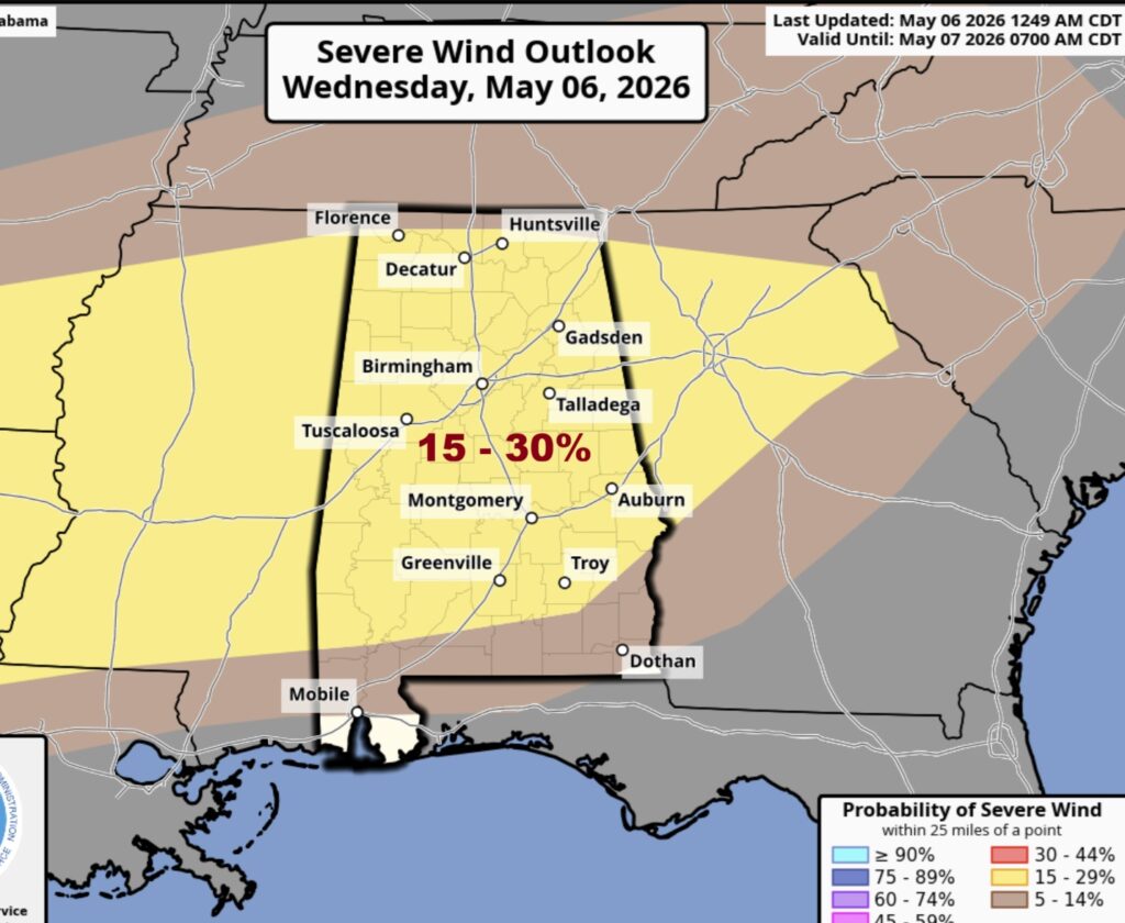
The greatest tornado threat will be across north central and western Alabama where there is an Enhanced Risk. A 15-30% risk is pretty significant.
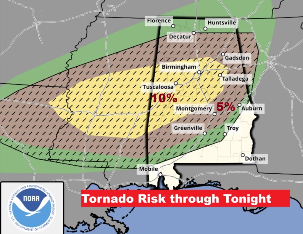
Damaging wind gusts will be the highest threat for most of us.
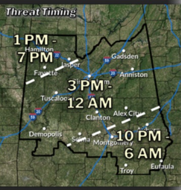
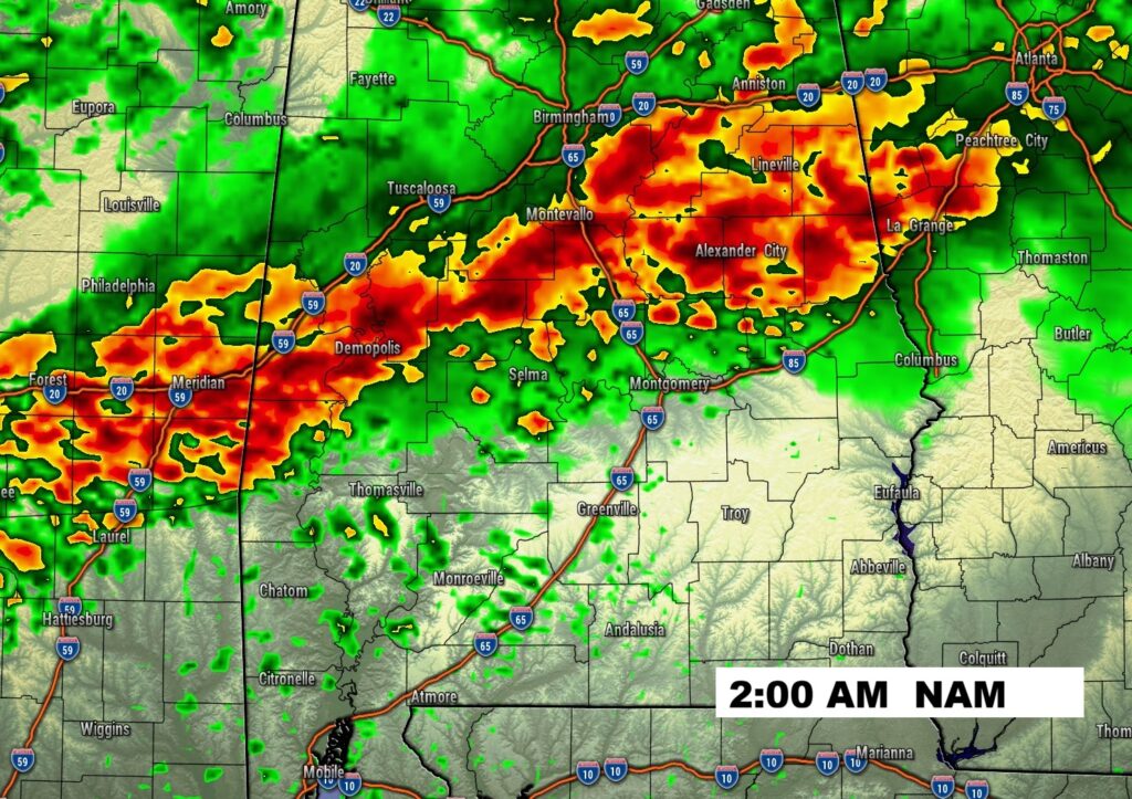
Here’s a rough timing guide for the greatest severe weather threat.
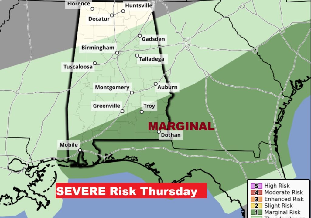
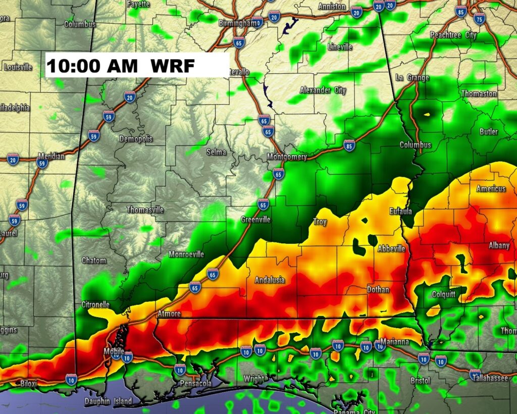
On Thursday, the Severe Risk shifts to southeast Alabama.
EXPECTED RAINFALL: There is a potential of excessive rainfall totals – especially between I-85 and I-20. Urban flooding could become a problem.
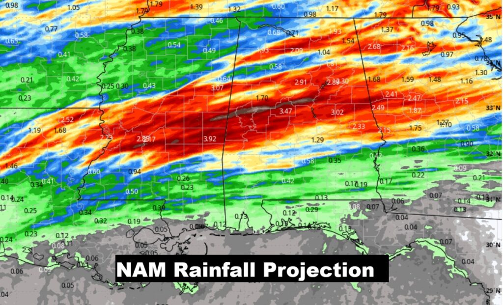
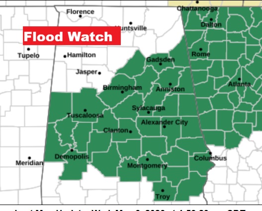
LATE BREAKING: Flood Watch now covers all of central Alabama as far south as Troy.
FUTURE RADAR: It’s quite complicated – but after looking at several model outputs, I selected the NAM model which seems to have the best grasp on how this event may evolve.
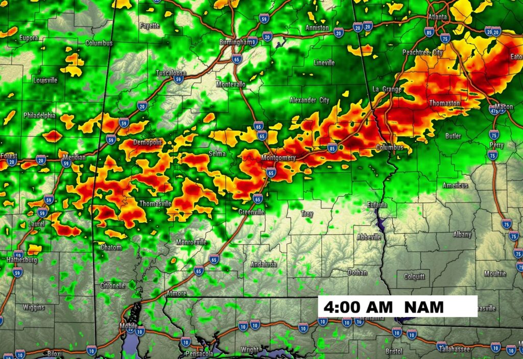
By late morning the storms will have shifted into southeast Alabama.
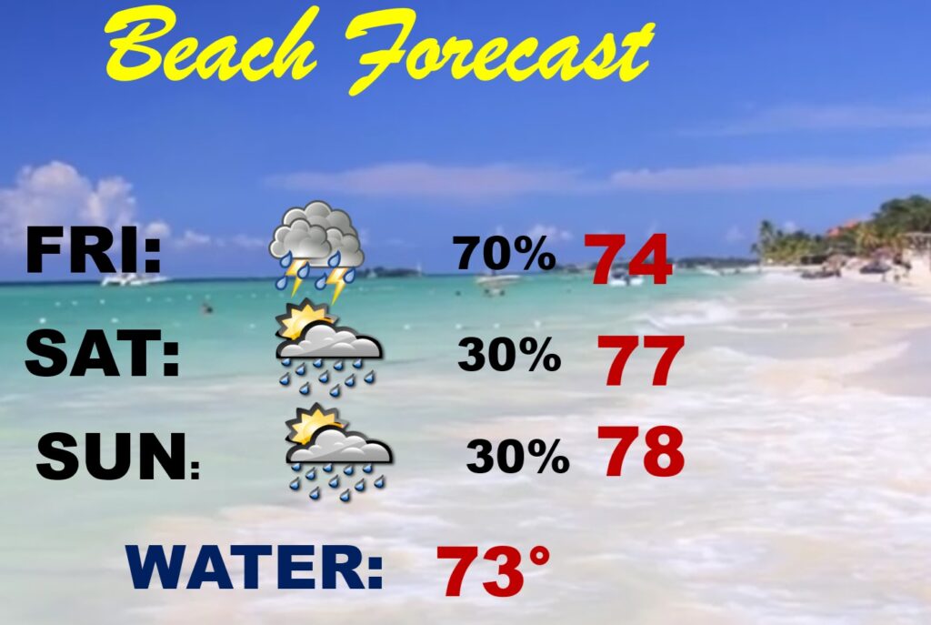
BEACH OUTLOOK: Be flexible with your plans. Scattered showers and thunderstorms will be around from time to time through the Mother’s Day weekend.
.
Thanks for reading this Blog this morning. This morning we are LIVE on the radio from 6 to 9 on NewsTalk 93.1. I’ll have another update for you in the 4 o’clock hour tomorrow morning. You can also watch us during our morning show on You Tube and Facebook. Search Newstalk 93.1. Stay Weather Aware.
–Rich