

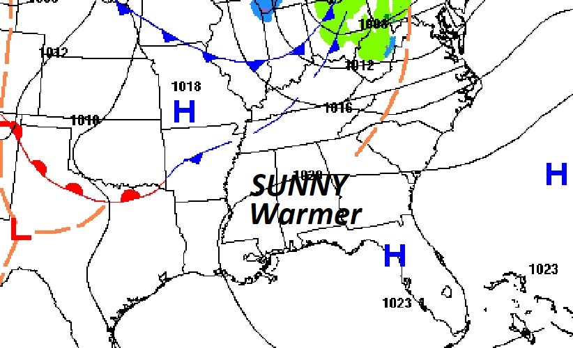
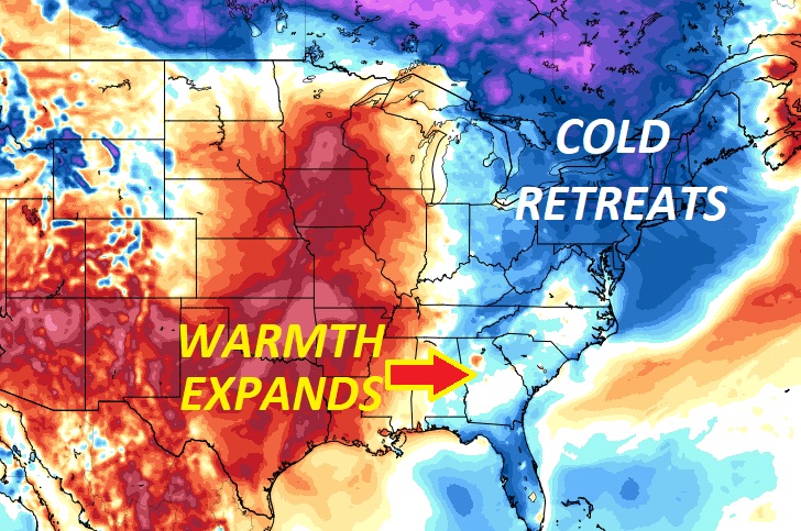
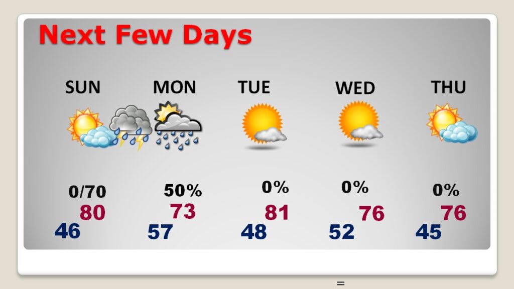
Good Morning! The recent quick cold snap is quickly fading. A nice warming trend begins today. We had mid 60’s yesterday, after a sub-freezing start at 29. Today, we’ll be in the mid 70’s, and near 80 Sunday. Sunshine will be abundant. It should be a great weekend. The next batch of showers and storms will arrive in the overnight hours Sunday night. Right now, any severe weather threat with this system should be confined to the northwest counties. On the Day 3 Monday outlook, the Level 1 Marginal risk shifts to south Alabama. Fortunately, I don’t see any other severe weather events in the next several days.
CLIMATE: Yesterday was very likely the final freeze of the season. It got down to 29 in Montgomery (MGM). High 65. (Normal 73/47)
TODAY: Sunshine. Warmer. High 75. Southwest wind 6 to 12 mph. Clear not as cold tonight. Low 46.
.
NEXT FEW DAYS: There’s a nice weekend warm-up on the way.We’ll be teasing 80 on Sunday. The next batch of showers and storms will arrive in the overnight hours Sunday night through Monday morning. Beautiful weather returns Tuesday through Thursday. Comfortably warm.
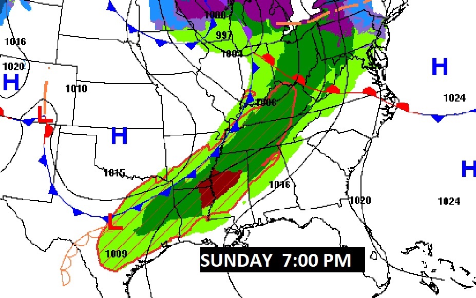
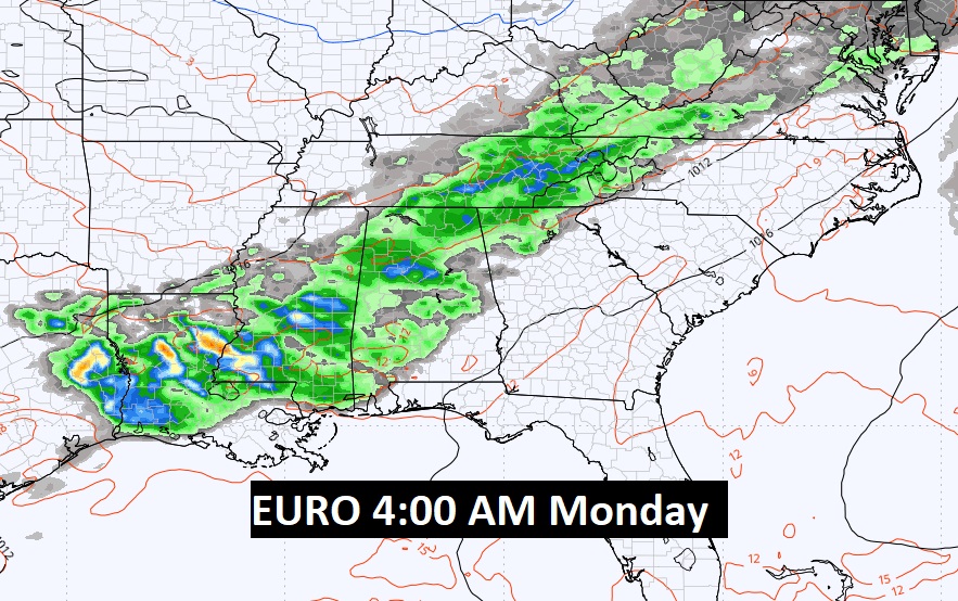
Here’s the set-up for the next round of showers and storm overnight Sunday night/Monday morning, as a front approaches. After this, all next week looks nice.
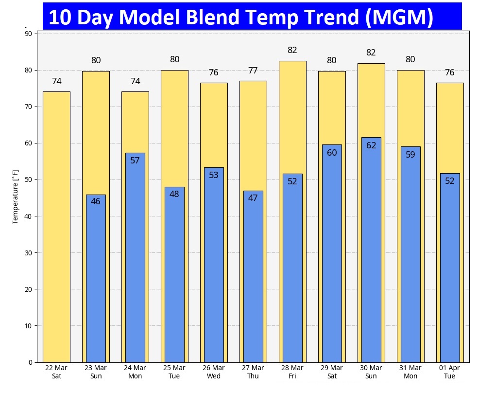
Here’s the 10 day model blend temperature trend. Are we done with chilly weather?
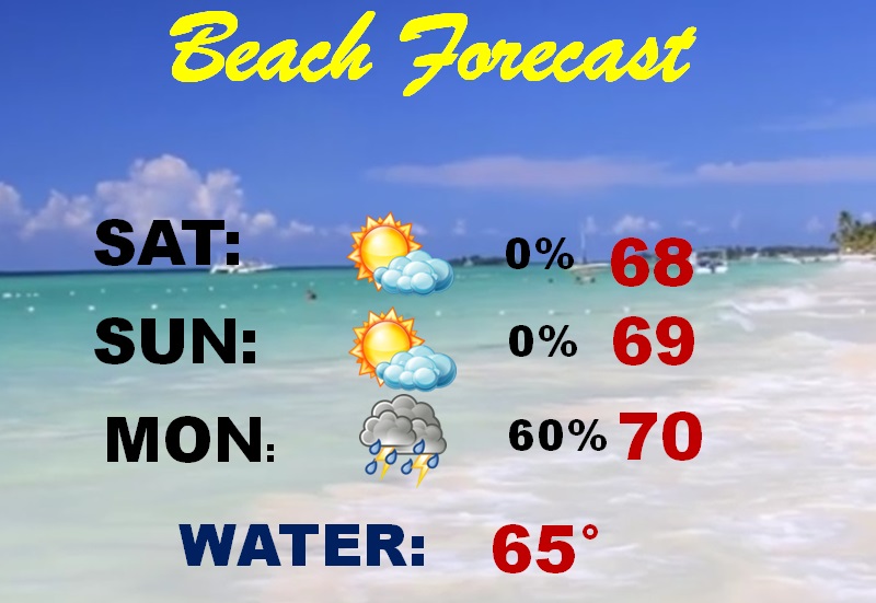
BEACH FORECAST: It’s a little cool, but generally nice through Sunday. The risk of showers and storms starts in the pre-dawn Monday timeframe.
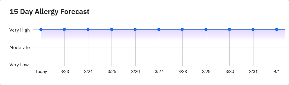
POLLEN: High levels continue for the next several days. No relief in sight.
Thanks for reading the blog. The next scheduled full blog will be Monday morning, Have a nice weekend!
–Rich