
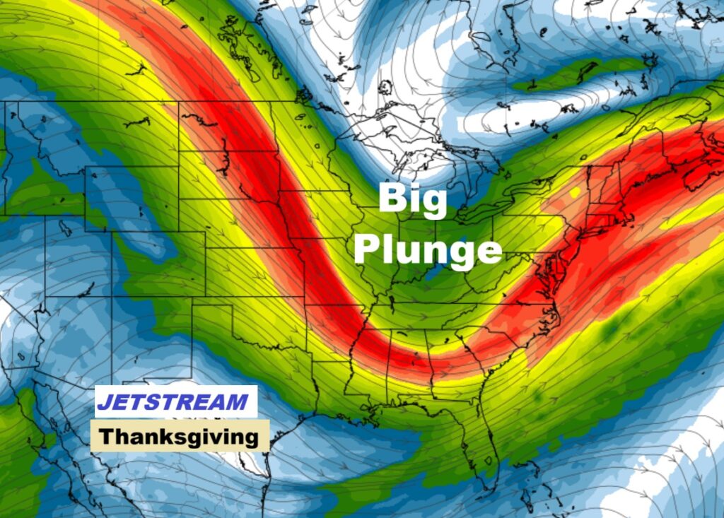
Good Morning! Get ready. A Big climate change is in our future. Yesterday’s record high (MGM) was 83. Today’s expected high will be 67. Thanksgiving’s high near 56. Freezing on Friday and Saturday morning around Dawn. It will be well below normal through Iron Bowl Saturday. (Normal 67/41) Next chance of rain Sunday and Monday, and especially Monday night into Tuesday. Here’s my brief video forecast discussion.
TODAY: Sunshine, Quite breezy, Much cooler. High 67 Northwest wind gusting to 20 mph. Clear and even colder tonight. Low 37.

NEXT FEW DAYS:
Thanksgiving will be chilly with highs in the 50’s. We’ll be close to a freeze by Black Friday dawn. It will be quite cool though Iron Bowl weekend with Cold nights. (Normal hi/lo 67/41) Next chance off rain Sunday and Monday especially Monday night into Tuesday.


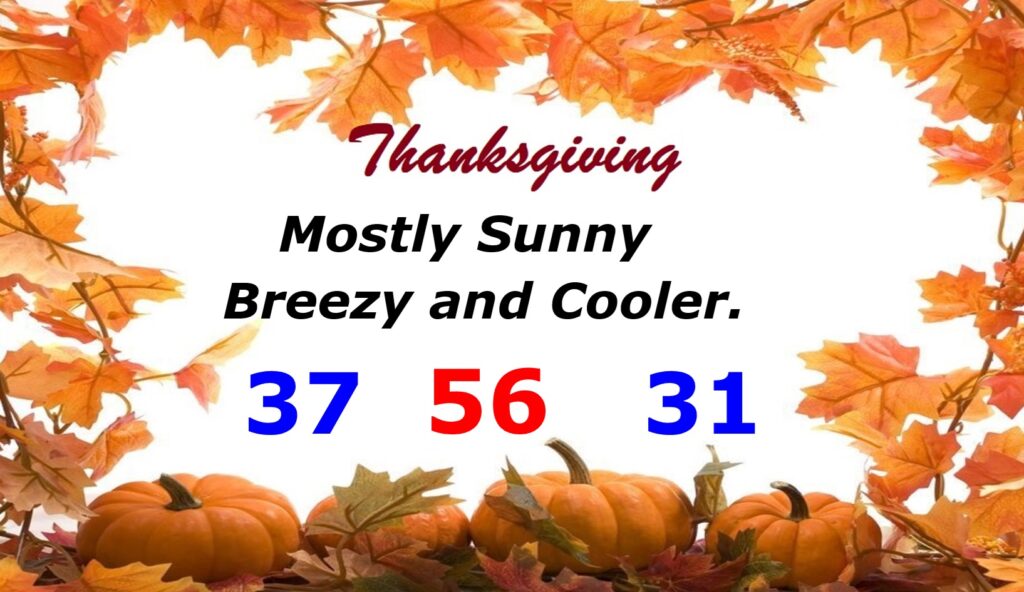
THANKSGIVING: Quite cool. Brisk. Mostly sunny. Morning low 37. Daytime high only 56. Low Thursday night 32.

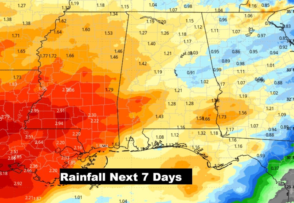
Here’s expected rainfall for the next 7 days. Spotty rain Sunday/Monday. Better rain chance Monday night and Tuesday.
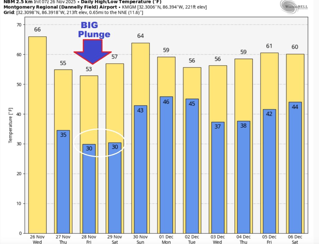
Here’s the 10 Day Model Temperature Trend. Quite cool through Iron Bowl Saturday. Back to the 60’s Sunday.
.
IRON BOWL: The BIG game is in Auburn this year. Kickoff at 6;30PM. The forecast calls for clear, cold conditions, with temperatures dropping through the 40s during the game. Saturday’s high in Auburn 56. Low Saturday night 40.
Thanks for reading this Blog this morning. This morning we are LIVE on the radio from 6 to 9 on NewsTalk 93.1. I’ll have another update for you in the 4 o’clock hour tomorrow morning. Have a nice Thanksgiving weekend.
–Rich