
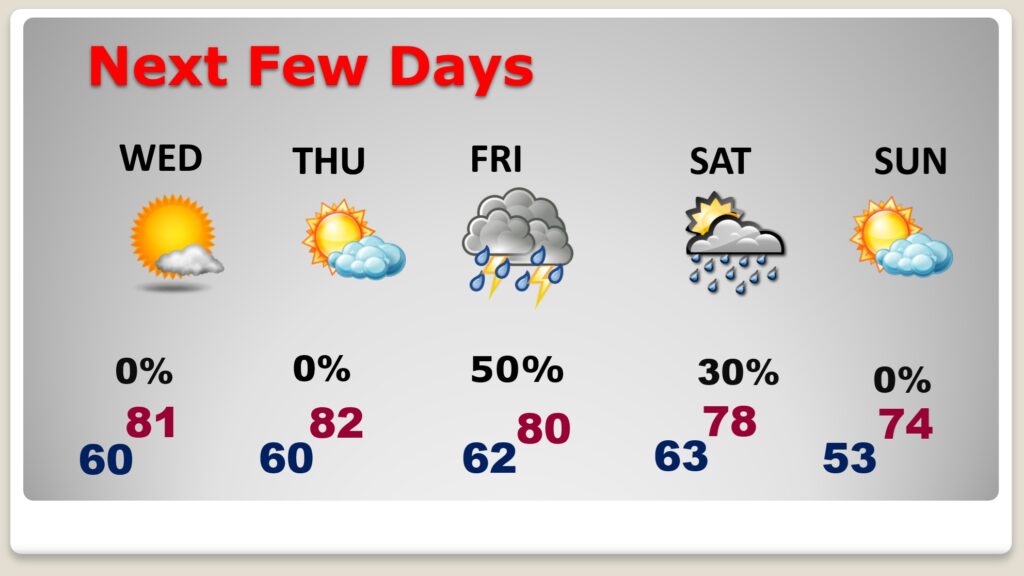
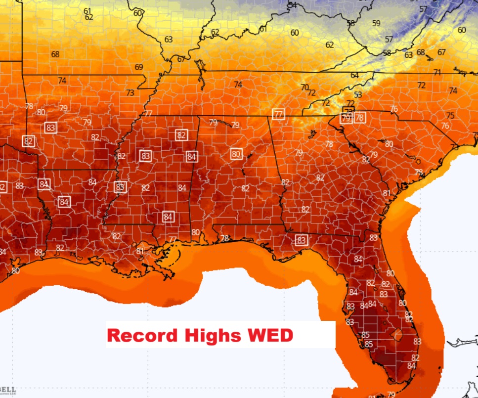
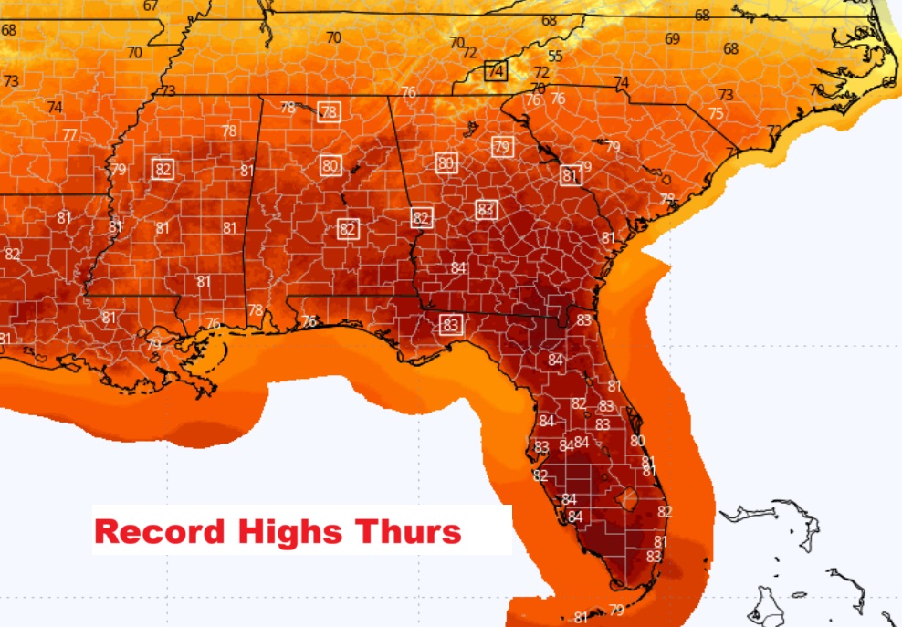
Good Morning!. Our string of warm, storm-free, dry days and comfortably cool nights continue. We’ll tease 80 today, and probably exceed 80 Wednesday and Thursday. Record highs will fall across the South particularly Wednesday and Thursday. The nights continue to moderate. We’ll be in the 50’s at night for the rest of the week. Normal hi/lo 69/43. The drought continues to grow worse. It’s a dry forecast probably through Thursday night. The best rain prospects arrives on Friday, Friday night and into early Saturday. Showers and thunderstorms. Here’s my brief Video Forecast Discussion.
TODAY: Sunshine. High 79. Light wind. Mostly clear, Not as cold, with a low around 57.
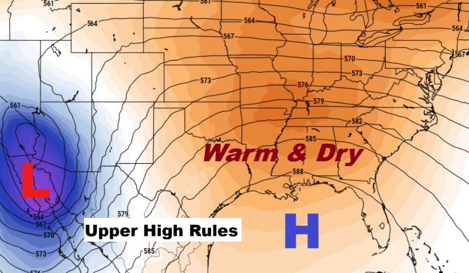
NEXT FEW DAYS: Spring-time in November continues. Perhaps even low 80’s by Wednesday and Thursday. Even the nights are moderating. We’ll be in the 50’s at night for the next several days. Normal hi/lo 69/43. We have a dry forecast probably until late Thursday night. The best rain prospects arrives on Friday, Friday night and into Saturday.
Record highs will fall across the South particularly Wednesday and Thursday. The MGM record on Thursday is 81 from 1901.
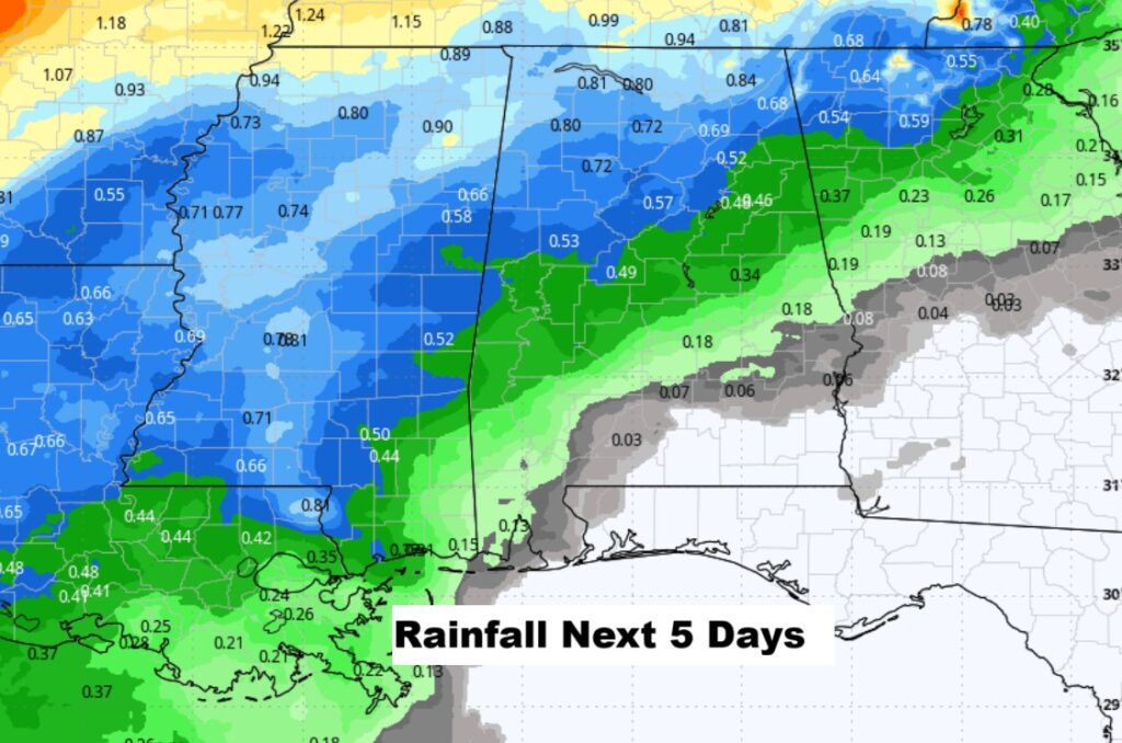
Here’s expected rainfall through the next 5 days. Potential amounts for many of us are not good.
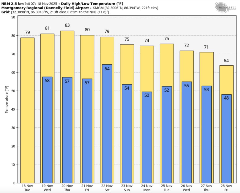
Here’s the 10 Day Model Temperature Trend through Black Friday. No arctic air in sight.
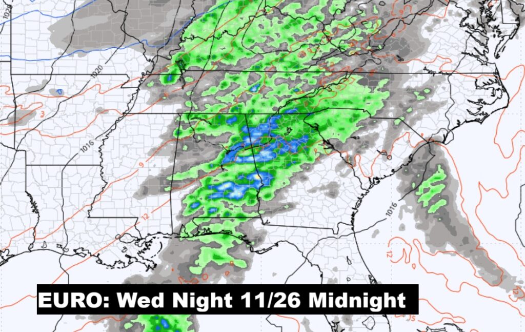
THANKSGIVING WEEK: Will a storm system affect the Thanksgiving forecast? Simply too close to call at this point. Here’s the EURO at Midnight Wednesday night 11/26 at Midnight.
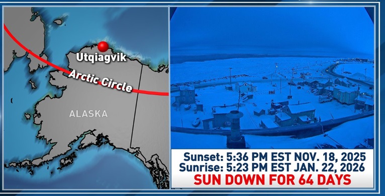
BYE BYE SUN: Once the sun sets in Utqiagvik (formerly Barrow), Alaska at 5:36 pm EST today (November 18th), it won’t rise again until 5:23 pm EST, January 22nd. That’s 64 days with NO SUN! Utqiagvik, AK is the northernmost city in the United States and is located roughly 350 miles north of the Arctic Circle. Once “Polar Night” begins, each day until January 22nd will be mostly pitch black. Barrow will still have a few hours of what’s known as “twilight”, which occurs when the sun is just below the horizon. During twilight, the sky will look like it does here before sunrise and after sunset.
Thanks for reading this Blog this morning. This morning we are LIVE on the radio from 6 to 9 on NewsTalk 93.1. I’ll have another update for you in the 4 o’clock hour tomorrow morning. Have a nice day.
–Rich