
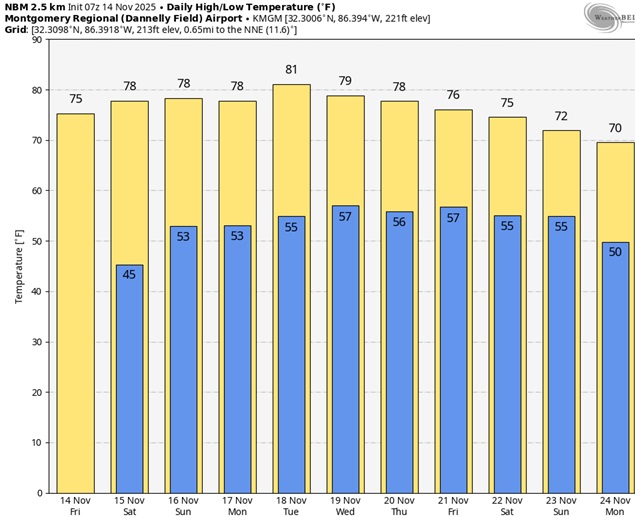
Good Morning! The Arctic Blast at the start of this week is now just a distant memory. Temperatures have turned around in a big way. Montgomery (MGM) had a high of 76 yesterday. We’ll be in the same neighborhood today. Expect highs in the upper 70’s over the weekend and we’ll be near 80. The nights are moderating. We’ll be close to 44 by Dawn this morning. Normal hi/lo 71/44. It’s a dry forecast through Wednesday. A few showers are possible next Thursday. Here’s my brief video forecast discussion.
TODAY: Sunny and warmer. High 76. Light wind. Mostly clear, with a low around 46.
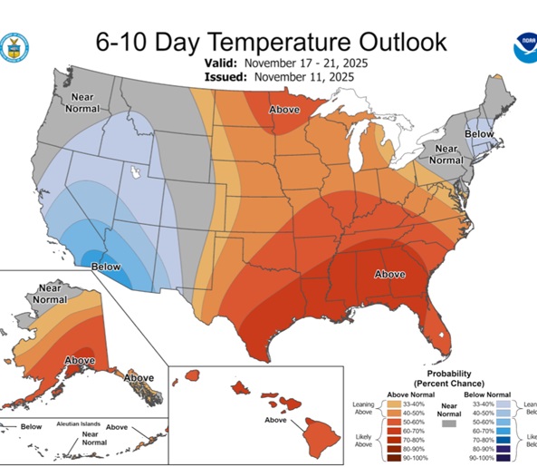
NEXT FEW DAYS: Spring-time in November. A series of very comfortable November days will stick around well into next week. We’ll be Back in the 70’s the today through the weekend and well into next week. Even the nights are moderating. Overnight lows in the 40’s will rise to the 50’s this weekend. We need rain desperately but it’s a dry forecast through at least the middle of next week.

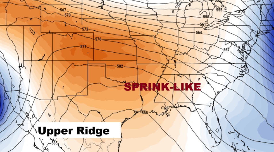
Here’s the 10 Day Model Temperature Trend. What a remarkable string of November days. Spring-time in November. The Arctic Flood Gates are closed.
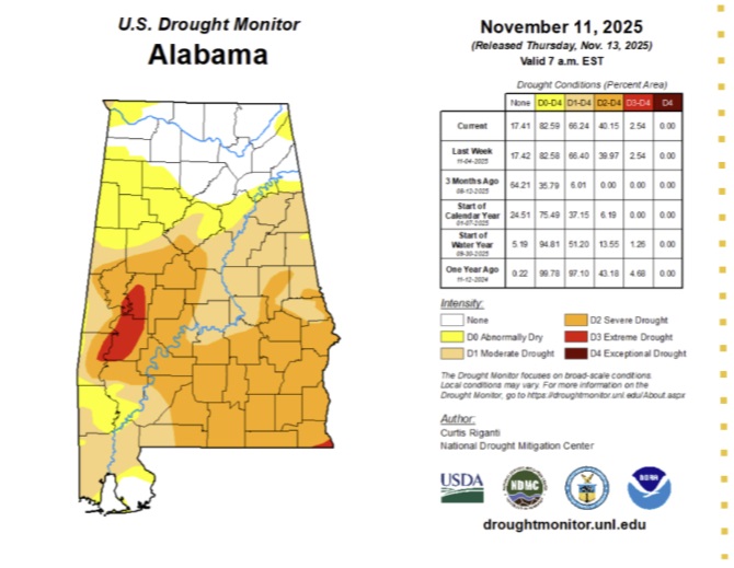
DROUGHT MONITOR: As the drought in Alabama continues to grow worse, the new drought monitor map now shows 66% of state has at least a moderate drought, and at least 40% of the state is in a severe or extreme drought situation. A Fire Burning ban continues in effect.
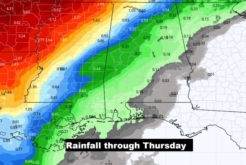
Here’s the bad news. No rain for several days. Next chance of scattered showers next Thursday.
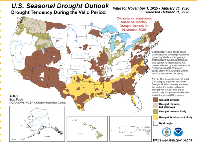
This is sad. The Drought Outlook through January.
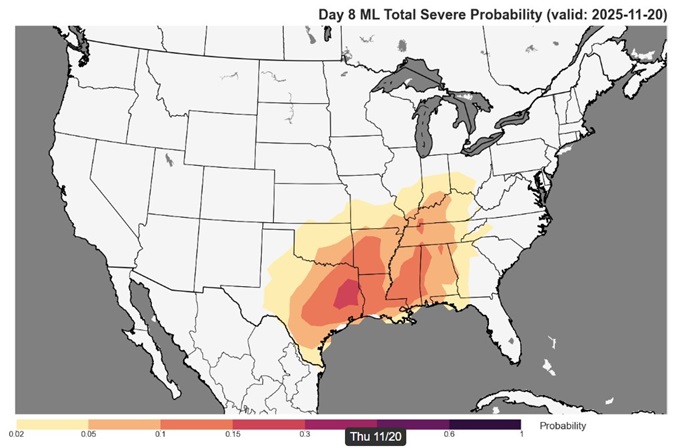
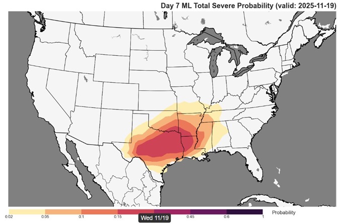
Could we see a significant severe weather threat across the South on Day 7 and especially Day 8? Maybe… Stay tuned.
Thanks for reading this Blog this morning. This morning we are LIVE on the radio from 6 to 9 on NewsTalk 93.1. I’ll have another update for you in the 4 o’clock hour tomorrow morning. Have a nice day.
–Rich