
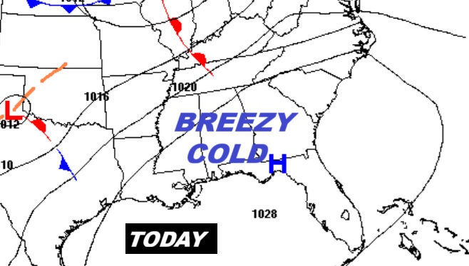
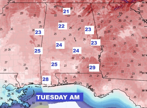
Good Morning! Are you ready for this early harsh taste of Winter? We’ve been telling you about this for about 10 days. The Arctic Express has rolled into Alabama. Today will be breezy and cold. High only 43. Wind chill in the 30’s. Shocking cold tonight. FREEZE Warning. By Dawn Tuesday expect a record low in the lower 20’s. (Record low 29 in 1991) The Veteran’s Day high will only reach 54. Low Tuesday night in the lower 30’s. Expect a BIG Warm up late week. Back to the 70’s Thursday through the weekend. Next chance of rain Sunday. Here’s my brief video forecast discussion.
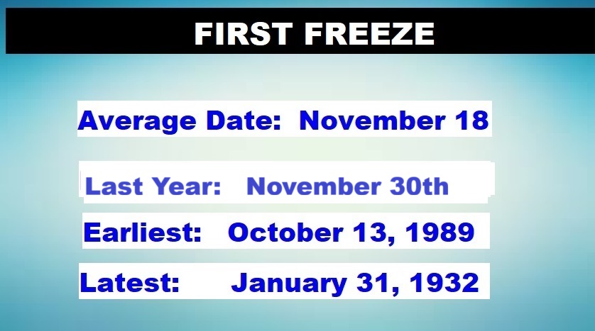
TODAY: Windy and COLD. Sunny, with a high near 43. Wind chill in the 30’s. Northwest wind 12 to 20 mph, with gusts as high as 30 mph.FREEZE WARNING TONIGHT. Widespread frost after 3am. Otherwise, clear, with a low around 23. Northwest wind 6 to 12 mph. Winds could gust as high as 20 mph. (Record low 29 from 1991) (Normal Low 43) (Normal high 72)
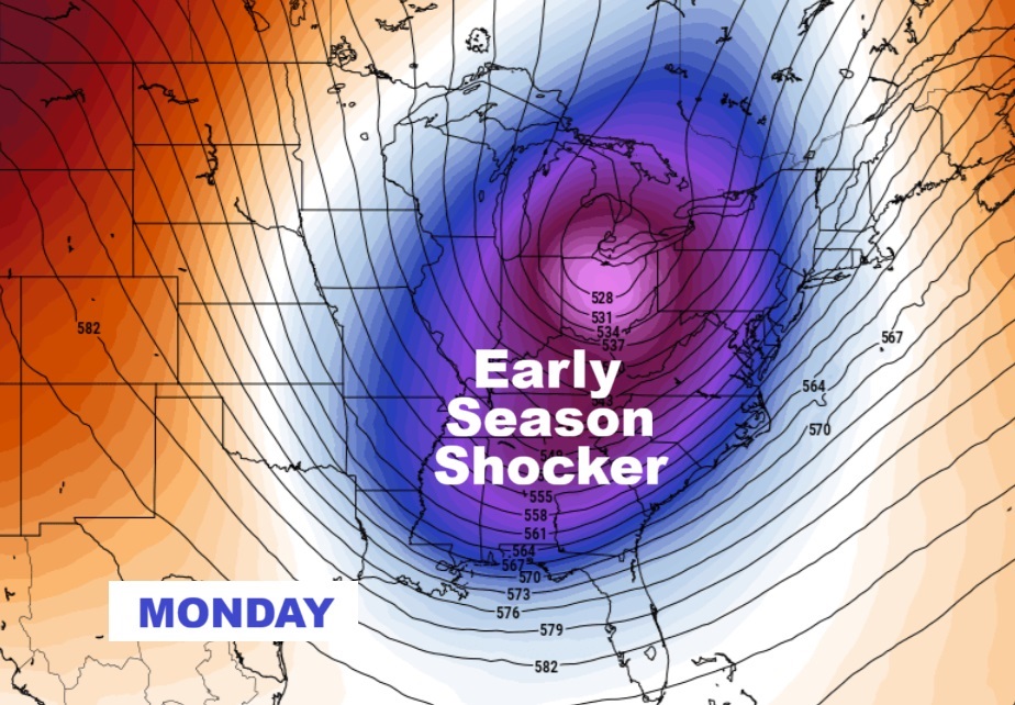
COLD Monday.
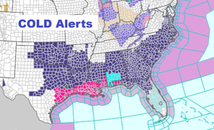
COLD Alerts across the South.
Tuesday AM shocking Lows. Major records will be broken
NEXT FEW DAYS: Harsh early taste of WINTER today and tonight especially. Back to the 60’s Wednesday. 70’s return Thursday through the weekend. Dry through Saturday.
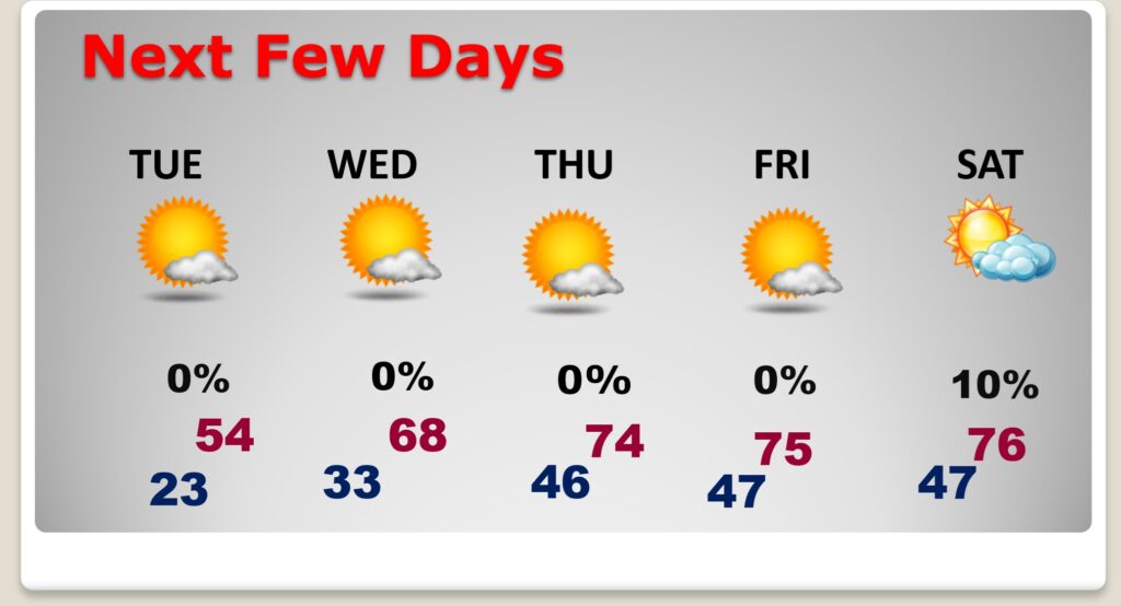
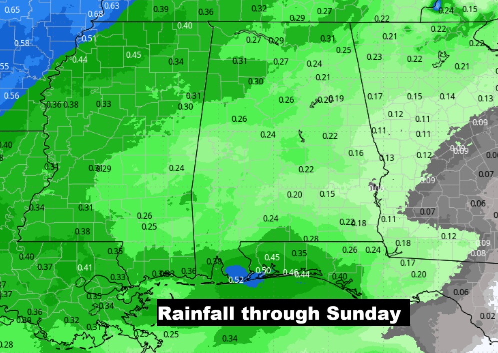
Next chance of showers on Sunday.
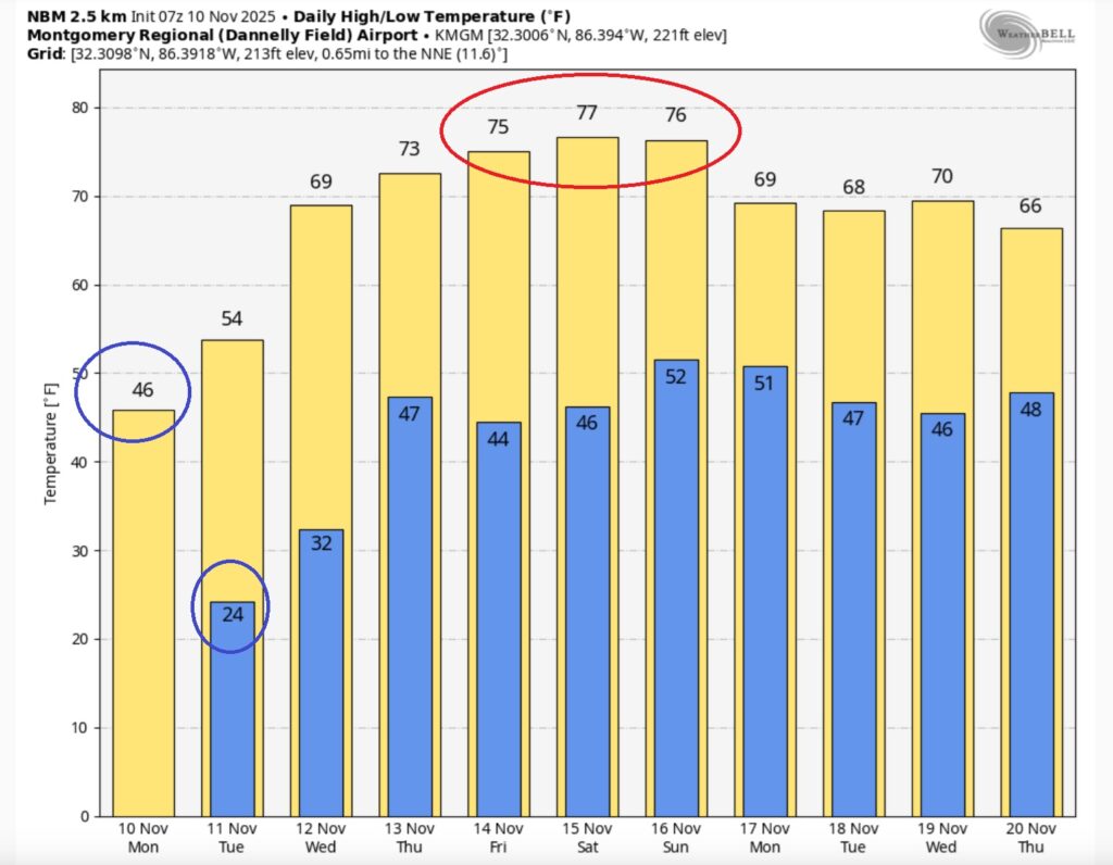
Here’s the 10 Day model blend temperature trend. Nice late week temperature turn-around late week. The “Stupid Cold” won’t last too many days.
Ready for the cold? Take cold weather precautions.

First fire of the season at my house. Right now….

Thanks for reading this Blog this morning. This morning we are LIVE on the radio from 6 to 9 on NewsTalk 93.1. I’ll have another update for you in the 4 o’clock hour tomorrow morning. Have a nice day.
–Rich