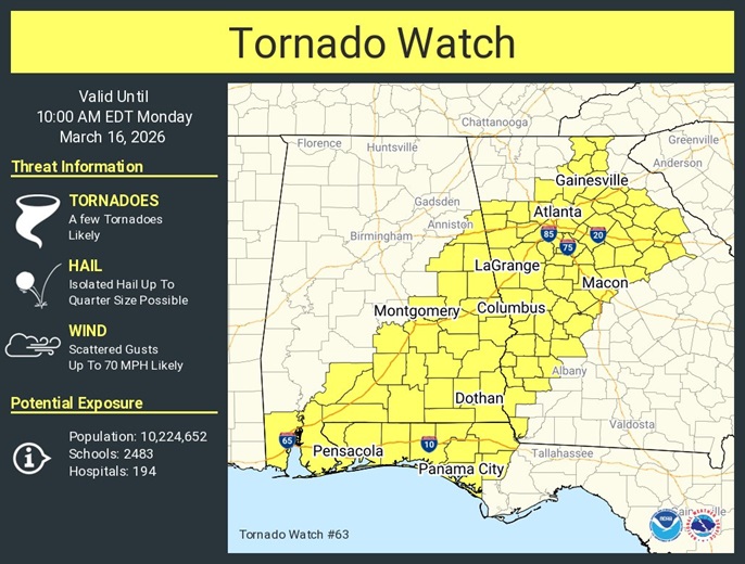
A Tornado Watch covers all of eastern and southeast Alabama. Officially the watch goes till 9AM, but for most of us the threat will end long before that.
Damaging wind gusts to 70+ mph are possible. Hail up to a quarter inch. A few tornadoes are likely. You need more than one reliable methods of receiving severe weather watches and warnings. Our free weather app will send you instant push notifications for severe weather alerts. Make sure your Weather Radio is in the alert mode. Never trust Severe Weather sirens. They can malfunction. Stay weather aware.
WIND ADVISORY IN EFFECT.
TODAY: Risk of leftover showers through the morning hours. Cloudy, then gradually becoming mostly sunny, with a temperature falling to around 40 by 1pm. Breezy, with a northwest wind 15 to 20 mph, with gusts as high as 35 mph.
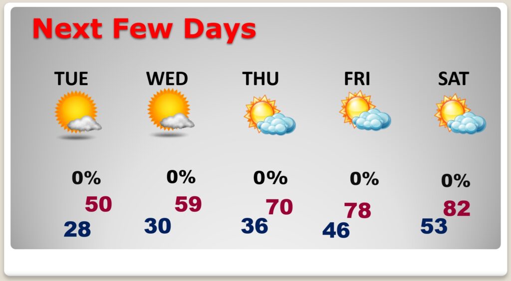
(Normal 71/46)
TONIGHT: Partly cloudy. COLD. Freeze warning. Low 28.