
OFFICIAL morning low at MGM was 35° this morning. Coldest of the season so far. Normal Low 48. Record low was 29° with snow flurries in 1993.
6AM UPDATE:
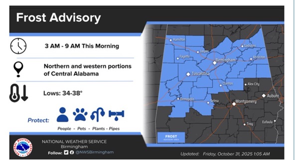
It’s the coldest morning of the fall season so far on this Halloween morning! In Montgomery (MGM) and Maxwell Air Force Base at 6AM it’s 36°. It’s also 36 at Troy, Greenville, and Alex City. Selma is the cold spot with 35°. The first frost advisory of the year covers the northern and part of Central Alabama as far south as Selma
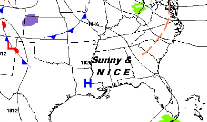
Happy Hallowwen! No tricks today. Mainly treats. Sunshine returns today. Highs will reach the mid and upper 60’s. Tonight will be the coldest night with lows in the upper 30’s tonight. Today, and the first weekend of November will be nice with lots of sunshine. We’ll be in the upper 60’s to near 70 Saturday and Sunday. (Normal 75/48) Expect a significant warming trend next week. We’ll be in the upper 70’s by Thursday. Looks like a dry forecast for several days.
TODAY: Sunny, with a high near 67. Tonight: Clear & cold, with a low in the upper 30’s.
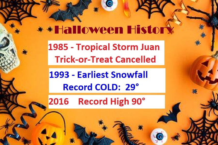
HALLOWEEN HISTORY: I have now covered 47 Halloweens for you. (Sunday will be my 48th Broadcast Anniversary in Montgomery) No other holiday has featured such weird, wild events – including the earliest recorded snowfall in Montgomery in 1993 and a Tropical Storm named Juan! Take a look!
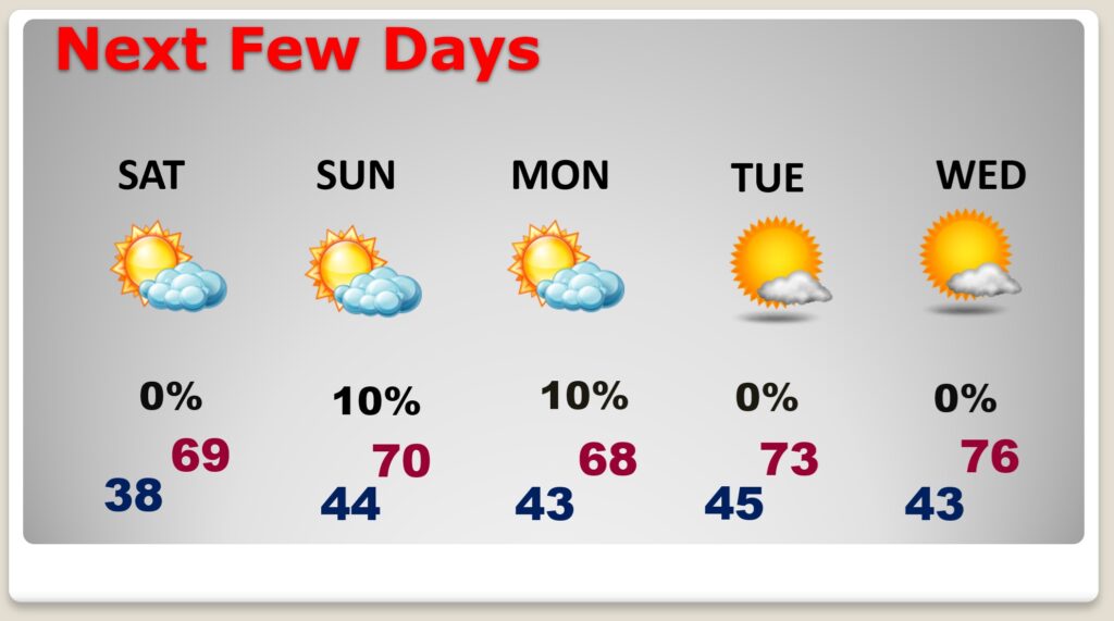
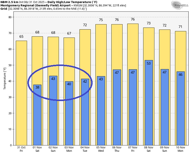
NEXT FEW DAYS: Thefirst weekend of November will be nice with lots of sunshine. We’ll be in the upper 60’s to near 70 Saturday and Sunday. Jacket weather nights will continue with mostly lower 40’s. (Normal 75/48) Expect a significant warming trend next week. We’ll be in the upper 70’s by Thursday. Looks like a dry forecast for several days.
Here’s the 10 Day model blend temperature trend.
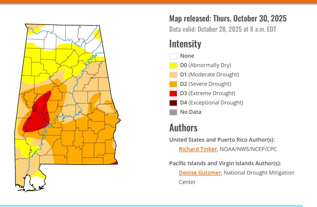
DROUGHT MONITOR: The new Drought Monitor is out. While the drought has improved across north Alabama, the rest of the state from Birmingham southward is not doing well. 67% of the state is in at least a moderate drought and 36% in a Severe Drought or greater.
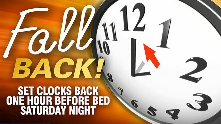
FALL BACK THIS WEEKEND: This is the weekend Daylight saving time ends and we “fall back” to CST. Set the clocks back one hour before you go bed Saturday Night. Officially the time change happens at 2AM Sunday.
Thanks for reading this Blog this morning. This morning we are LIVE on the radio from 6 to 9 on NewsTalk 93.1. I’ll have another update for you in the 4 o’clock hour tomorrow morning. Have a nice day.
–Rich