
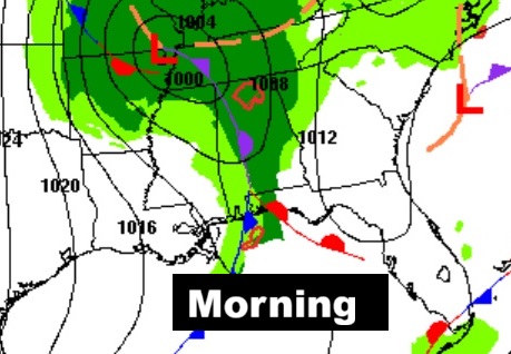
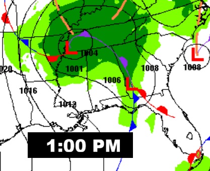
Good morning! The rain in our state this morning is out ahead of the latest cold front moving through our state. The risk of showers will continue mainly through mid-day, before showers exit eastward into Georgia.
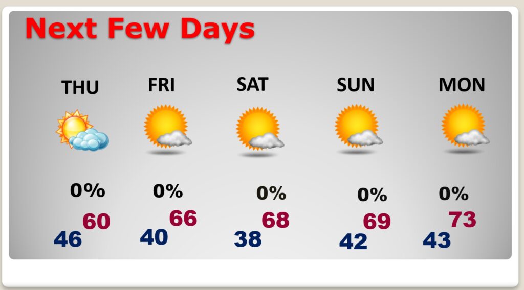
Following the frontal passage, get ready for the coolest air of the fall season so far. Highs today and Thursday will barely reach 60. We’ll be near or below 40 Thursday night and upper 30’s Friday night. After a day or extreme devastation in Jamaica on Tuesday, Hurricane Melissa made a second landfall early this morning (3:10 AM EDT) in Cuba, still as a major Cat 3 hurricane. Here’s my Brief Video Forecast Discussion.
TODAY: Showers, mainly before 1pm. High near 60. Southeast wind around 15 mph becoming west in the afternoon. Winds could gust as high as 30 mph. Mostly cloudy tonight, with a low around 47. West with gusts as high as 25 mph.
The front clears the area early ending the shower threat – followed by much cooler air.
NEXT FEW DAYS:. Following the frontal passage today, get ready for the coolest air of the fall season so far. Thursday’s high will barely reach 60. We’ll be near or below 40 Thursday night and upper 30’s Friday night. Weekend: Sunshine. Highs in the 60’s. (Normal hi/lo 76/49)
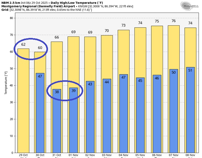
Here’s the 10 Day model blend temperature trend. Much cooler especially next 3 days and nights. Nice warm-up Next Week.
Hurricane MELISSA UPDATE:
After a day or extreme devastation in Jamaica on Tuesday, Hurricane Melissa made a second landfall early this morning 65 miles west of Guantanamo (3:10 AM EDT) in Cuba, still as a major Cat 3 hurricane. The next destination is the southeast Bahamas and eventually Bermuda.
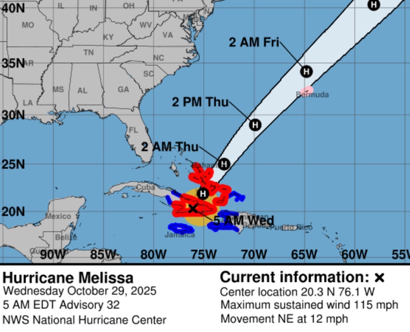
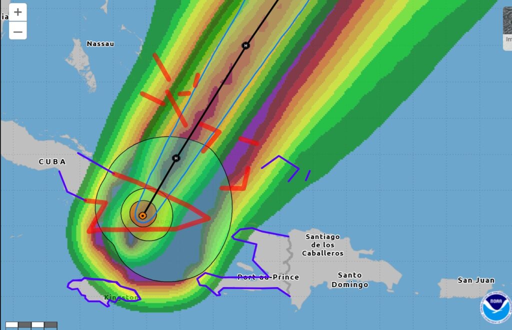
This morning Melissa is still MAJOR Category 3 hurricane with 115 mph winds located 65 miles west of Guantanamo, moving northeast at 12 mph.
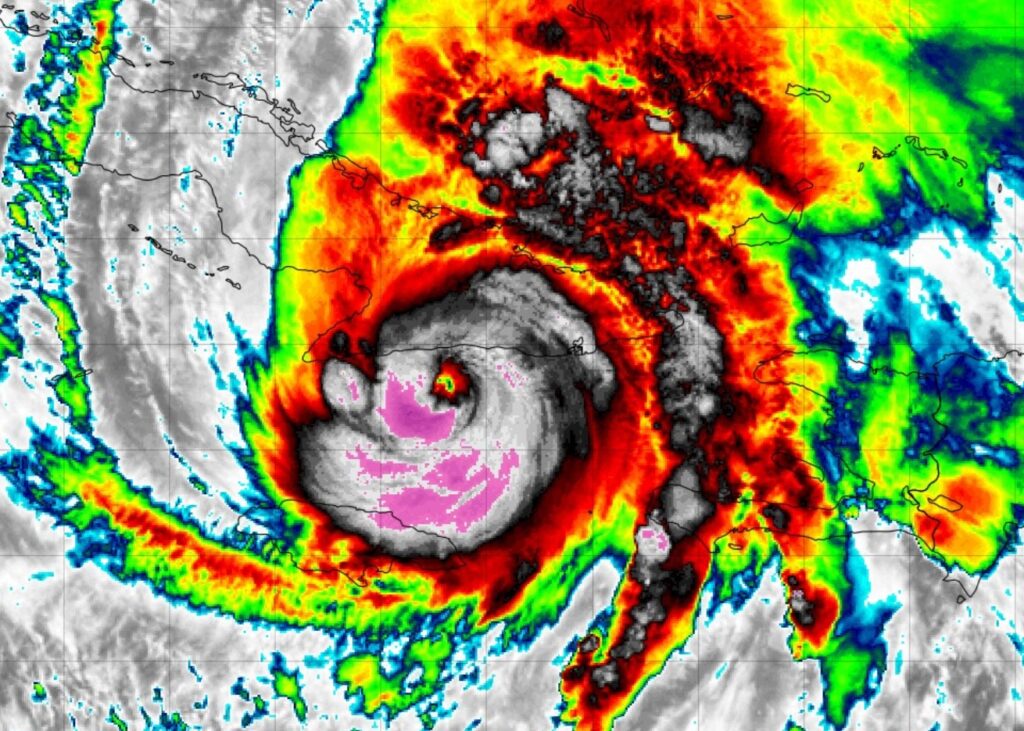
Major Cat 3 Hurricane Melissa over Cuba as seen from the Goes 19 satellite.
.
Thanks for reading this Blog this morning. This morning we are LIVE on the radio from 6 to 9 on NewsTalk 93.1. I’ll have another update for you in the 4 o’clock hour tomorrow morning. Have a nice day.
–Rich