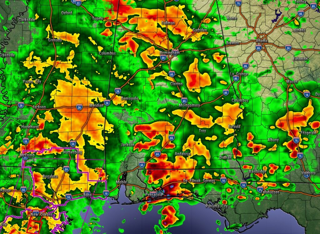
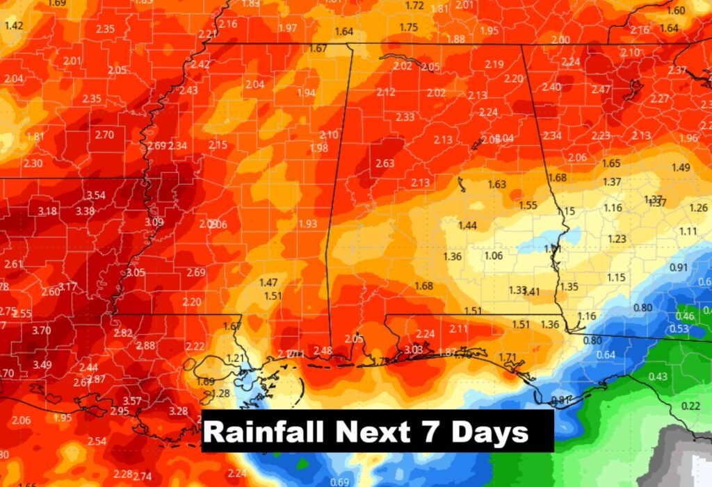
Get ready. Showers and thunderstorms will be moving into the state this morning and across much of the area by this afternoon this evening and tonight. Of course, we’re in a Drought – so rain is just what the doctor ordered. Some areas could see more than an inch of rain when all is set and done. Some storms in SW Alabama could reach severe limits.
Hurricane MELISSA UPDATE:
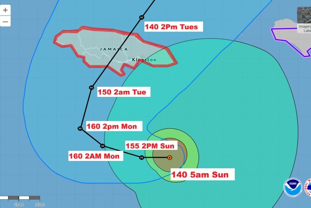
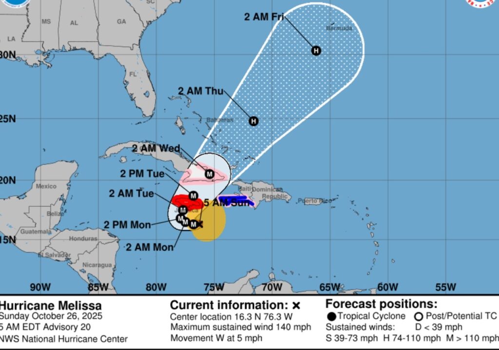
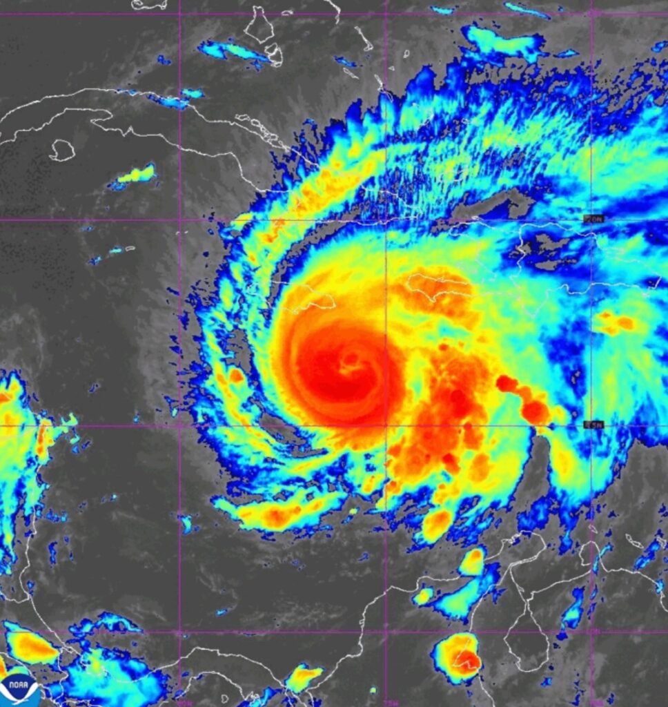
What’s about to happen in the island nation of Jamaica is practically unthinkable. It will be the worst hurricane disaster in Jamaican history – worst than Gilbert in 1988. At 5AM EDT winds in Melissa have reached 140 mph.
Melissa is in the midst of a period of extreme rapid
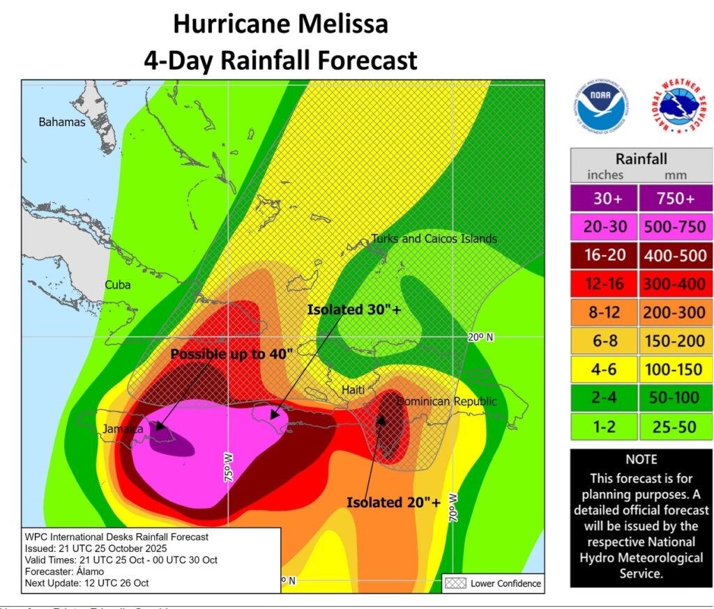
intensification. Currently located 120 SSE of Kingston moving west at 5. Melissa is expected to reach Category 5 status today. Melissa is expected to be a major hurricane when making landfall in Jamaica Monday night or Tuesday morning and southeastern Cuba late Tuesday. Rainfall will be measured in FEET. Extensive infrastructural
damage, long-duration power and communication outages, and isolation of communities are expected. Life-threatening storm surge is likely along portions of the southern coast Monday night and Tuesday morning. Terrible Hurricane history is about to be made. Eastern Cuba, Southeast Bahamas, and the Turks and Caicos: There is an increasing risk of a significant storm surge, damaging winds, and heavy rainfall by the middle of the week. In eastern Cuba, the risk of life-threatening flash flooding and landslides is increasing.