
Good morning! The front that moved through our state yesterday has made it to the coast. High pressure is in control. Expect a beautiful Fall Day today with a high only in the middle 70’s.
The coolest morning will be Thursday with low 40-‘s expected. It looks like we will be storm-free and dry through Saturday. Daytime highs mostly in the upper 70’s to near 80 Thursday, Friday and Saturday, with nights in the 40’s. Scattered showers and storms will arrive by Sunday, with a lingering chance Monday. Here’s my Brief Video Forecast Discussion.
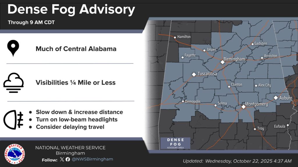
TODAY: DENSE FOG ADVISORY until 9AM. Sunshine. Cooler. North wind 6 to 13 mph. High 75. Partly cloudy tonight. Low 46. (Normal 79/52)
FOG: Dense Fog Advisory has been expanded and now includes most of central Alabama, including Selma, Montgomery and Auburn this morning till 9. Visibility ¼ mile or less in spots.
NEXT FEW DAYS: Great Fall weather continues with sunshine and highs in the upper 70’s to near 80 Thursday through Saturday.
The coldest morning 44 on Thursday. Looks like we will be storm-free and dry through daytime Saturday. Daytime highs mostly in the 70’s Thursday, Friday and Saturday. Nights in the 40’s. Scattered showers and storms will arrive by Sunday, with a lingering chance Monday.
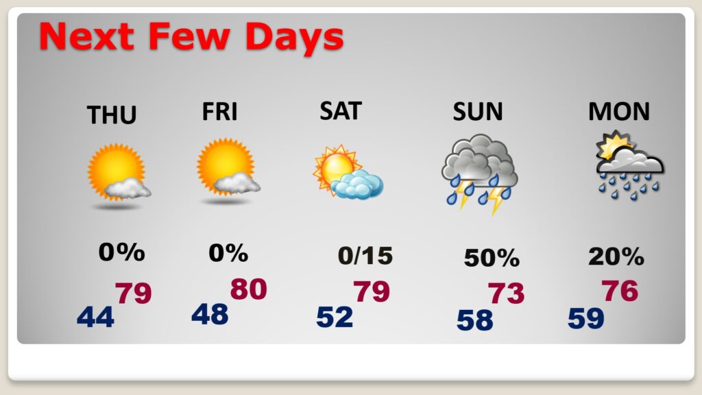
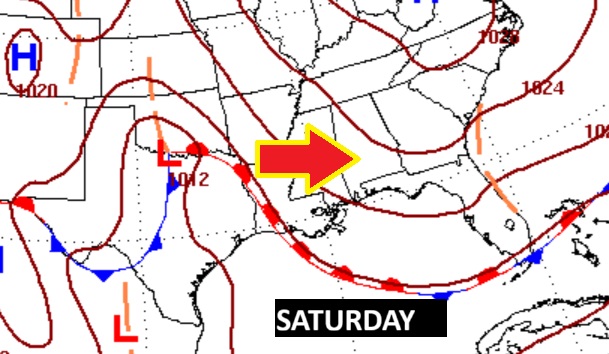
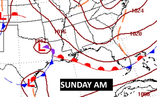
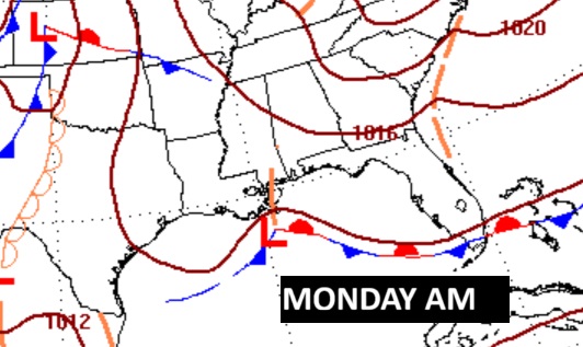
The next significant weather maker is this weekend, as a low pressure storm system slides eastward through the Gulf states. Scattered showers and storms will arrive by Sunday, with a lingering chance Monday.
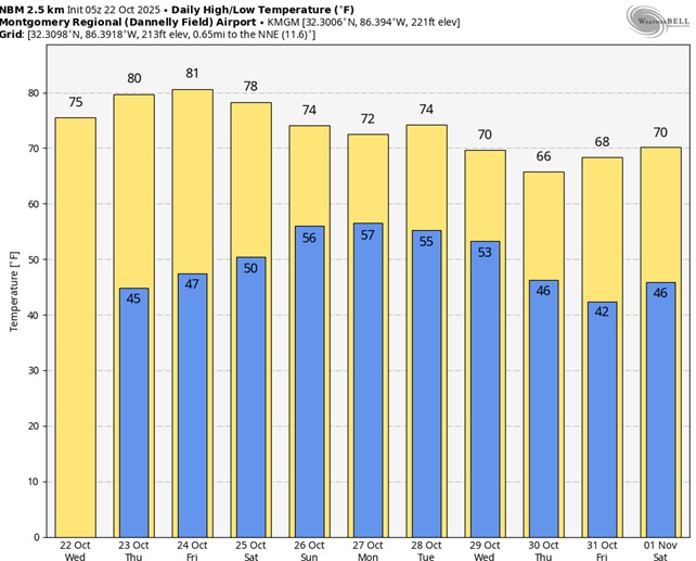
Here’s the 10 Day model blend temperature trend.
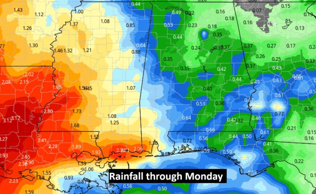
Hopefully some more beneficial rainfall. At least a little. Here’s the rainfall outlook through Monday.
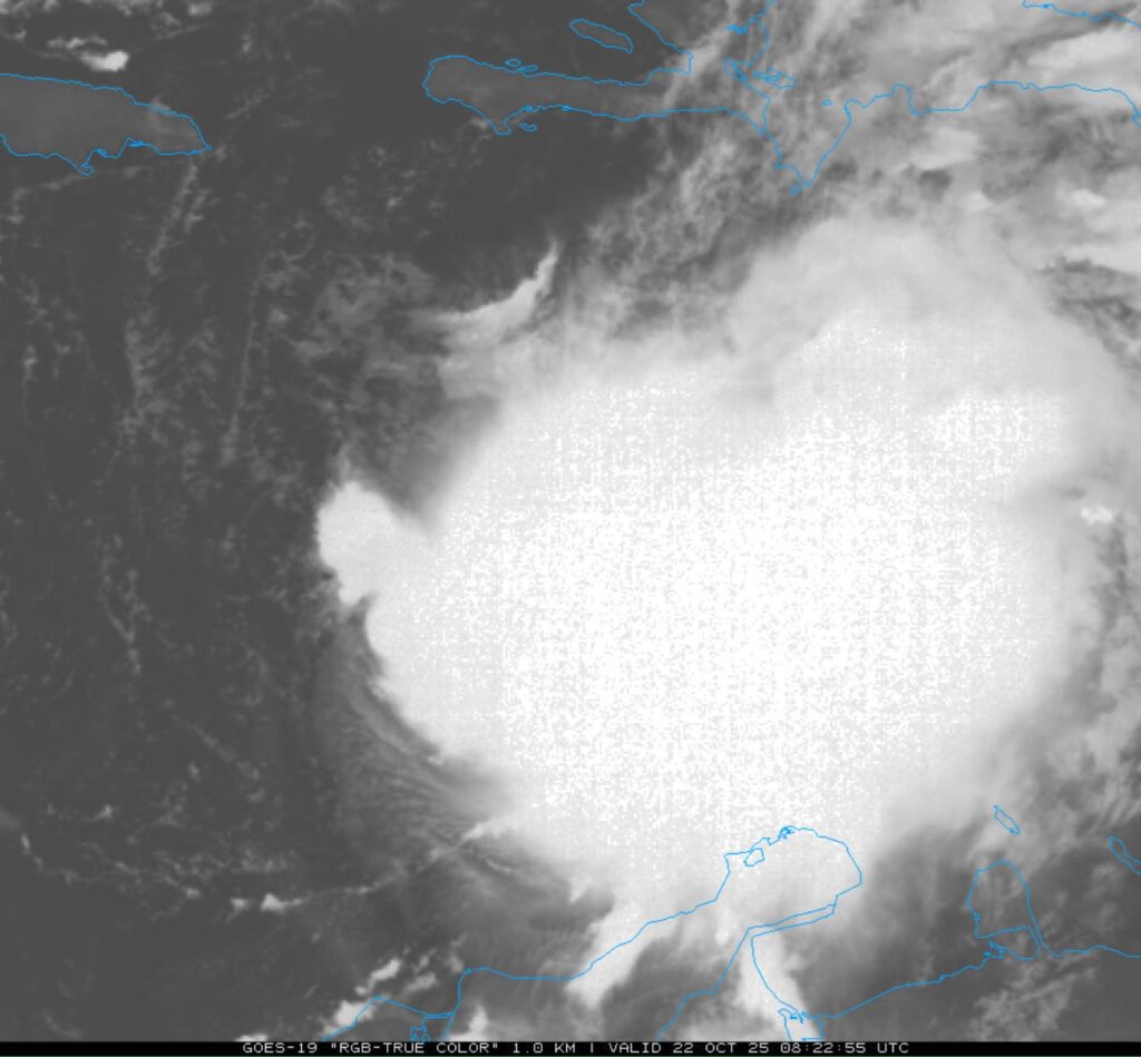
TROPICAL:
There’s much uncertainty in the future track of Tropical storm Melissa.
NHC says: Hurricane conditions are possible in the southwestern peninsula of Haiti where a Hurricane Watch is in effect. A Tropical Storm Watch is in effect for Jamaica. There is significant uncertainty in the track and intensity forecast of Melissa.
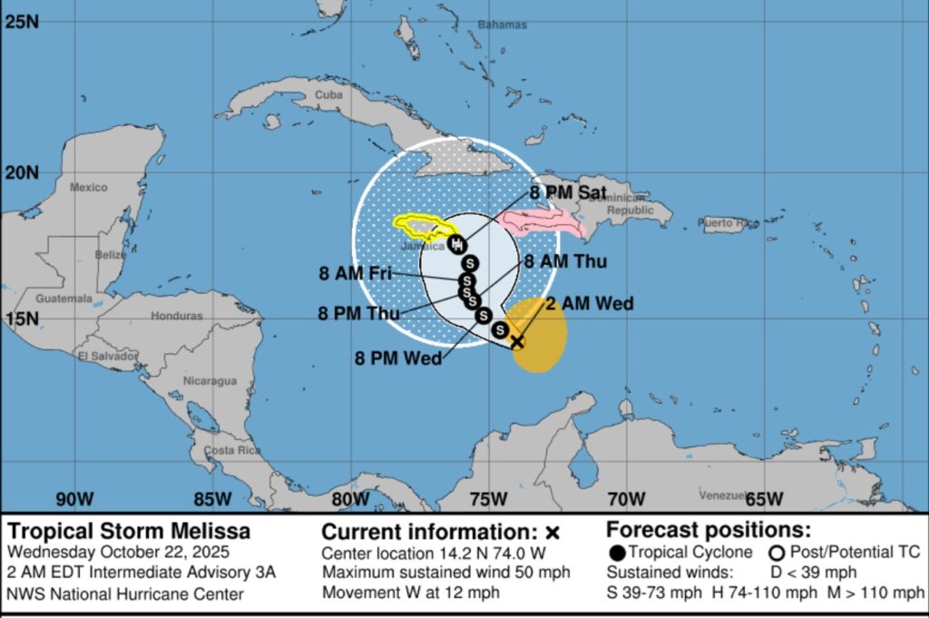
Melissa dominates the central Caribbean.
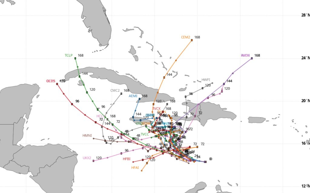
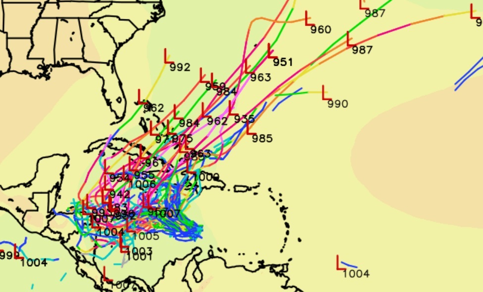
The models are certainly baffled and all over the place on Melissa’s future.
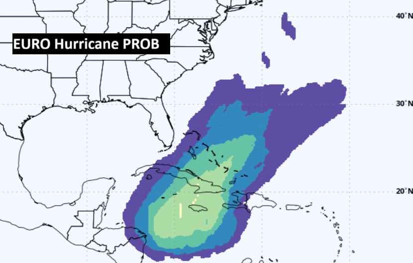
Here’s the EURO probability of Melissa becoming a Hurricane.
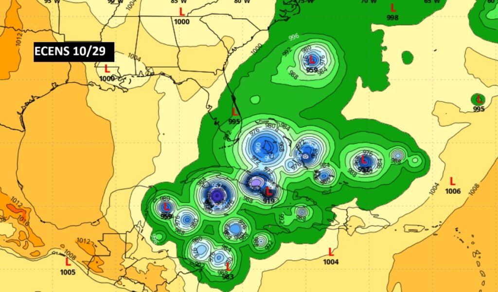
The EURO Ensemble Members shows the variety of possible future Melissa solutions showing the forecast dilemma.
Thanks for reading this Blog this morning. This morning we are LIVE on the radio from 6 to 9 on NewsTalk 93.1. I’ll have another update for you in the 4 o’clock hour tomorrow morning. Have a nice day.
–Rich