
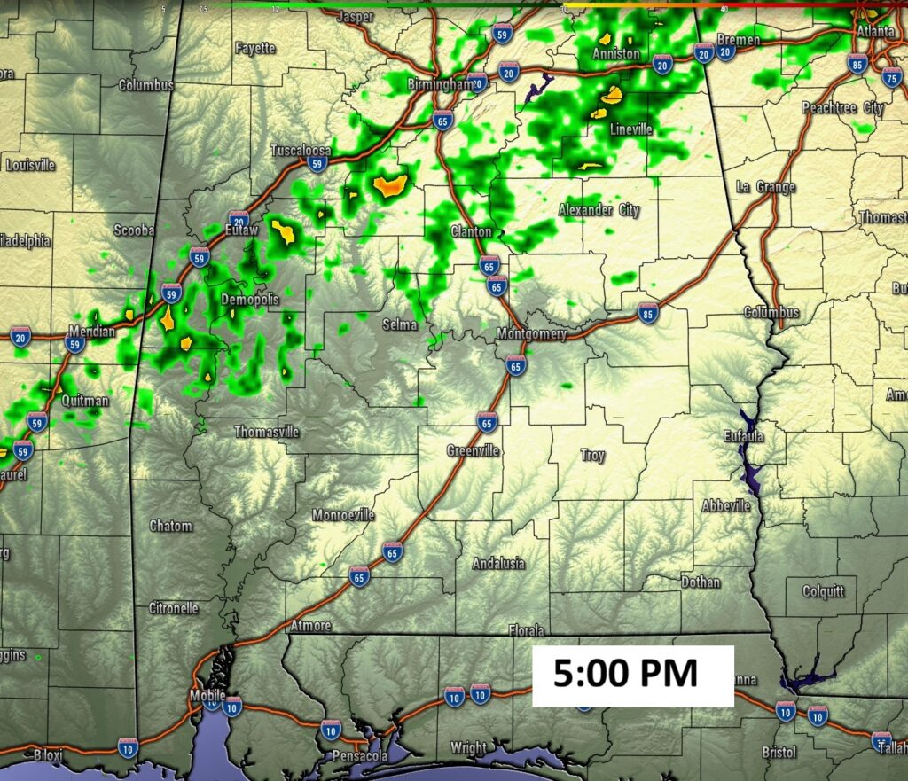
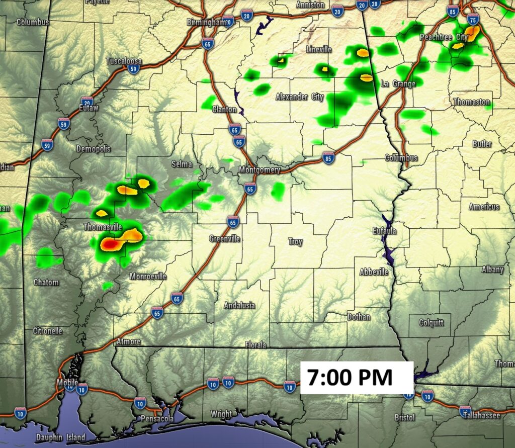
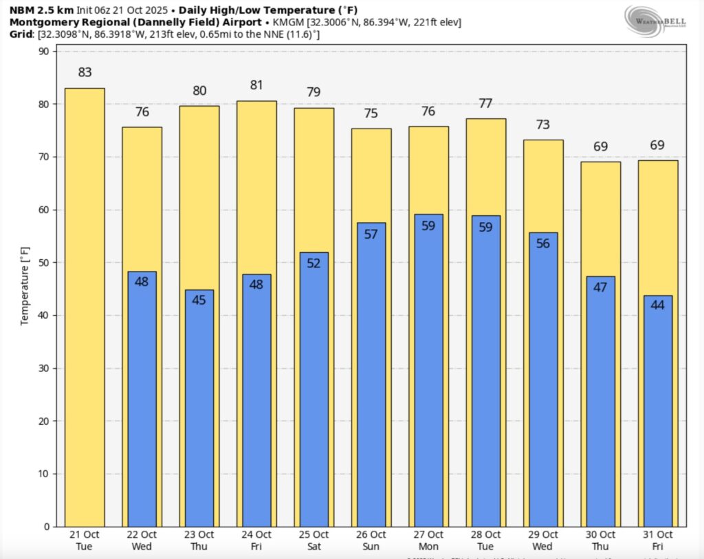
Good morning! Temperatures will rebound a bit to the lower 80’s. But, a reinforcing front is on the way, arriving by late afternoon or evening. A couple of isolated showers ahead of the front. I have the rain chance under 20%.
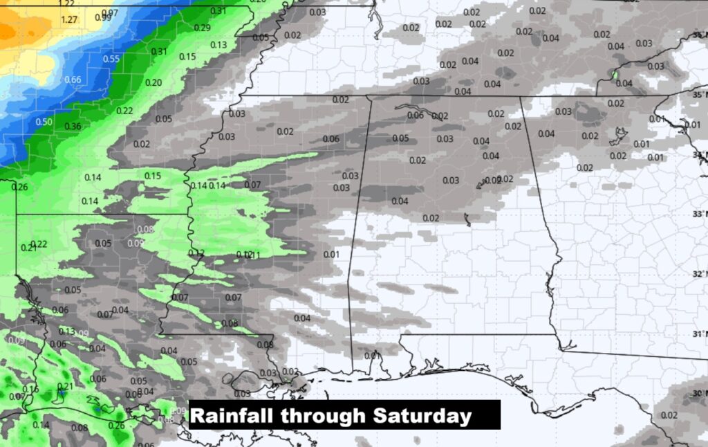
The coolest day will be lower to mid 70’s Wednesday and coolest. morning 43 on Thursday. Looks like we will be dry through daytime Saturday. Scattered showers and storms will arrive as early as late Saturday night and Sunday. Here’s my Brief Video Forecast Discussion.
TODAY: MostlySunny. Rain chance 20% or less. Light wind. High 82. Partly cloudy tonight. Low 50.
Weak front moves through the state today. The reinforcing front will deliver some cooler nights and highs in the 70’s tomorrow.
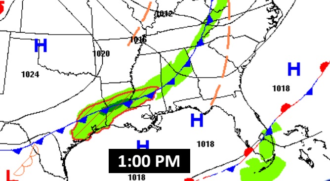
FUTURE RADAR: Only isolated showers. Rain chance 20% or less.
NEXT FEW DAYS: Wednesday will be dry and cooler with highs mostly in the mid 70’s. Nights will be quite chilly in the 40’s.
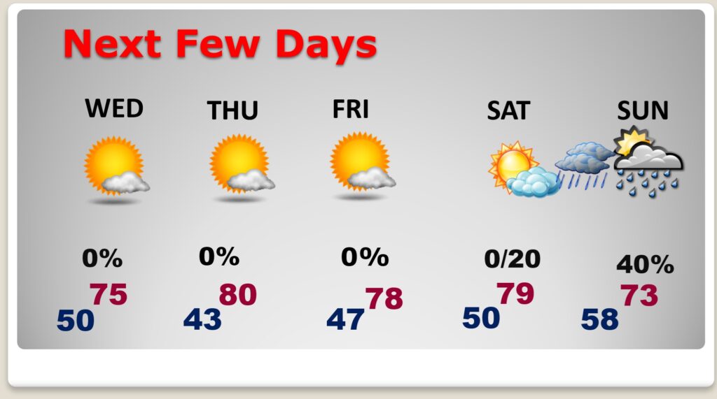
The coldest morning 43 on Thursday. Looks like we will be storm-free and dry through daytime Saturday. Daytime highs mostly in the 70’s Thursday, Friday and Saturday. Nights in the 40’s. Scattered showers and storms will arrive as early as late Saturday night and Sunday.
The 10 Day model blend temperature trend. Lots of ups and downs. Some of the coolest air will be close to Halloween.
The next significant weather maker is this weekend.
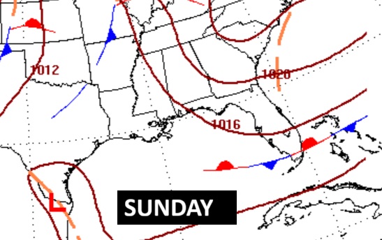
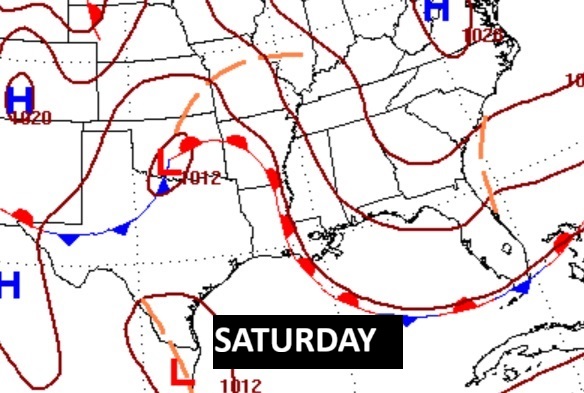
Scattered showers and storms will arrive as early as late Saturday night and Sunday. Hopefully some more beneficial rainfall.
TROPICAL:
Topical Trouble. INVEST 98-L, with a 90% chance of development to a Depression and eventually Tropical Storm Mellisa.
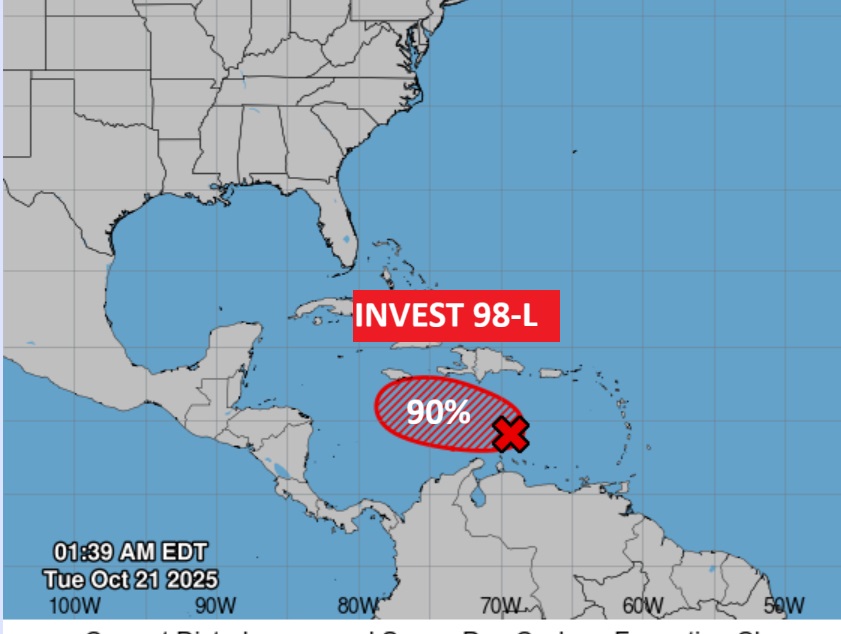
Eventually this system bring lots of wind and rain to the Greater Antilles.
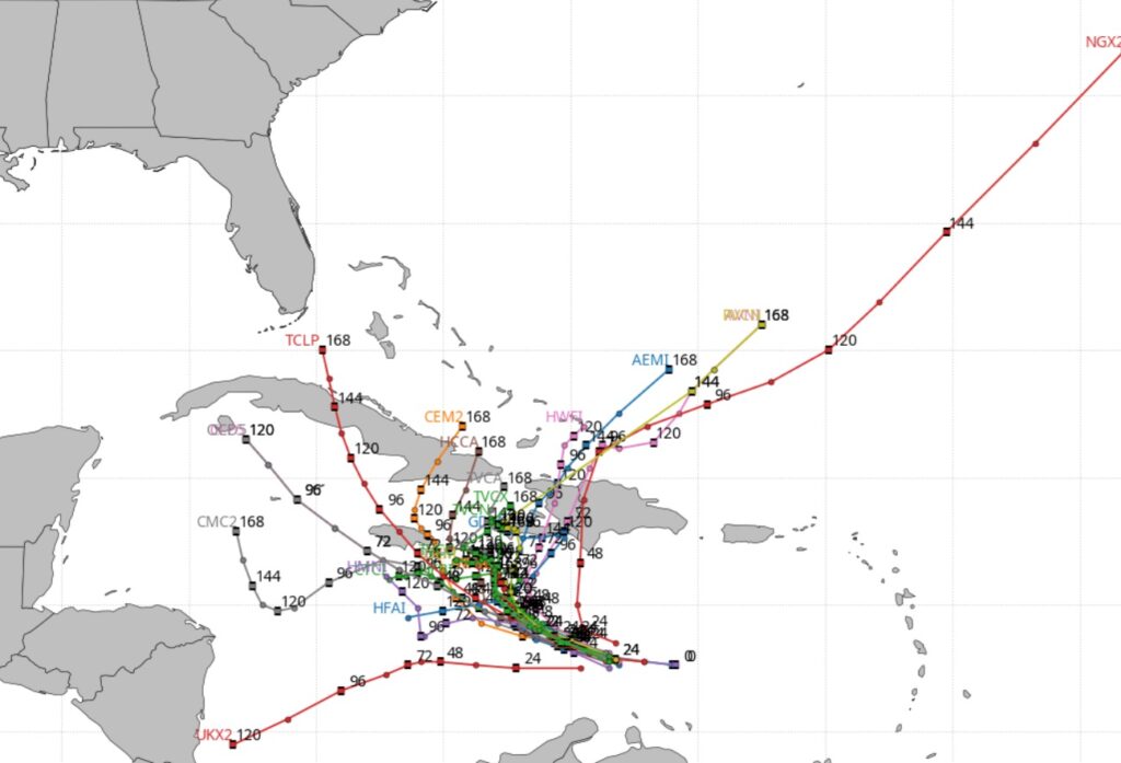
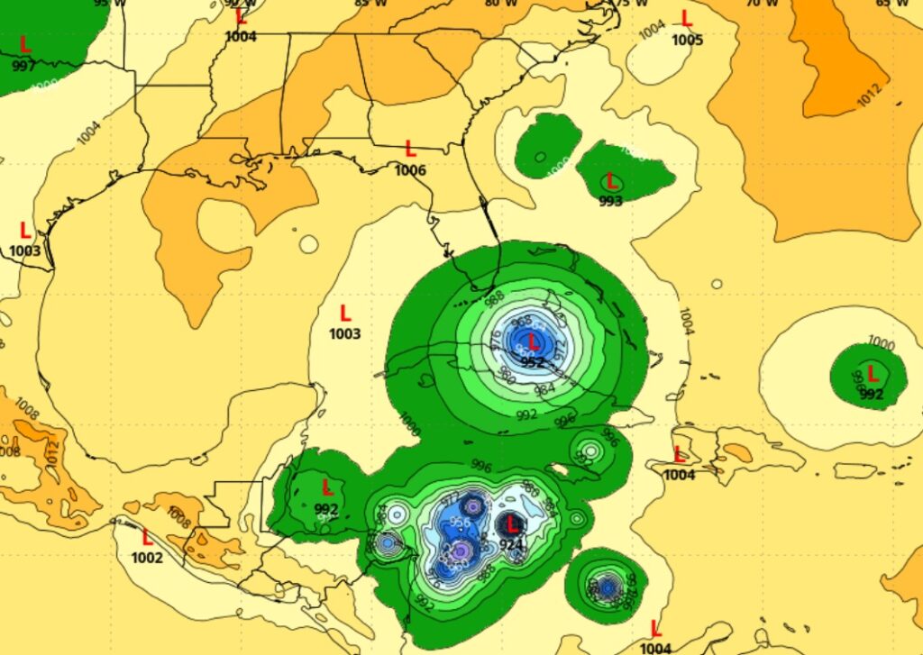
The Global models continues to strongly indicate that the Caribbean needs to be monitored next week for tropical development.
Thanks for reading this Blog this morning. This morning we are LIVE on the radio from 6 to 9 on NewsTalk 93.1. I’ll have another update for you in the 4 o’clock hour tomorrow morning. Have a nice day.
–Rich