
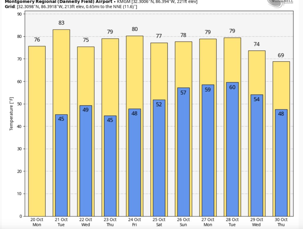
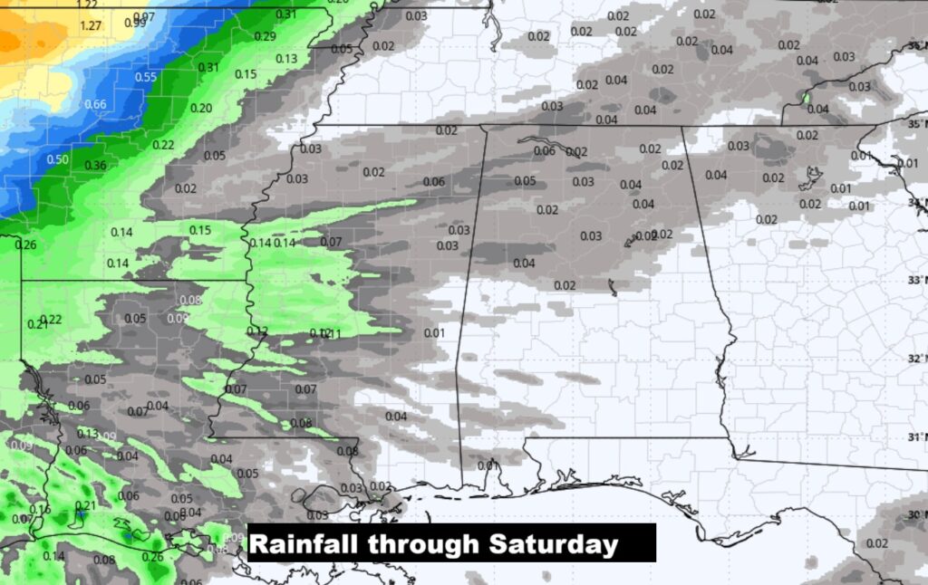
Good morning! What a big change of reality. It’s a very cool morning. Today’s high may only reach the mid 70’s, following the weekend Cold Front that brought beneficial rainfall. We’re headed for the mid 70’s tonight. Tuesday’s high will rebound just a bit to the lower 80’s. But, then, there will be a secondary reinforcing surge of cool air which will arrive Tuesday evening. I have the rain chance under 20%.
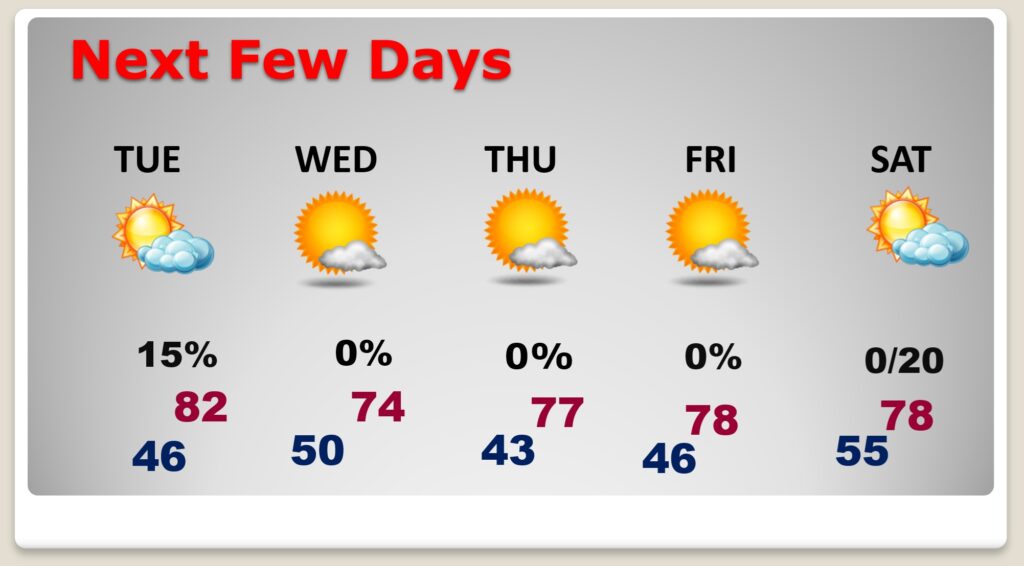
The coolest day will be lower 70’s and breezy Wednesday and coldest morning 43 on Thursday. Looks like we will be dry through daytime Saturday. Here’s my Brief Video Forecast Discussion.
TODAY: Sunny. Low humidity. Comfortably cool. North wind 6 to 12 mph. High 76. Clear and chilly tonight. Low 48.
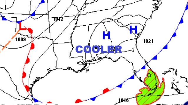
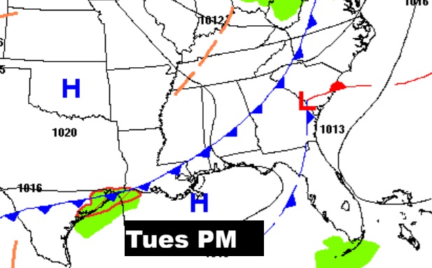
NEXT FEW DAYS: Tuesday’s high rebounds just a bit to the lower 80’s. But, then, there will be a secondary reinforcing surge of cool air which will arrive Tuesday evening. I have the rain chance under 20%.
The coolest day will be lower 70’s and breezy Wednesday and coldest morning 43 on Thursday. Looks like we will be storm-free and dry for several days. Small chance of showers Saturday night & Sunday. Daytime highs in the 70’s Thursday, Friday and Saturday. Nights in the 40’s.
The 10 Day model; blend shows lots of Fall ups and downs.
Dry forecast for the week ahead.
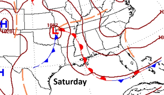
Cold this weekend storm system bring a severe weather threat to the South?
TROPICAL:
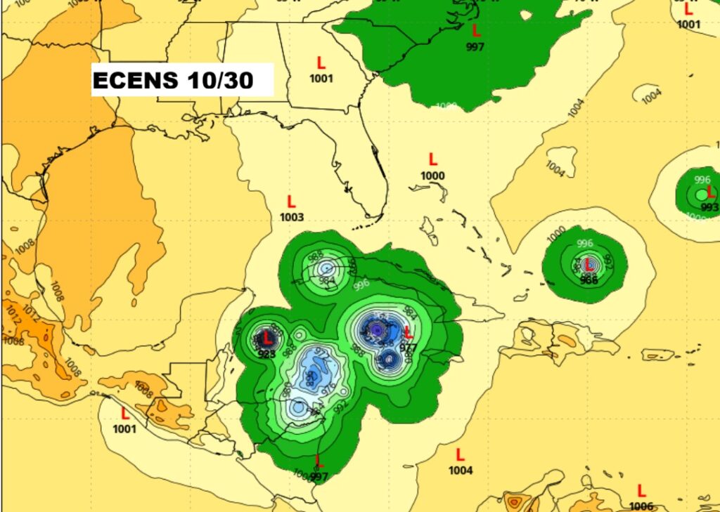
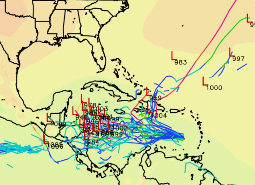
Topical Trouble in the Caribbean. INVEST 98-L, with a 70% chance of development is in a hostile environment for a couple of days NHC: Thereafter, environmental conditions are expected to become more conducive for development as the wave slows down over the central Caribbean Sea, and a tropical depression is likely to form during the middle to
latter part of this week.
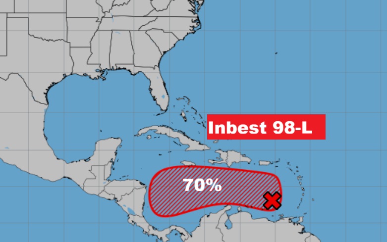
Eventually this system could terrorize the Greater Antilles.
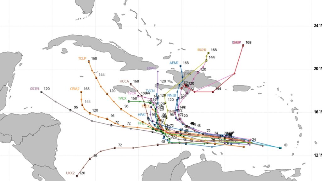
The Global models continues to strongly indicate that the Caribbean needs to be monitored next week for tropical development. Stay tuned.
Thanks for reading this Blog this morning. This morning we are LIVE on the radio from 6 to 9 on NewsTalk 93.1. I’ll have another update for you in the 4 o’clock hour tomorrow morning. Have a nice day.
–Rich