
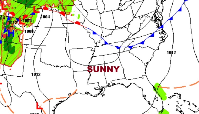
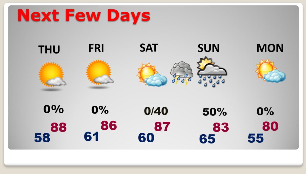
Good morning! Temperatures have warmed up. Not only are the days warmer, the nights are not quite as cool. This trend will continue. Sunny days and mostly clear nights will continue. We’ll be in the upper 80’s today through Saturday.
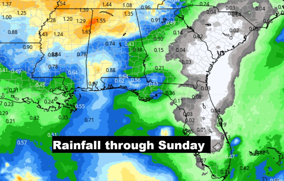
It’s still a dry forecast at least through Saturday. Scattered showers return to the forecast late Saturday night and on Sunday. Next week looks dry again, with another cool-down expected. Here’s my brief video forecast discussion.
TODAY: Sunshine. Low humidity. High 87. Light wind. Clear and not as cool tonight. Low 58.
NEXT FEW DAYS: Temperatures continue to rebound. Days are warmer. Nights are not as cool. It’s still a bone-dry forecast through at least Saturday. Scattered showers return to the forecast Saturday night and especially Sunday.
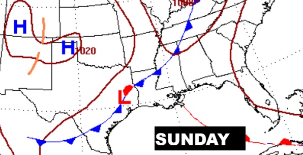
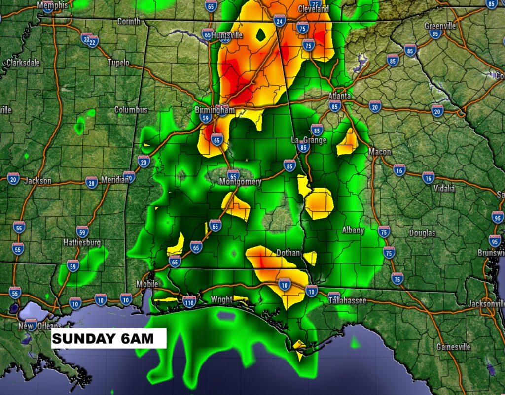
The Sunday frontal system will bring the best chance of precious raindrops we’ve seen in quite a while.
Here’s the 10 day Model Blend temperature trend. Temperatures will cool down again next week behind Sunday’s Cold front. (Normal 81/55)
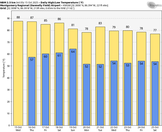
NO rain is expected through Saturday. Scattered showers return to the forecast Saturday night and especially Sunday ahead of the next front.
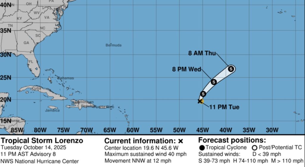
TROPICAL:
Tropical Storm Lorenzo is a weak tropical storm in the far east Atlantic. It does not have much of a future. The rest of the Atlantic Basin is quiet for now.
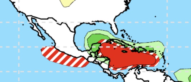
The EURO Ensembles Member Lows continues to strongly indicate that the western Caribbean and the Gulf need to be watched carefully near the end of this month.
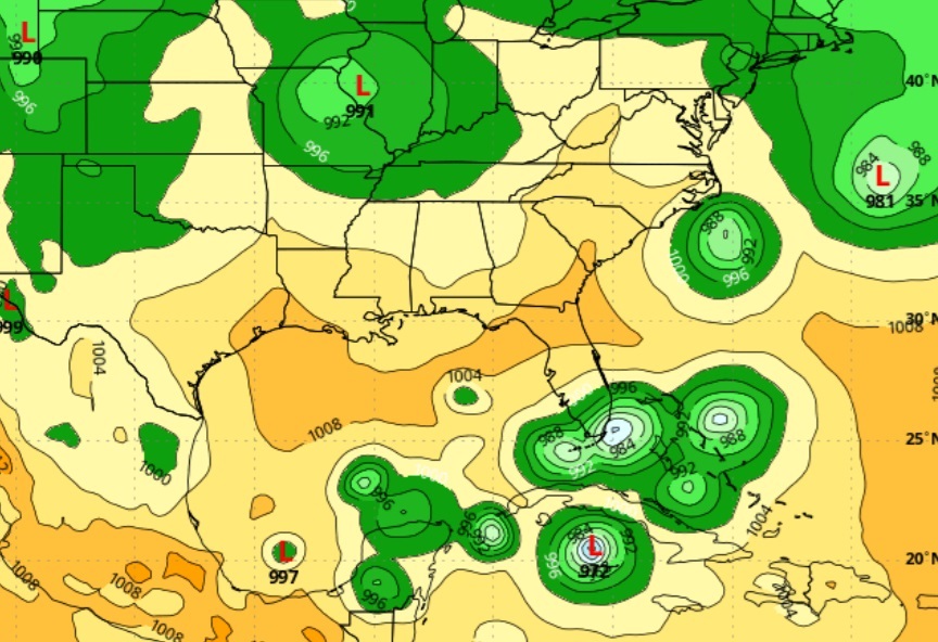
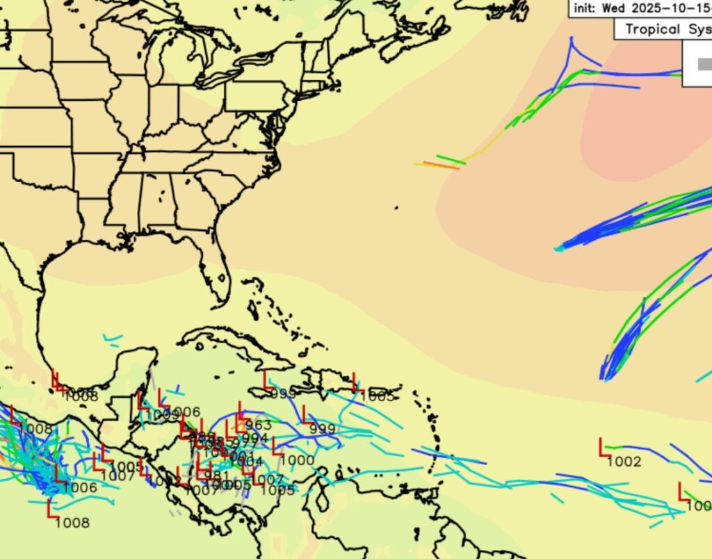
Even the CPC is highlighting the Caribbean next week.
Thanks for reading this Blog this morning. This morning we are LIVE on the radio from 6 to 9 on NewsTalk 93.1. I’ll have another update for you in the 4 o’clock hour tomorrow morning. Have a nice day.
–Rich