
Good morning! Temperatures are starting to rebound. The days are warmer and nights are not quite as cool. This trend will continue. Sunny days and mostly clear nights will continue.
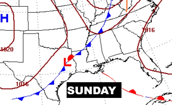
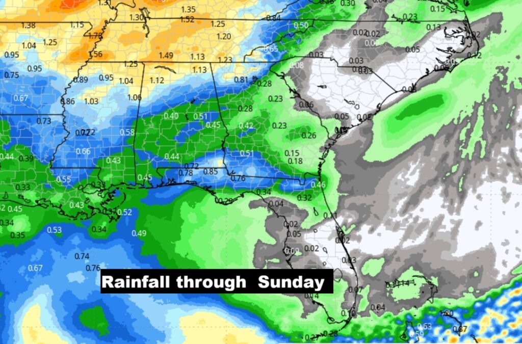
It’s still a bone dry forecast at least through Saturday. Scattered showers return to the forecast late Saturday night and especially Sunday. Next week looks dry again, with another cool-down expected. Here’s my brief video forecast discussion.
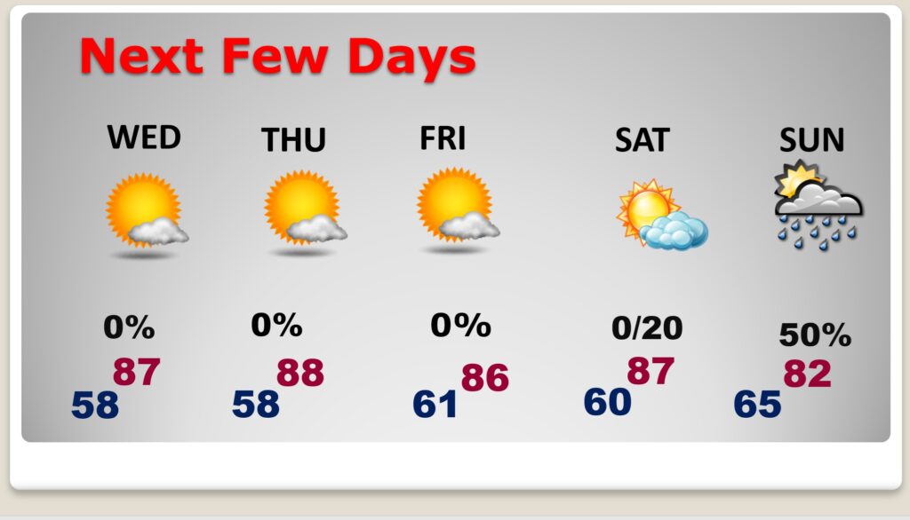
TODAY: Sunshine. Low humidity. High 87. Light wind. Clear and not as cool tonight. Low 58.
NEXT FEW DAYS: Temperatures are starting to rebound. Meanwhile, the Drought continues to grow worse. It’s still a bone-dry forecast through at least Saturday. Scattered showers return to the forecast Saturday night and especially Sunday.
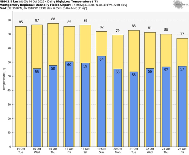
Here’s the 10 day Model Blend temperature trend. Temperatures are rebounding. Next week will trend cooler again behind Sunday’s cold front.
NO rain is expected through Saturday. Scattered showers return to the forecast Saturday night and especially Sunday ahead of the next front.
TROPICAL:
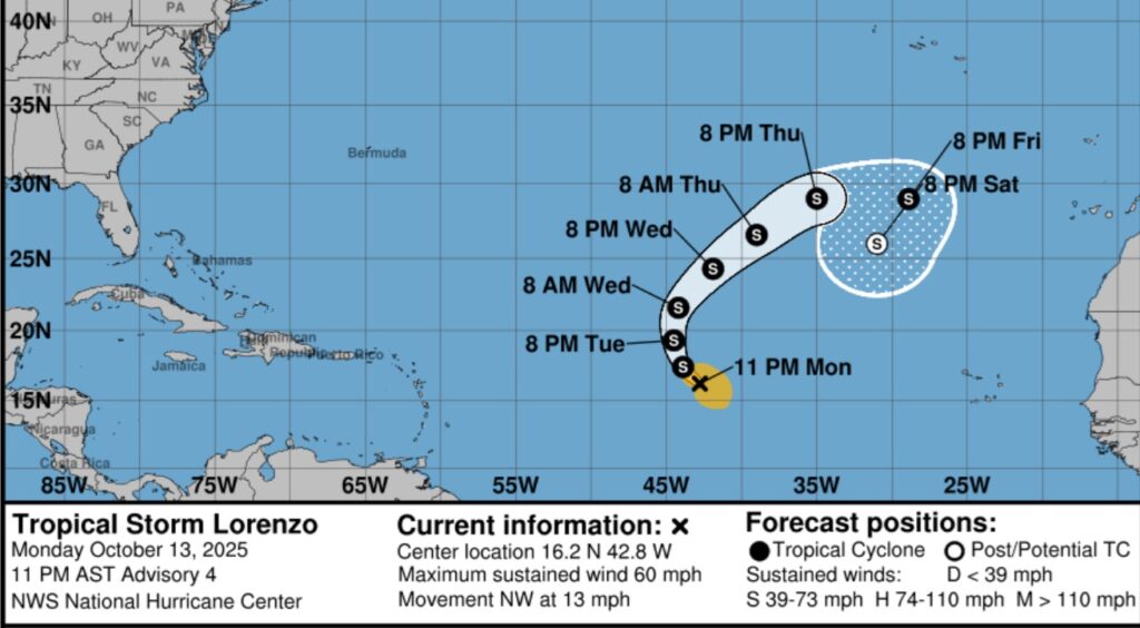
Tropical Storm Lorenzo is growing stronger is the far east Tropical Atlantic, curving eastward. It is not expected to become a hurricane. The rest of the Atlantic Basin is quiet for now.
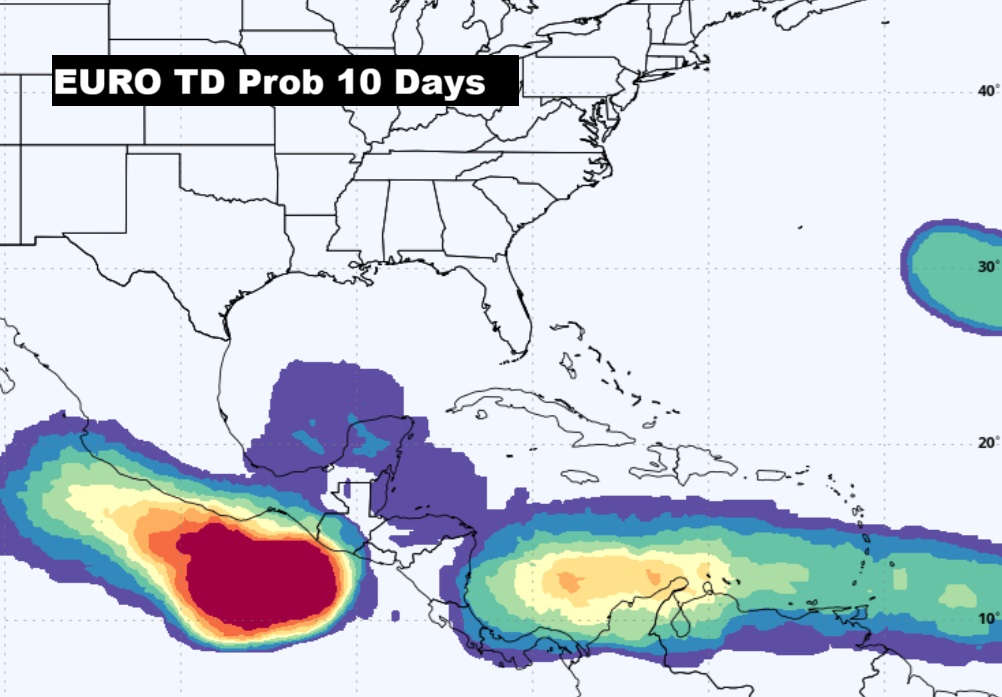
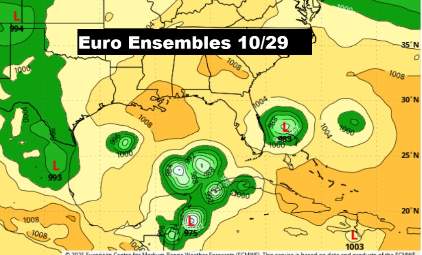
The EURO continues to strongly hint that the western Caribbean and the Gulf need to be watched carefully late in the month especially.
Thanks for reading this Blog this morning. This morning we are LIVE on the radio from 6 to 9 on NewsTalk 93.1. I’ll have another update for you in the 4 o’clock hour tomorrow morning. Have a nice day.
–Rich