
Good morning! On this Columbus Day, a chilly start will turn into a very comfortable day with low humidity. Looks like another jacket weather night tonight. but, temperatures will start to moderate mid to late week. It’s still a bone dry forecast at least through Friday. Scattered showers return to the forecast Saturday night and especially Sunday ahead of the next front. Here’s my brief video forecast discussion.
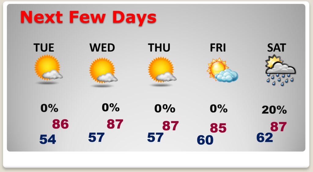
TODAY: Sunshine. Low humidity. High 85. North wind 5 to 10 mph. Clear and cool tonight. Low 57.
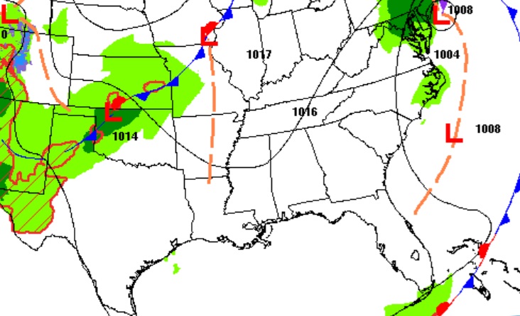
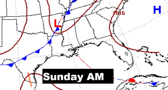
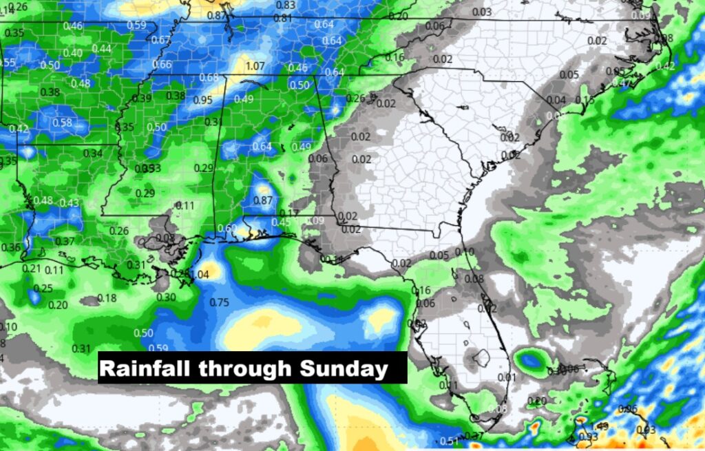
NEXT FEW DAYS: Temperatures will moderate mid to late week. Meanwhile, the Drought continues to grow worse. It’s still a bone dry forecast through at least Friday. Scattered showers return to the forecast Saturday night and Sunday ahead of the next front.
Here’s the 10 day Model Blend temperature trend. The warmest days and nights will be in the middle of this week.
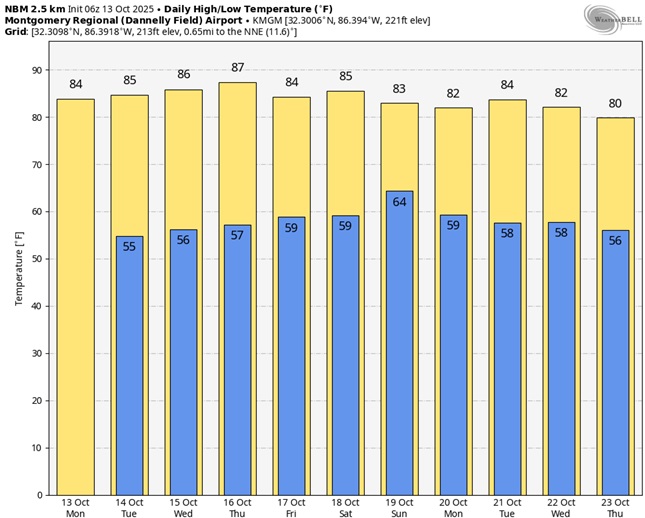
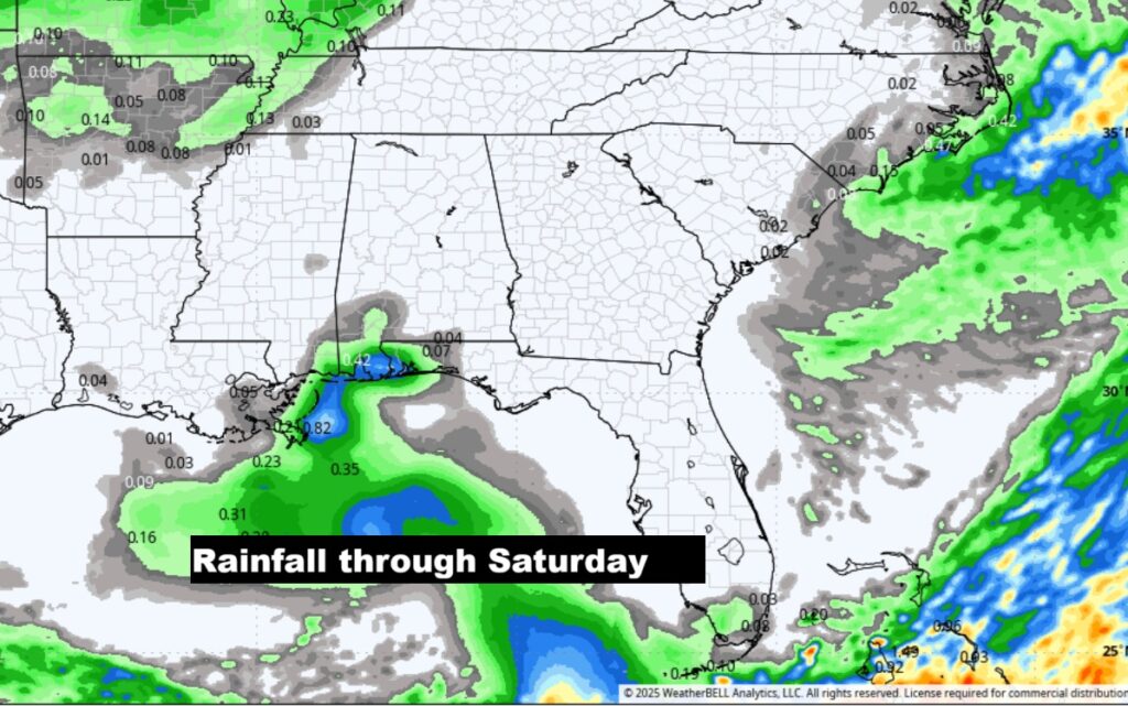
NO rain is expected through Friday. . Scattered showers return to the forecast Saturday night and Sunday ahead of the next front.
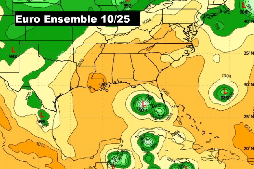
TROPICAL:
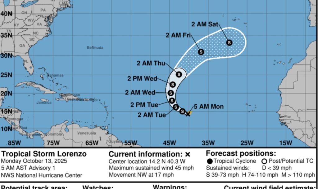
The 12th name of the Tropical Season — Lorenzo was named this morning in the far eastern Tropical Atlantic with 45 mph winds. It will take a big right hand curve in the east Atlantic.
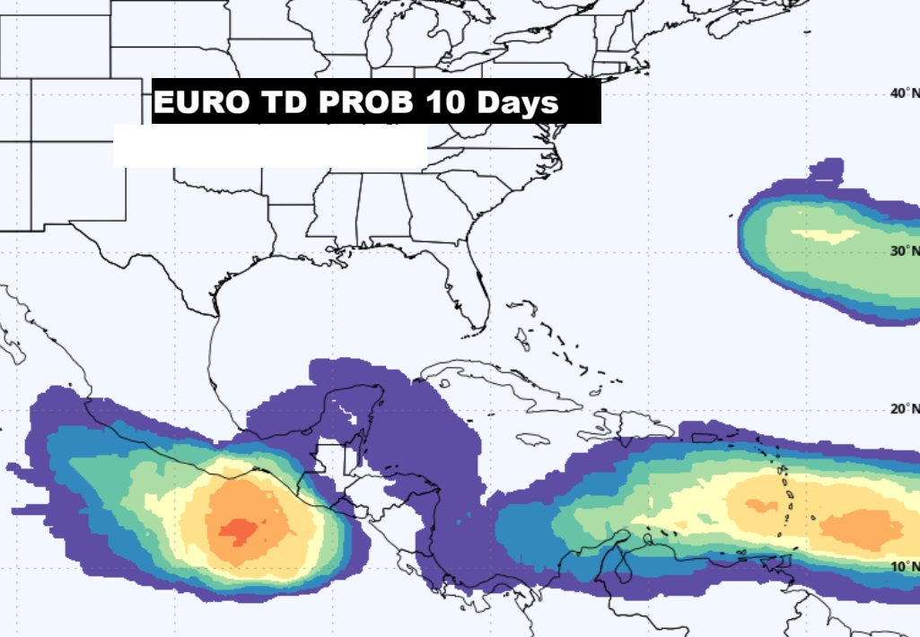
The EURO continues to strongly hint that the western Caribbean and the
Thanks for reading this Blog this morning. This morning we are LIVE on the radio from 6 to 9 on NewsTalk 93.1. I’ll have another update for you in the 4 o’clock hour tomorrow morning. Have a nice day.
–Rich