
Good Morning! Nice Fall Air is in place. Humidity is much lower. Today’s high 79. (Normal 83/58) Nice Northeast breeze today gusting to 20 mph. Get ready for some jacket weather nights in the 50’s. Should be a great Fall Weekend. Meanwhile, the Drought continues to worsen. Not a drop of rain is expected in the foreseeable future. Here’s my brief video forecast discussion.
TODAY: Sunshine. Low humidity. Breezy. High 79. Northeast wind 10-16 gusting to 20 mph. Clear and cool tonight. Low 57.
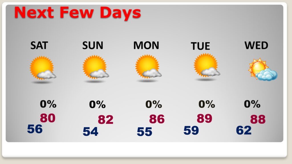
NEXT FEW DAYS: Some nice Fall air is in place with low humidity days and jacket weather nights. Should be a great Fall Weekend. Meanwhile, the Drought continues to worsen. Not a drop of rain is expected in the foreseeable future.
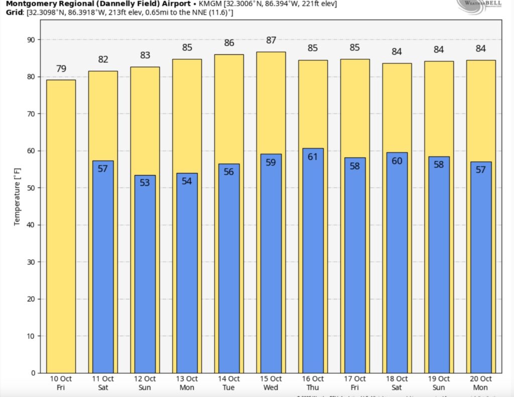
Here’s the 10 day Model Blend temperature trend. Pleasant.
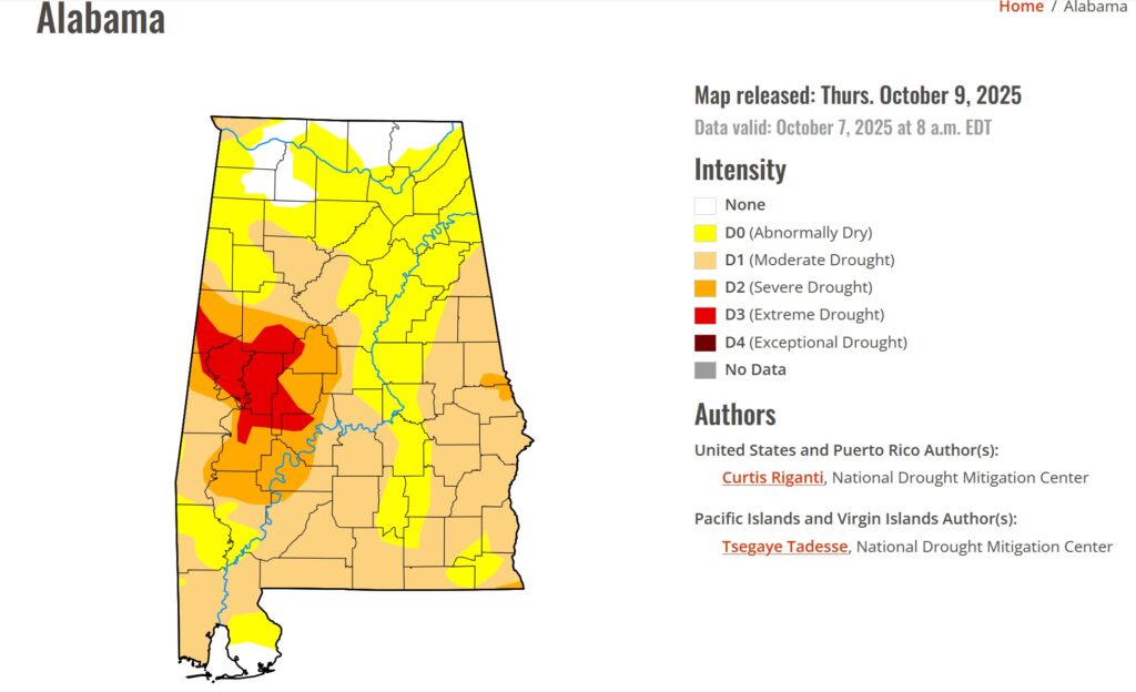
New Drought Monitor Map shows a worsening situation. ALL of the state is in some degree of Drought. 51% of the state is in a Moderate Drought or greater, and 15% in a Severe or Extreme drought. The Drought is worse in west Alabama.
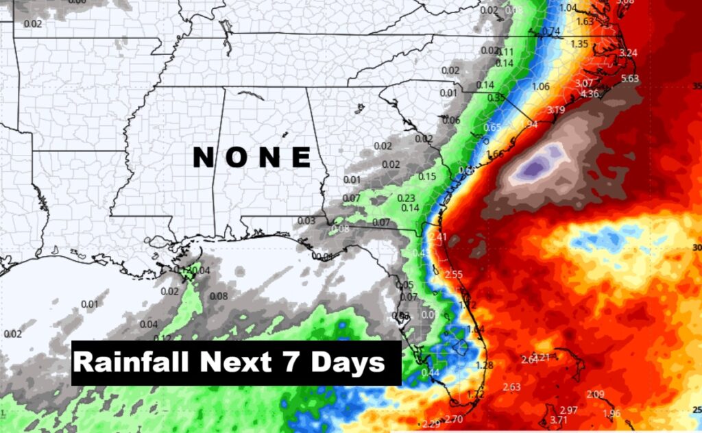
No rain is expected for the next several days.
TROPICAL OUTLOOK:
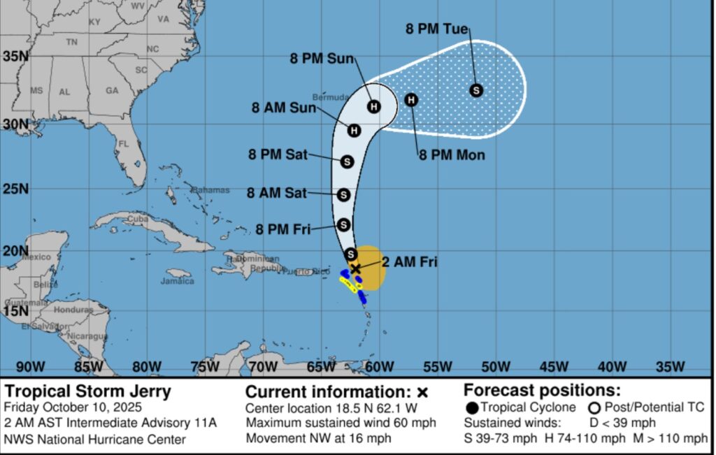
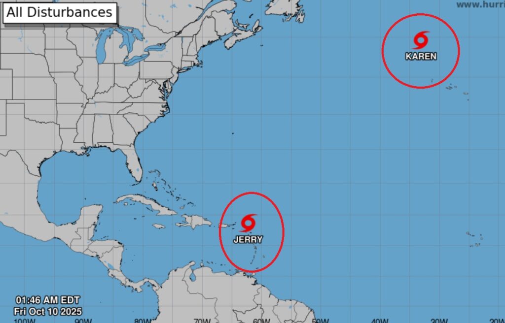
Tropical storm Jerry is likely to be a hurricane soon as it continues to curve into the Atlantic.
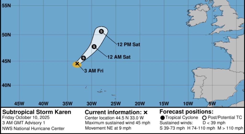
Elsewhere – For some reason, NHC wasted the name KAREN for a sub tropical Storm in the distant north central Atlantic. Both Jerry and Karen are “fish storms.”
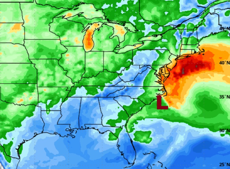
Besides the Tropical activity – there is a POWERFUL Non Tropical Low, a Nor Easter, off the US Middle Atlantic Coast, moving NE along the Atlantic coast. which could produce 40-60 mph wind gusts, along with tremendous wave action.
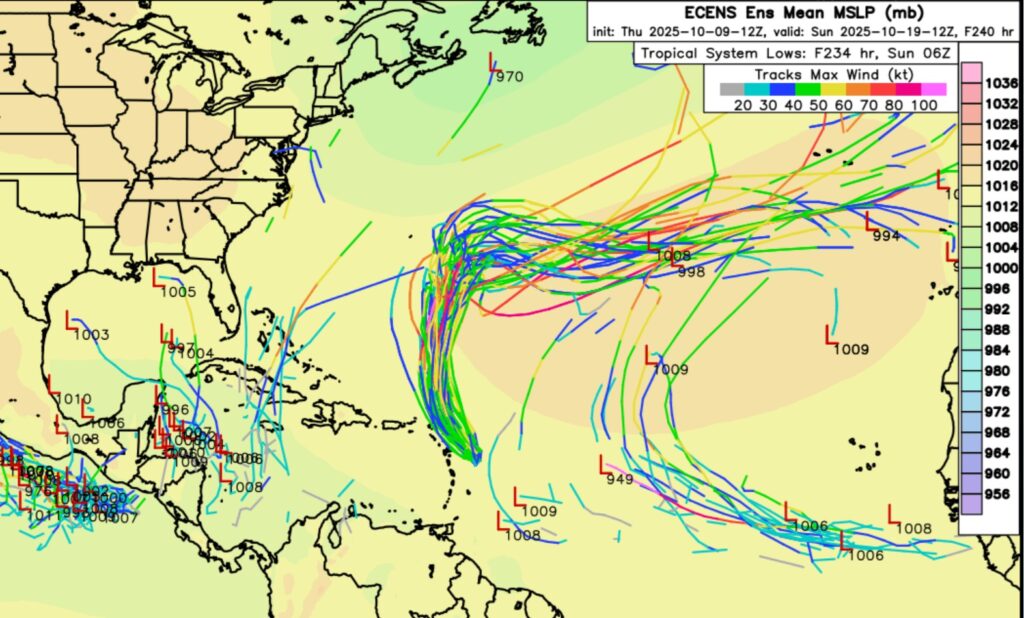
The EURO Ensemble models Member Lows are still highlighting some potential future trouble from the west Caribbean to Florida and into the Gulf.

—
This morning we are LIVE on the radio from 6 to 9 on NewsTalk 93.1. I’ll have another update for you in the morning. Have a nice day.
–Rich