
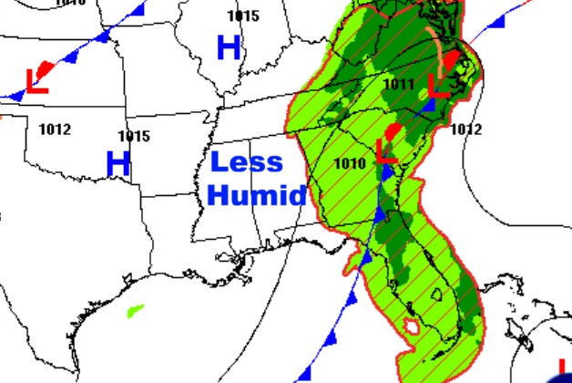
Good morning! For us – the forecast is very quiet and uneventful for several days. Dry air, with lower humidity and cooler nights. Dry as a bone for the week ahead. The front that moved through has made it to the Southeast US coastline. Meanwhile, all eyes on the tropics. We now have Potential Tropical Cyclone Nine (PTC 9) approaching the Bahamas Future Imelda could have tremendous future implications for the SE US. But the future forecast is extremely complicated.
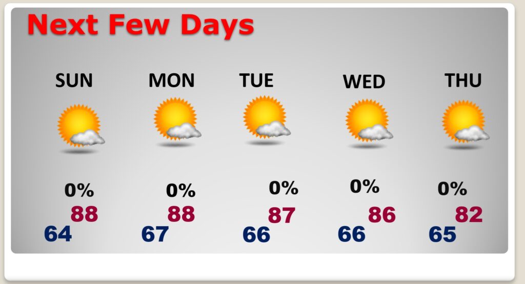
TODAY: Plenty of sunshine, mixed with some clouds. Not as humid. High 87. Rain chance not zero, but less than 20%. Partly cloudy comfortable tonight. Low 64.
NEXT FEW DAYS: It’s a quiet forecast. Sunny days. Mainly clear nights. Completely dry. Highs mostly in the upper 80’s. Low mainly in the middle 60’s.
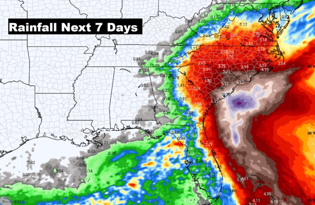
Here’s Future Rainfall for the next 7 days. Dry for us. Look at the Carolinas. Future Imelda will likely have a significant impact. Scary possibility for the Carolinas.
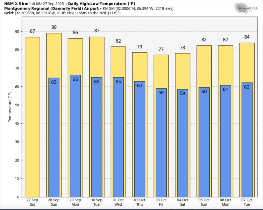
Here’s the 10 Day Temperature Trend. Wow. Look at October 2-6. Some really really nice stuff.
TROPICAL OUTLOOK:
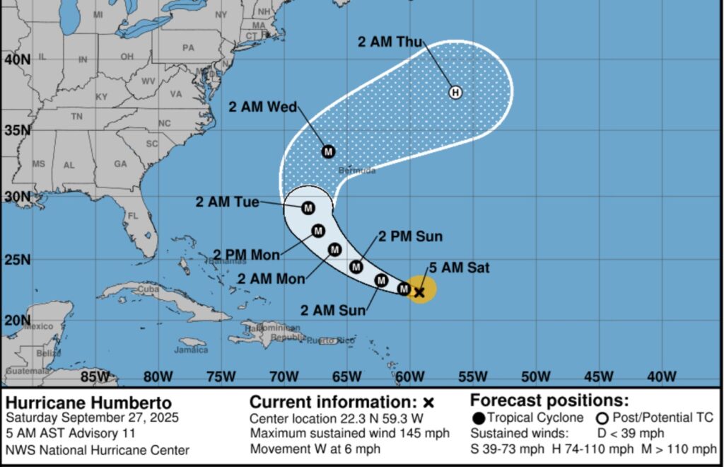
Humberto has rapidly intensified into a Major Category 4 – 145 mph hurricane. The cone indicates Bermuda could see a significant impact by mid-week. But, also Humberto could have an impact on PTC 9. Complicated.
That system that was Invest 94-L, heading toward the Bahamas has now been designated Potential Tropical Cyclone Nine (PTC 9) . This designation from NHC allows for the issuing of tropical alerts even before a system actually develops.
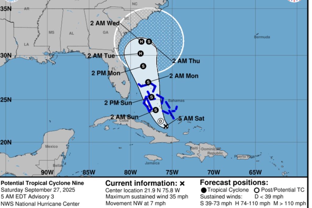
Tropical storm warnings are now in effect for portions of the Bahamas. Eventually this system could have a major effect on the Carolina coastline. But, does it come ashore, or stay off the coast, or go out to sea? We don’t know.
https://www.nhc.noaa.gov/text/refresh/MIATCPAT4+shtml/270842.shtml?
Will these two systems have an effect on each other? There’s a very interesting weather phenomenon that could come into play. The Fujiwhara effect, is a phenomenon that occurs when two nearby cyclonic vortices move around each other and close the distance between the circulations of their corresponding low-pressure areas. The effect is named after Sakuhei Fujiwhara, the Japanese meteorologist who initially described the effect. Binary interaction of smaller circulations can cause the development of a larger cyclone, or cause two cyclones to merge into one. Geeky, I know.
.
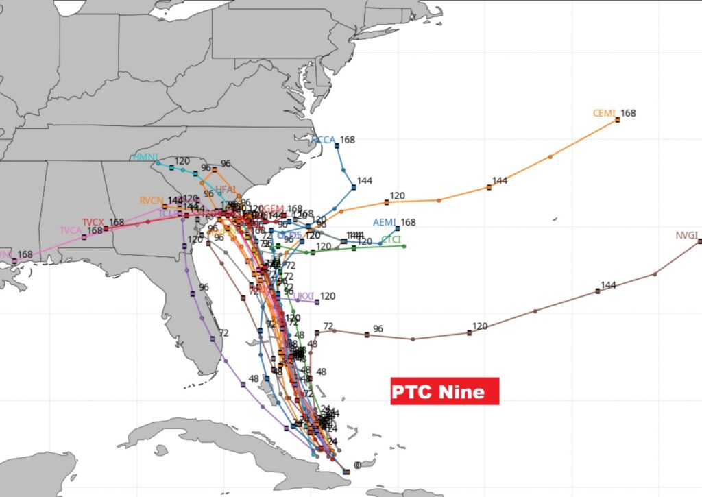
The Tropical Spaghetti models certainly indicates much uncertainty in Future Imelda’s potential track. It’s a very complicated forecast on many levels. Has much to do with Humberto’s future.
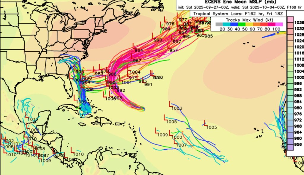
Here’s the EURO model Ensembles Member Lows Map. Geez. The Imelda possibilities are numerous and complicated. The models are having so much trouble. The biggest problem is we do not currently have an organized system for a better forecast. Stay tuned.
If you’re a Weather Geek – you’ll love reading this technical discussion from NHC.
https://www.nhc.noaa.gov/text/refresh/MIATCDAT4+shtml/270843.shtml?
The next scheduled Blog update and Video Discussion is scheduled for Monday morning in the 4 o’clock hour. Have a nice day!
–Rich