
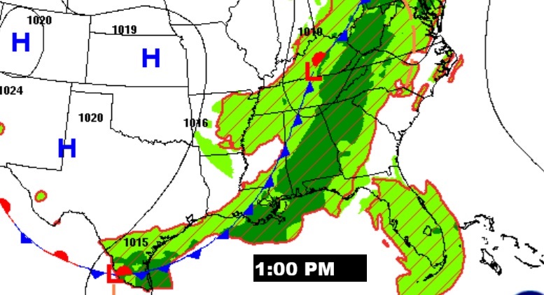
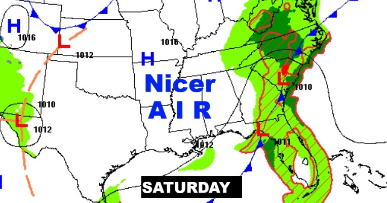
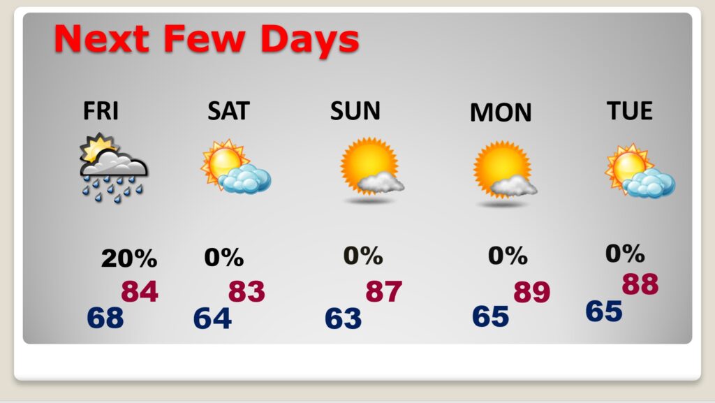
Good morning! An important frontal system will bring showers and thunderstorms to the state today. We need the rain, but unfortunately not every town will get substantial rainfall. The expected rainfall map now looks disappointing. We’ll see. There could be some leftover showers and storms Friday. Widely scattered to isolated. By Friday night, and over the weekend, expect lower humidity and much nicer air. Highs over the weekend will be in the 80’s with cooler low to mid 60’s at night. Here’s my brief video forecast discussion.
TODAY: Scattered showers and thunderstorms. High 85. Low tonight 68.
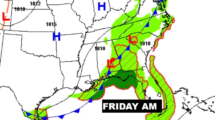
The cool front will march across the state today, reaching SE Alabama by early Friday. Small chance of showers will remain Friday. You’ll start to feel that nicer, less humid air by Friday evening and over the weekend.
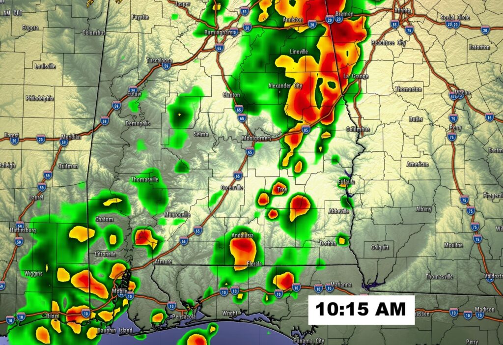
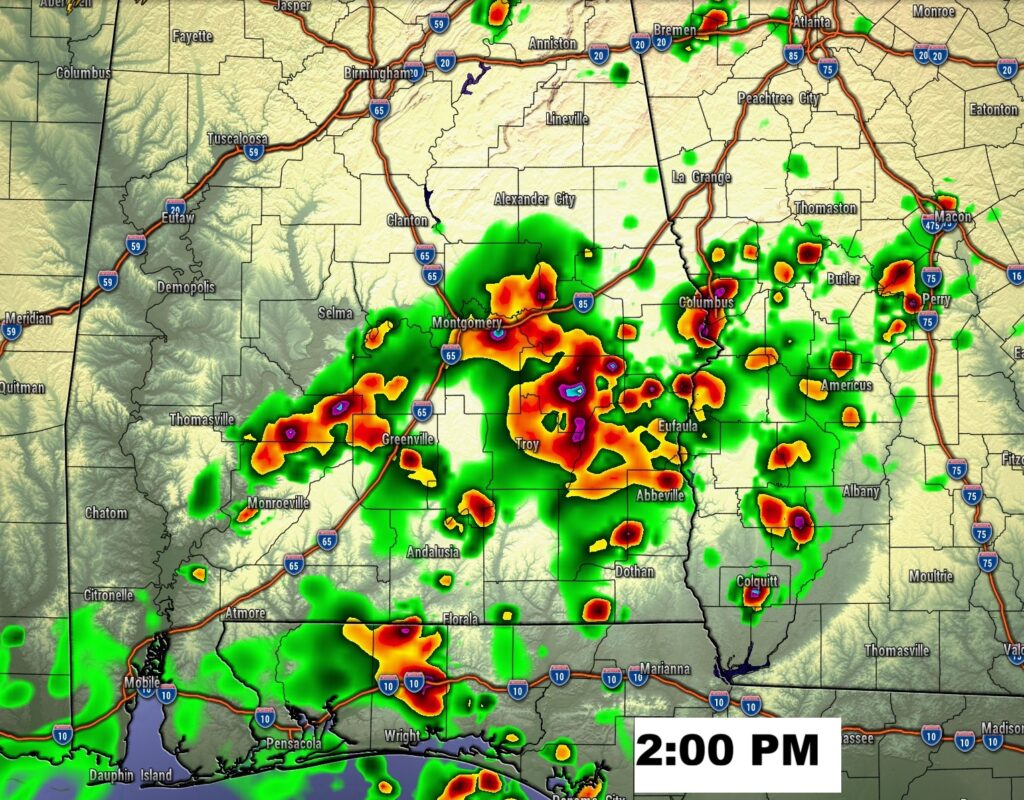
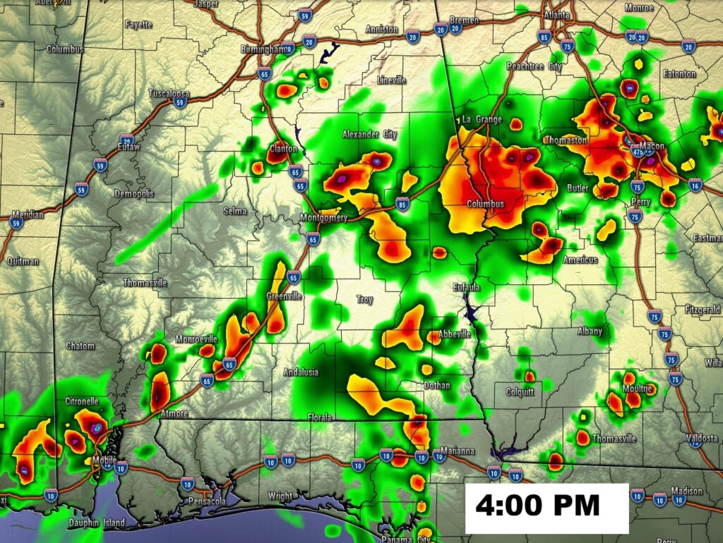
FUTURE RADAR: Fingers crossed. Hopefully there will be some downpours roaming around today. Our weather App will keep you on top of the action. Good luck!
NEXT FEW DAYS: There could be some leftover showers and storms Friday. By Friday night and over the weekend expect lower humidity and much nicer air. Highs over the weekend will be in the 80’s with cooler low to mid 60’s at night.
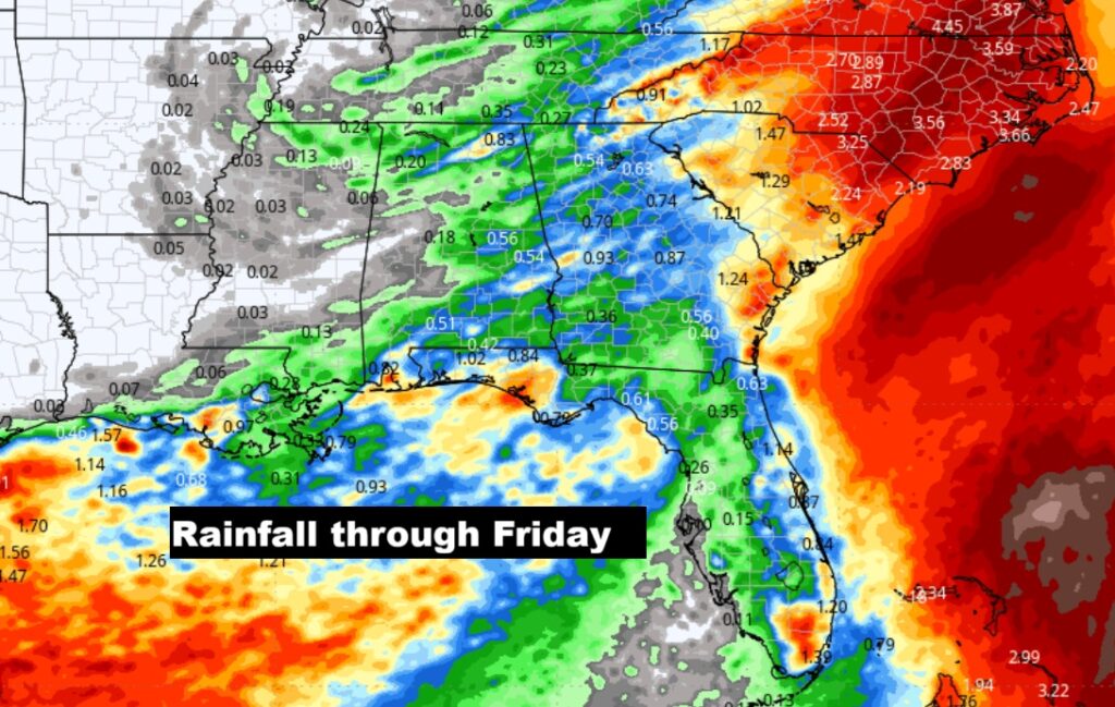
Unfortunately, the projected rainfall is now far less than what we originally hoped. We’ll take every drop we can get. New Drought monitor map comes out this morning.
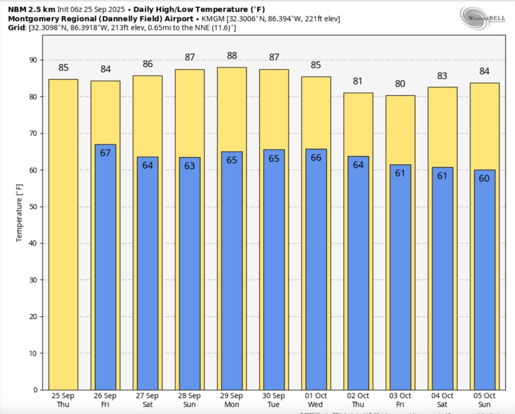
Here’s the 10 Day Temperature Trend. Looks like we could stay below 90 for the next 10 days. Some nice nights are in our future.
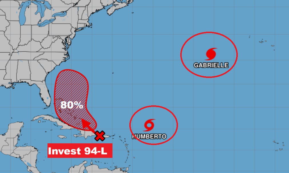
TROPICAL OUTLOOK: All of a sudden, the Atlantic is on fire.
Gabrielle headed toward the Azores. Hurricane Warning in effect. This storm could eventually have an impact on Portugal and Spain.
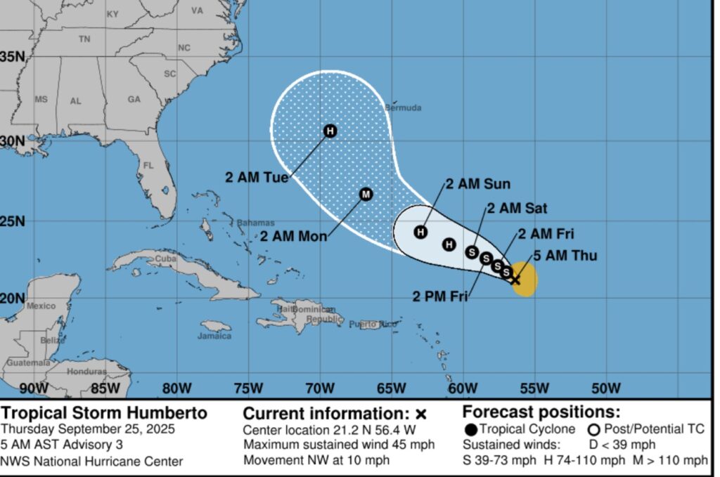
Humberto is in the Tropical Atlantic and could eventually become a major hurricane over the weekend. Bermuda needs to watch this one.
In front of that, Invest 94-L, with an 80% chance of development could be a threat to the Bahamas. Could it have an impact on the SE US? This one certainly has our attention. The next name available is Imelda.
Could the closeness of Humberto and 94-L have an effect on these systems?
The Fujiwhara effect, sometimes referred to as the Fujiwara interaction or binary interaction, is a phenomenon that occurs when two nearby cyclonic vortices move around each other and close the distance between the circulations of their corresponding low-pressure areas. The effect is named after Sakuhei Fujiwhara, the Japanese meteorologist who initially described the effect. Binary interaction of smaller circulations can cause the development of a larger cyclone, or cause two cyclones to merge into one. Extratropical cyclones typically engage in binary interaction when within 2,000 kilometres (1,200 mi) of one another, while tropical cyclones typically interact within 1,400 kilometres (870 mi) of each other.
The Tropical Spaghetti models indicate Invest 94-L needs to be watched carefully.
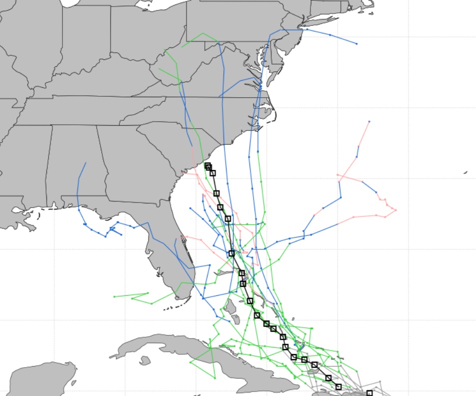
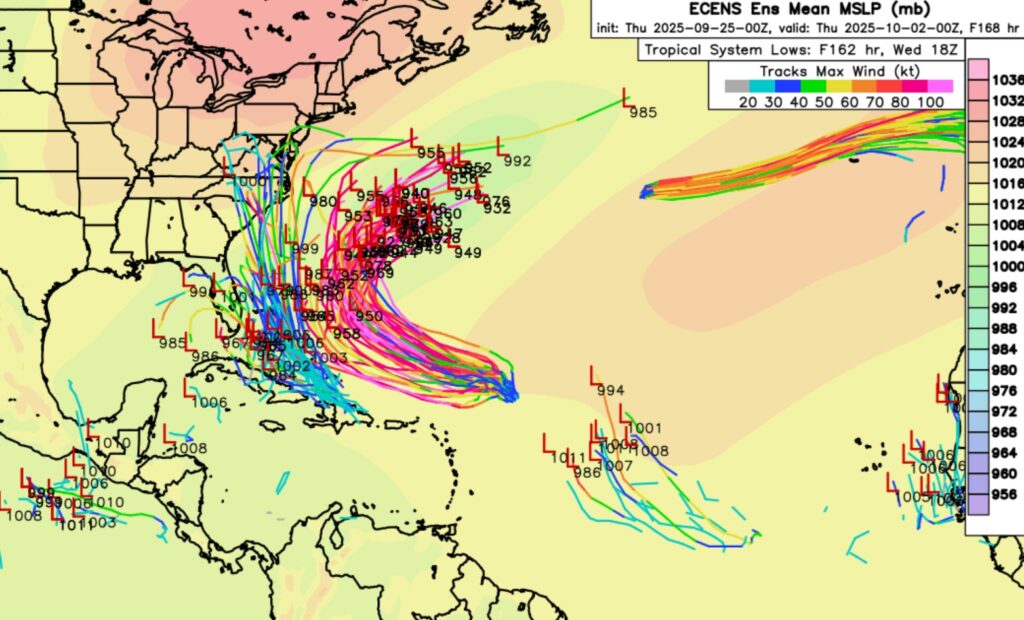
Even more interesting is the EURO Ensembles Model indicate potential trouble for the Southeastern US Coastline. So far, the biggest potential US threat of the season. Stay tuned.
Thanks for reading the blog. Today everything is normal including LIVE on the Radio of NewsTalk 93.1 WACV. There will be another video forecast discussion and Blog Update in the 4 o’clock hours tomorrow morning. You can always find my forecast updates hourly on the 8 station Bluewater family of stations every day of the year.
–Rich