
Good morning! Any hopes for some nice Fall air is certainly not likely this week. The 90+ degree days will continue. Humidity is still not too bad. The Heat Index will stay below 100. Nights are still quite tolerable. Most nights lows will be in the middle 60’s. The storm-free dry pattern will continue for the next several days. The official first day of Fall is next Monday. Here’s my brief video forecast discussion.
TODAY: Sunshine. Warmer. Still Tolerable humidity. High in the low 90’s. Mainly clear and still comfortably cool tonight. Low 64.
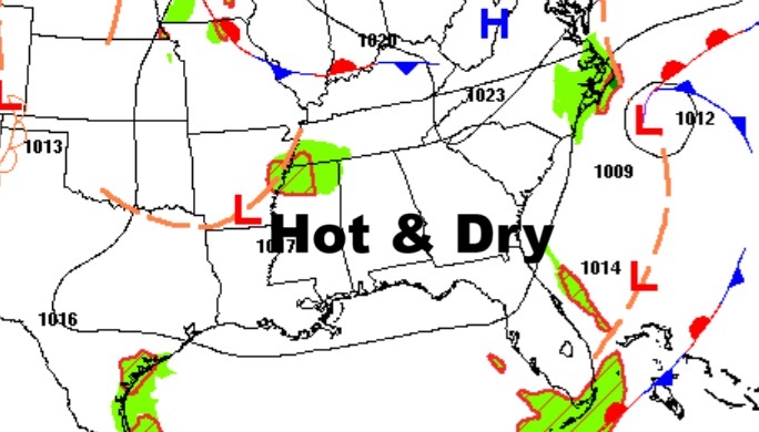
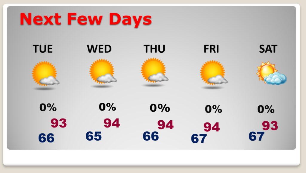
NEXT FEW DAYS: Hot Dry days will continue. Expect lower 90’s today, and low to mid 90’s Wednesday through Saturday. The nights are comfortable in the 60’s. Fortunately, humidity is still fairly tolerable, and the nights are comfortably cool. I see no storm systems in the next several days.
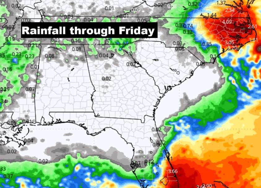
Here’s the projected rainfall this week.
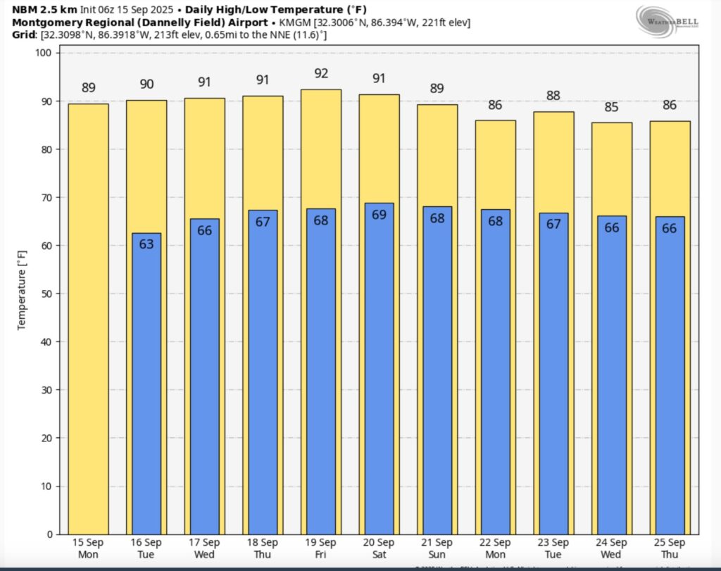
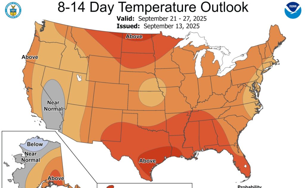
Here’s the 10 Day Temperature Trend. Fall is on HOLD.
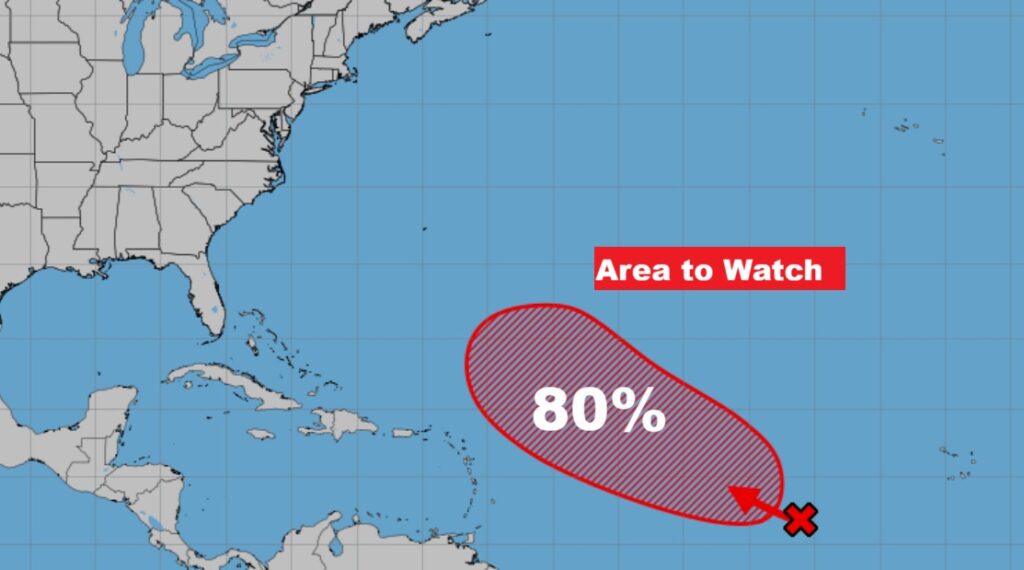
TROPICAL OUTLOOK: That Area to Watch in the Tropical Atlantic now has a 80% chance of development. It’s expected to become a tropical depression later this week and then very likely tropical storm Gabrielle.
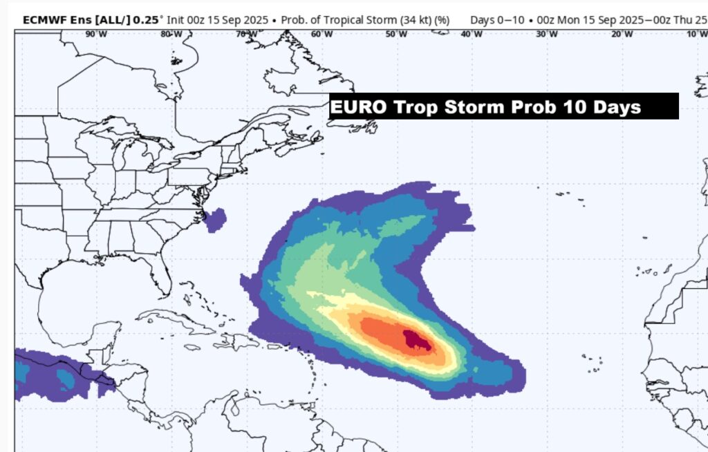
Here’s what the EURO says about the next 10 days. This is the probability of a Tropical storm. Strong chance we’ll get the next named storm. The rest of the tropics are surprisingly quiet.
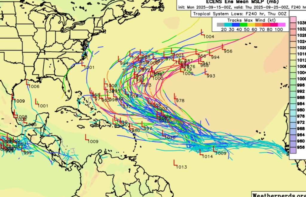
Here’s the EURO Ensemble Member Lows outlook through the next 10 days.
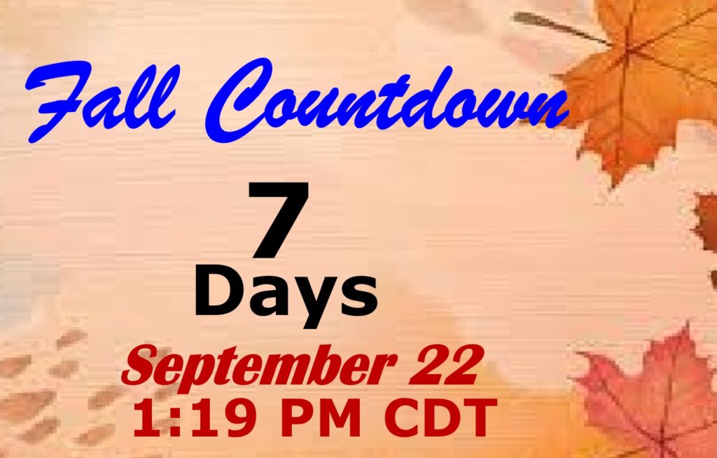
FALL COUUNTDOWN: The Autumnal Equinox is now just 7 days away. The first official day of Fall: Mon, Sep 22, 2025, 1:19 PM
Thanks for reading the blog. Today everything is normal including LIVE on the Radio of NewsTalk 93.1 WACV. There will be another video forecast discussion and Blog Update in the 4 o’clock hours tomorrow morning. You can always find my forecast updates hourly on the 8 station Bluewater family of stations every day of the year.
–Rich