
Good morning! Alabama continues to Heat up. Yesterday’s high of 93 was the hottest of the week so far at MGM. Hot, dry days will continue. Expect lower 90’s today through Monday, and low to mid 90’s Tuesday and Wednesday. The nights are comfortable in the 60’s. Fortunately, humidity is still fairly tolerable, and the nights are comfortably cool. I see no storm systems for the next several days. In the Tropics – there is just that one Area to Watch in the Tropical Atlantic. That’s it. Surprisingly quiet.
CLIMATE DATA: Friday’s hi/lo in Montgomery at MGM – 93/64. Normal 91/68. No rain. Month to date rainfall: 0.00 (-1.51 below normal)
TODAY: Total sunshine. Warmer. Still Tolerable humidity. High in the low 90’s. Mainly clear and still comfortably cool tonight. Low 65.
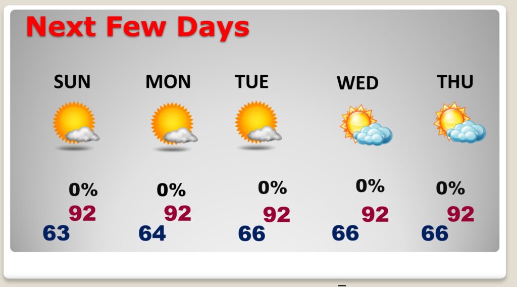
NEXT FEW DAYS: Hot Dry days will continue. Expect lower 90’s today through Monday, and low to mid 90’s Tuesday. The nights are comfortable in the 60’s. Fortunately, humidity is still fairly tolerable, and the nights are comfortably cool. I see no storm systems in the next several days. Just a bone dry forecast.
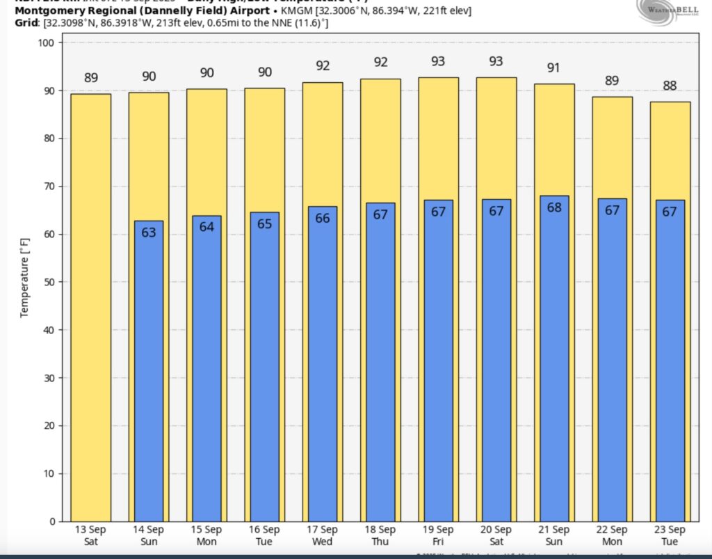
Here’s the 10 Day Temperature Trend. Still, no cool air in sight. Endless summer continues.
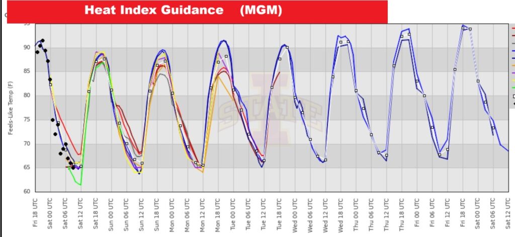
Fortunately, no Triple Digit Heat Index days are expected.
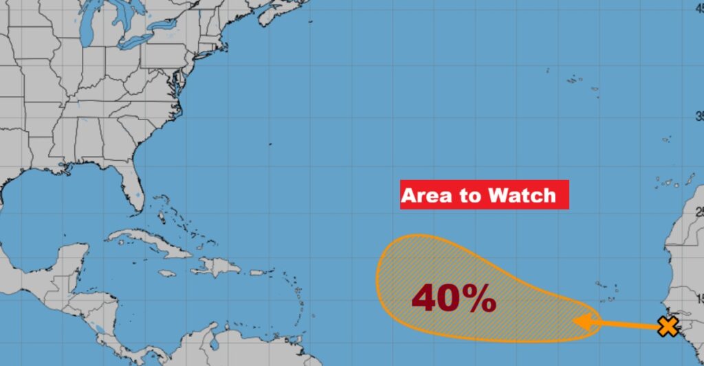
TROPICAL OUTLOOK: There is Area to Watch in the far eastern Tropical Atlantic. NHC says there will be gradual this weekend and beyond as this Tropical Wave moves westward with a 40% chance of development.
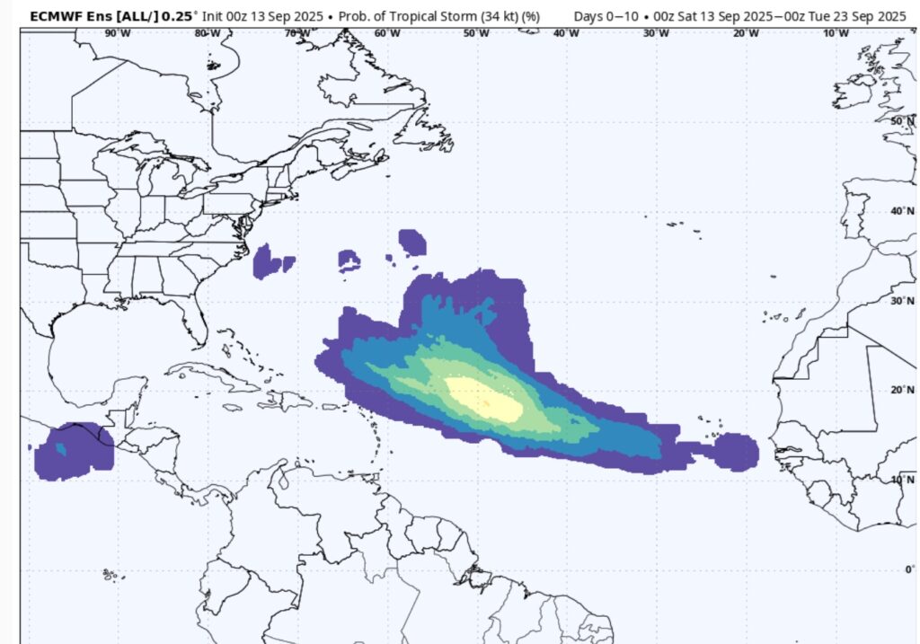
Here’s what the EURO says about the next 10 days. This is the probability of a Tropical storm. Next available name is Gabrielle.
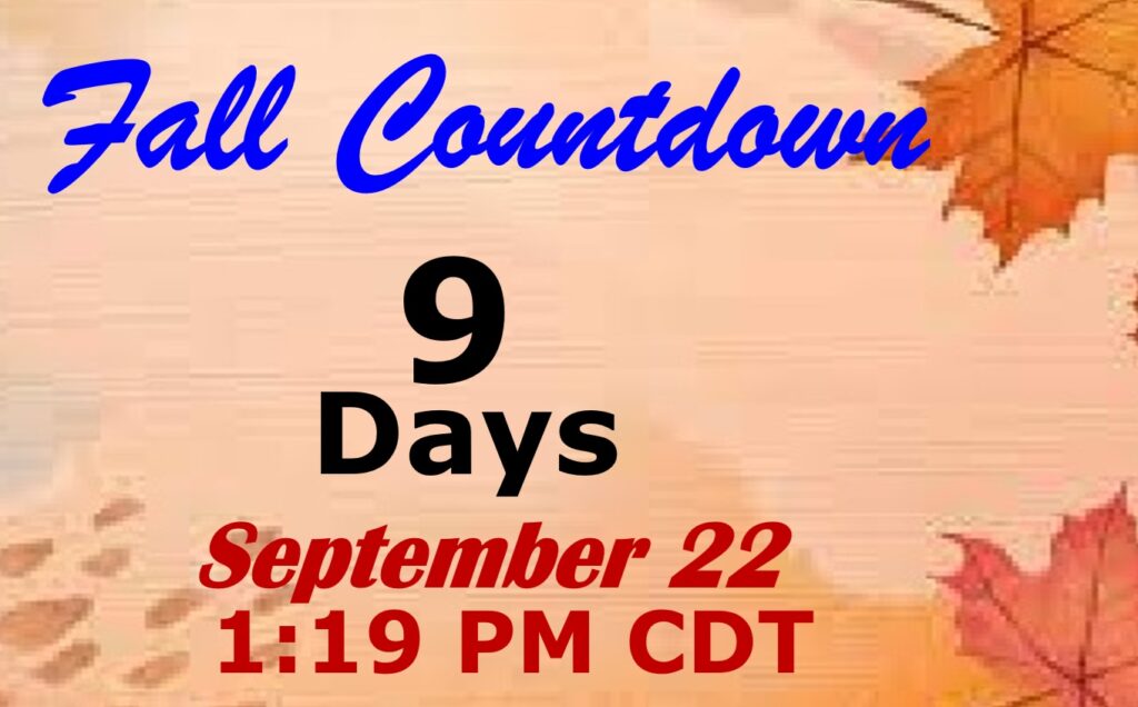
FALL COUUNTDOWN: The Autumnal Equinox is now just 9 days away. The first official day of Fall: Mon, Sep 22, 2025, 1:19 PM
The next scheduled Blog update and Video Discussion is scheduled for Monday morning in the 4 o’clock hour. Have a nice day!
–Rich