
Abbreviated update this morning. I’m at a weather conference in Huntsville.
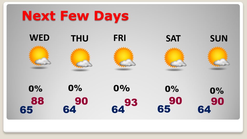
Good morning! We have been enjoying some pristine weather. In fact Monday morning’s low of 56 was a record low. Today will be very comfortable with low humidity again. The rest of the week ahead will be storm-free and nice. I know you don’t want to hear this, but we will be back to the 90’s fort several days in a row starting around Thursday.
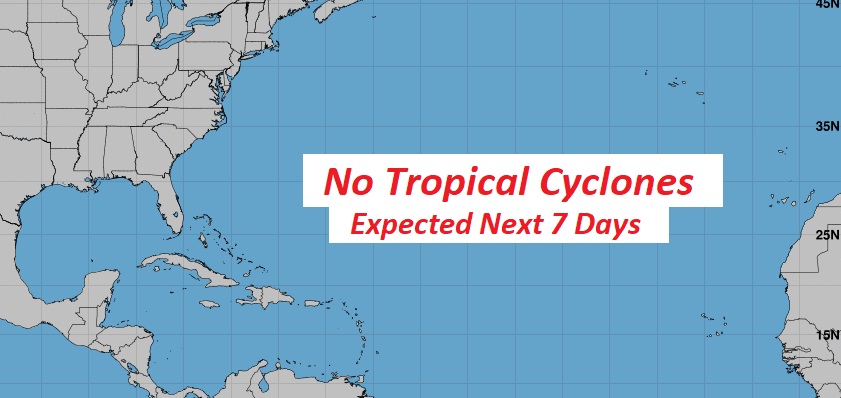
There are no features in the tropics according to NHC. That’s amazing considering this is statistically the peak week in the tropics statistically.
TODAY: Partly cloudy. Comfortable humidity. High 86. Mainly clear and comfortably cool tonight. Low 66.
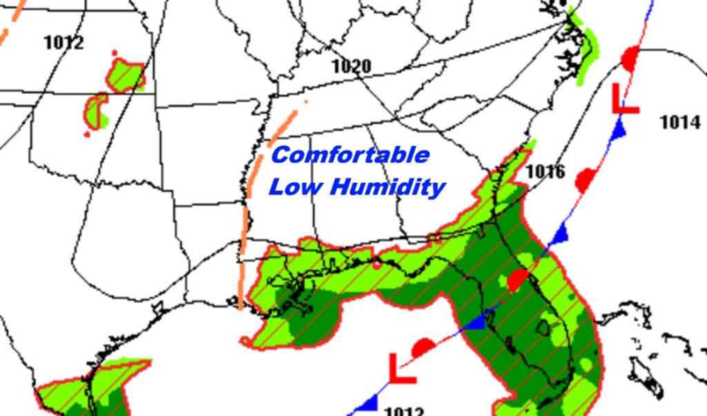
NEXT FEW DAYS: Sunny days with low humidity and clear comfortably cool nights. The rest of the week ahead will be storm-free and nice. I know you don’t want to hear this, but we will be back to the 90’s fort several days in a row starting around Thursday. Summer is not done.
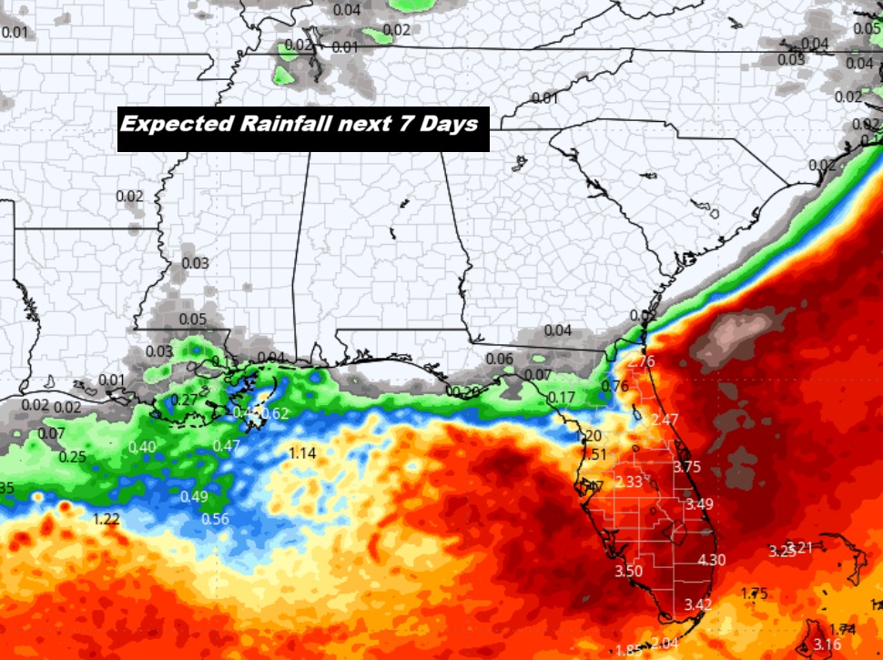
Here’s the projected rainfall for the next 7 days. Look at Florida.
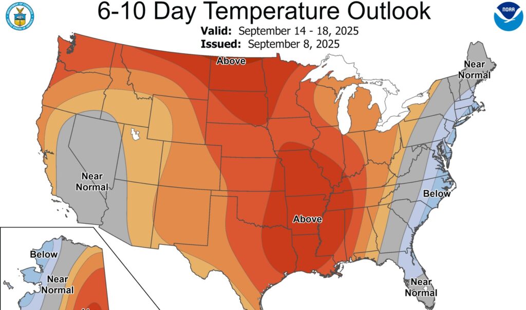
Here’s the 10 Day Temperature Trend. Unfortunately, the 90’s will return for several days.
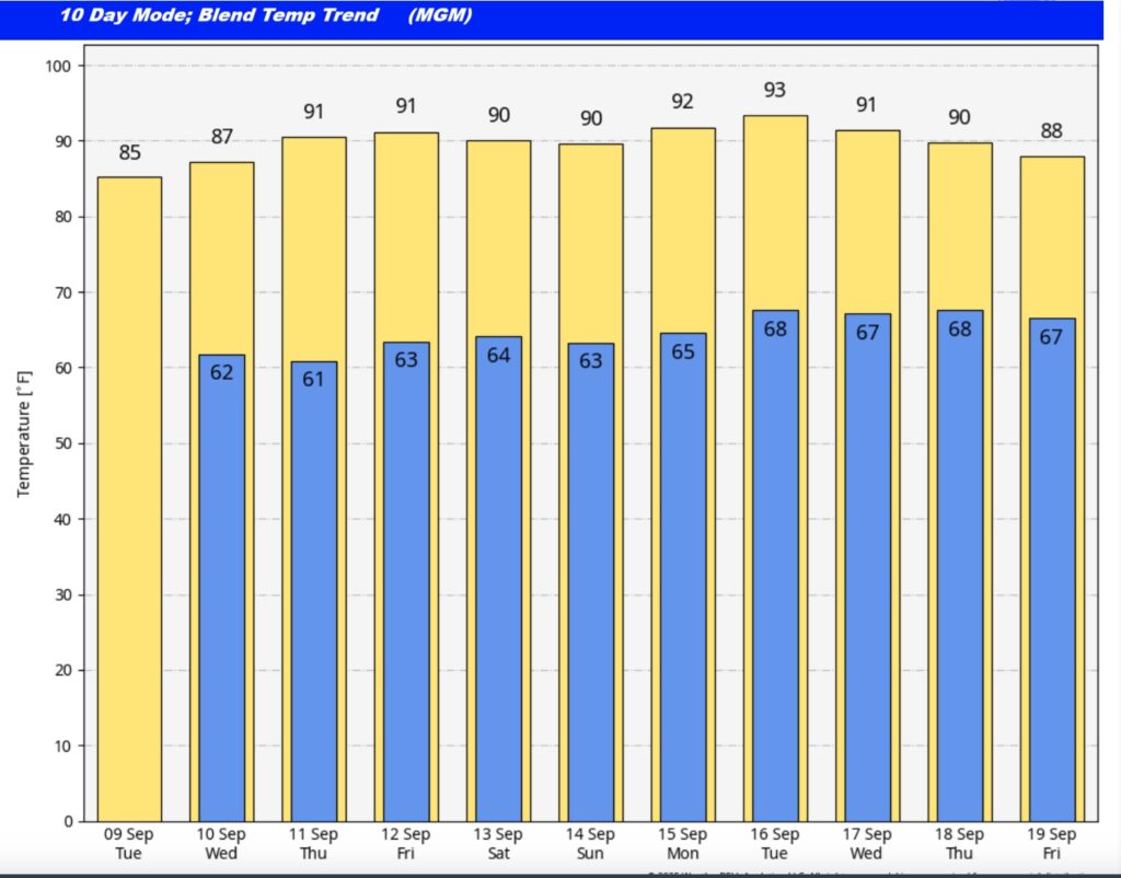
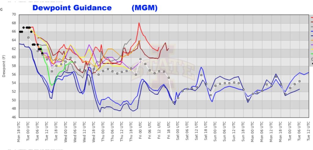
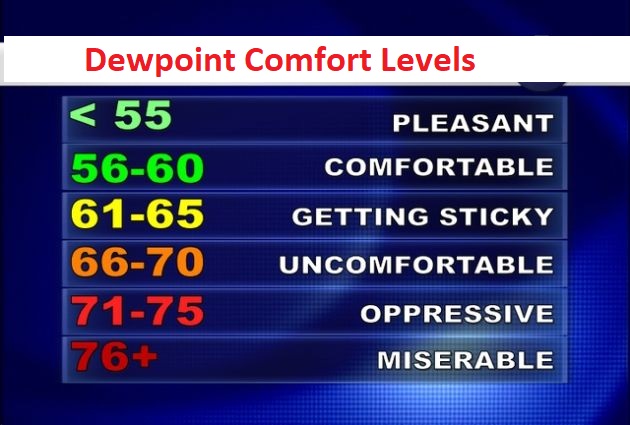
Yes – we’re headed back to the 90’s starting Thursday. But, fortunately the projected Dewpoint numbers are not stupid.
Endless summer.
TROPICAL OUTLOOK: There are no features in the tropics according to NHC. That’s amazing considering this is statistically the peak week in the tropics statistically.
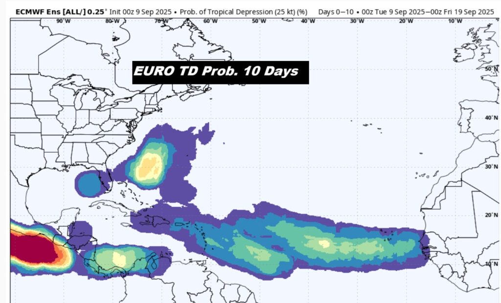
Here’s what the EUJRO says about the next 10 days. Possible areas to keep an eye on. Look at the Bahamas.
FALL COUUNTDOWN: The Autumnal Equinox is now just 13 days away.
I’m at the National Weather Association 50th Annual Conference in Huntsville today through Wednesday.
The next scheduled Blog update and Video Discussion is scheduled for tomorrow morning in the 4 o’clock hour. Have a nice day!
–Rich