
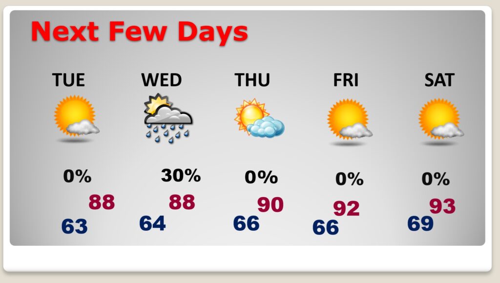
Good morning! It may be the 2nd day of Meteorological Fall, but summer heat is far from over. (Normal hi low is 92/70) We’ll flirt with 90 today and Wednesday – lower 90’s by Thursday and middle 90’s by Friday and Saturday. Best chance of showers today will be in the northern half of the state. For the rest of us – the rain chance is not zero but very small. Most of the week should be dry. We have no tropical concerns in this part of the world this week, even though we are approaching the peak of the season. Here’s my brief video forecast discussion.
TODAY: A good bit of sun. Rain chance 10%. Light wind. High 89. Mostly clear tonight. Low 64.
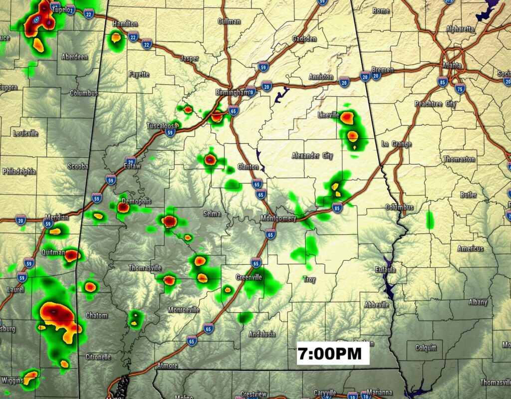
Best chance of showers will be in the northern half of the state. For the rest of us – the rain chance is not zero but very small.
NEXT FEW DAYS: It will continue to be dry and sunny Tuesday and for much of the week ahead. Ready for more summer late week? Temperatures go back to the 90’s and the humidity creep back.
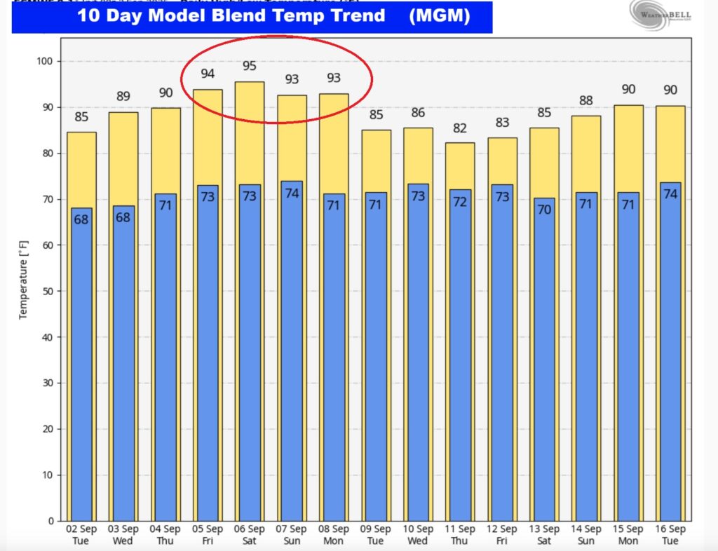
Here’s the 10 Day Temperature Trend. Look at the mid to late week and into the weekend. 90’s will return.
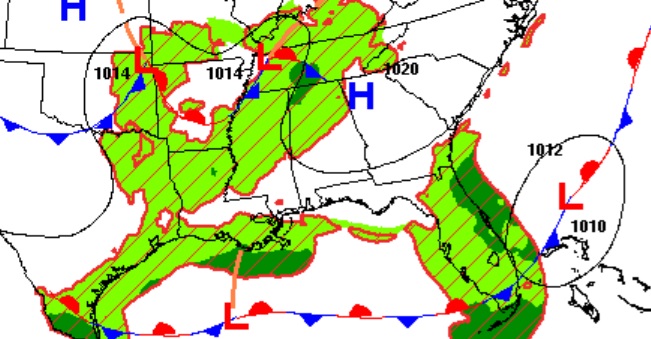
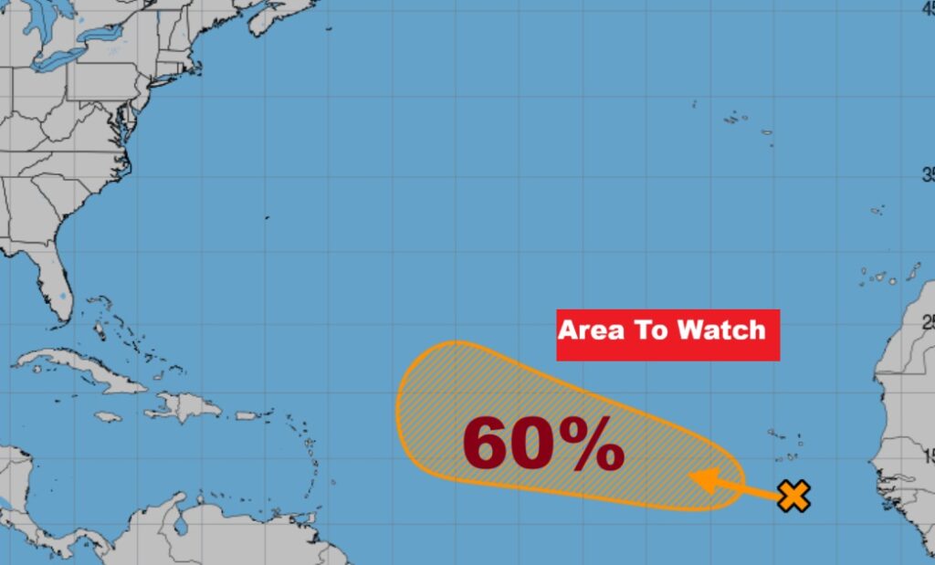
TROPICAL OUTLOOK: That Area to watch in the tropical Atlantic is a westward moving Tropical wave. NHC gives this Area a 60% chance of development. It’s expected to turn into the open Atlantic.
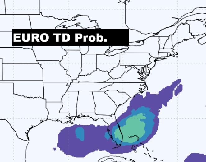
The EURO remains us we need to watch the Gulf and SE Coastline.
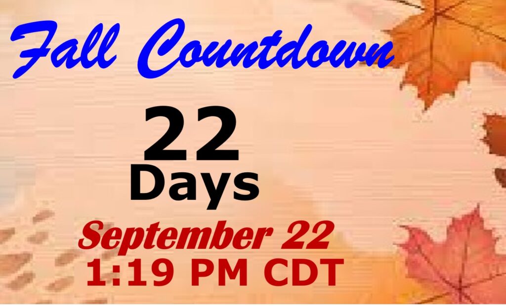
FALL COUUNTDOWN: The Autumnal Equinox is now just 22 days away.
Thanks for reading the blog. Today everything is normal including LIVE on the Radio of NewsTalk 93.1 WACV. There will be another video forecast discussion and Blog Update in the 4 o’clock hours tomorrow morning. You can always find my forecast updates hourly on the 8 station Bluewater family of stations every day of the year.
–Rich