
Good morning! Happy Labor Day. Welcome to September! Welcome to Meteorological Fall. What a great forecast on what is one of the Big Three Outdoor Holidays of the year. It’s a dry, fairly comfortable forecast as far as humidity. Spotty storms return Wednesday as a front approaches. Ready for more summer late week? Temperatures go back to the 90’s and the humidity will be back. Otherwise…NO big ticket weather on the horizon.
TODAY: Abundant sunshine. Light wind. High 87. Mostly clear, pleasantly cool tonight. Low 63. Yesterday’s high was 89.
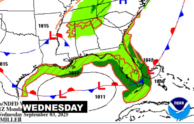
NEXT FEW DAYS: It will continue to be dry and sunny Tuesday. Spotty storms return Wednesday as a front approaches. Ready for more summer late week? Temperatures go back to the 90’s and the humidity will be back.

Here’s the 10 Day Temperature Trend. Ouch. Look at the late week return of the 90’s.
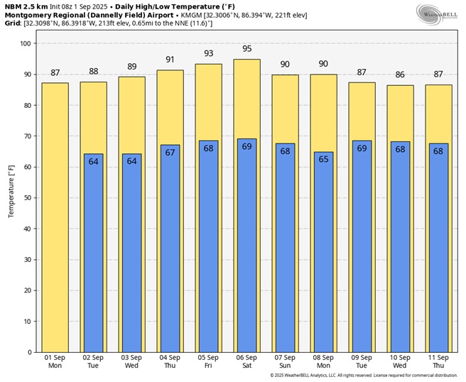
Not only are the temperatures going up, check out the Dewpoints especially starting Thursday through the weakened.

TROPICAL OUTLOOK:
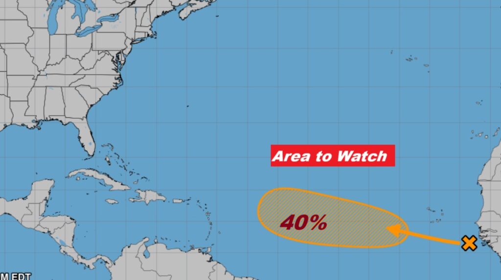
NHC says that Area to Watch in the far east Atlantic now has a 40% chance of development in the next 7 days.
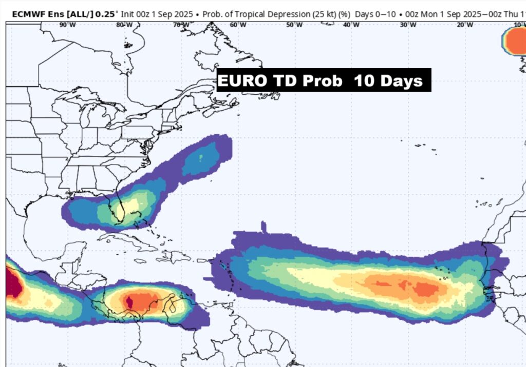
The EURO Continues to signal that we need to watch for possible “homegrown” development in the northern Gulf and off the SE US coast for the next few days.
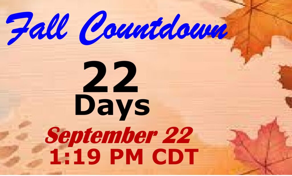
FALL COUUNTDOWN: The Autumnal Equinox is now just 22 days away.
Conecuh Burgers at my house yesterday from Peppertree. Beautiful day poolside on the Patio.
The next scheduled Blog update and Video Discussion is scheduled for tomorrow morning in the 4 o’clock hour. Have a nice Labor Day!
–Rich