
Good morning! What’s called “False Fall” continues, and it feels great. We’re enjoying nice string of comfortable days and pleasantly cool nights. Highs will be in the middle 80’s again today and Thursday. Low at night in the lower 60’s will feel great. We’ll be dry at least through Thursday evening, with partly cloudy days and cool nights. The next chance of showers and storms begins late Thursday night and Friday as a disturbance moves across the state. Expect more random scattered storms over the Labor Day weekend. Not a washout. Highs in the mid 80’s. Here’s my brief forecast discussion.
TODAY: Sun/cloud mix. Comfortable Low humidity. North breeze 5 to 10 mph. High 86. Partly cloudy and pleasantly cool tonight. Low 62. Sunrise: 6:19 AM, Sunset 7:17 PM.
We’re enjoying a nice northwesterly flow at 20,000 feet.

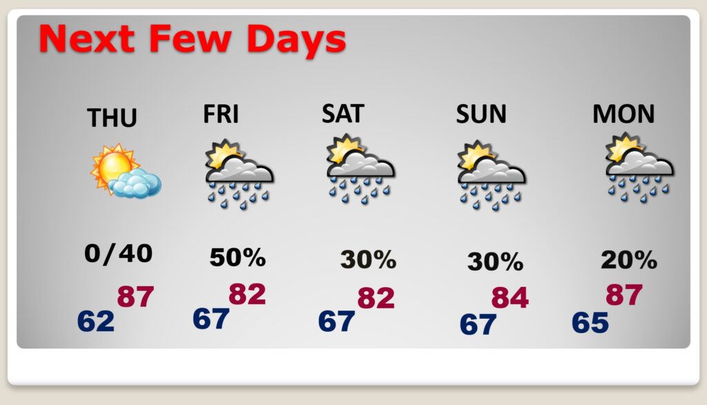
NEXT FEW DAYS: The next chance of showers and storms begins late Thursday night and Friday as a disturbance moves across the state. Expect more random scattered storms over the Labor Day weekend. Not a washout. Highs in the mid 80’s.
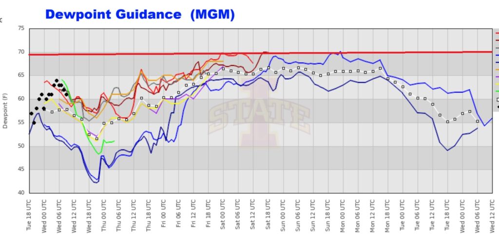
What’s called “False Fall” Continues. And, the key to our comfort is those much lower dewpoints. Late yesterday afternoon the dewpoint fell to 55. Today, models suggest we could see upper 40’s dewpoints. Feels great! But, UH OH. Look at what happens to the dewpoint this weekend. False Fall will end too soon. #alwx

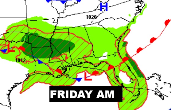
NEXT DISTURBANCE: Showers return to the forecast late Thursday night and Friday. as Labor Day weekend begins.
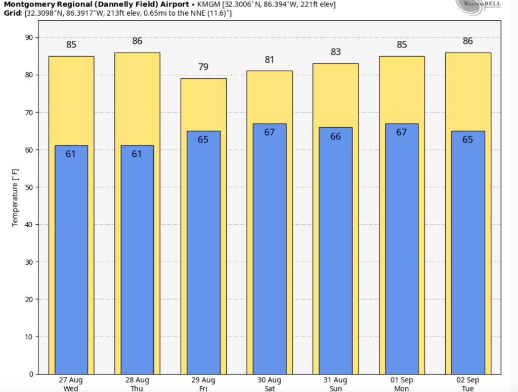
Here’s the 7 Day Temperature Trend. We’re probably going to stay below 90 for several days.
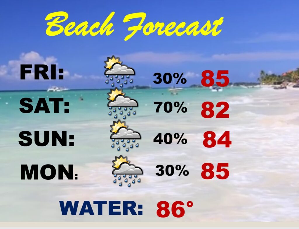
BEACH OLUTLOOK: Showers and storms will be rather numerous Saturday.
RAINFALL through MONDAY: Guidance says we could see 1-2″ Thursday night/Friday.
Take a look at the Gulf coast.

TROPICAL OUTLOOK:
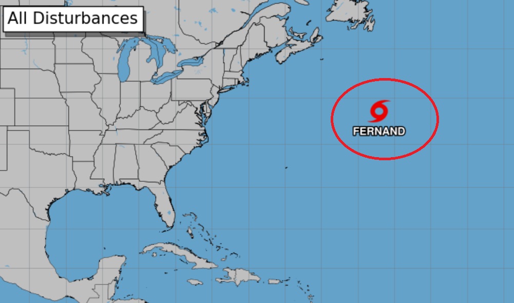
FERNAND is a 45 mph “fish Tropical storm” in the middle of the Atlantic.
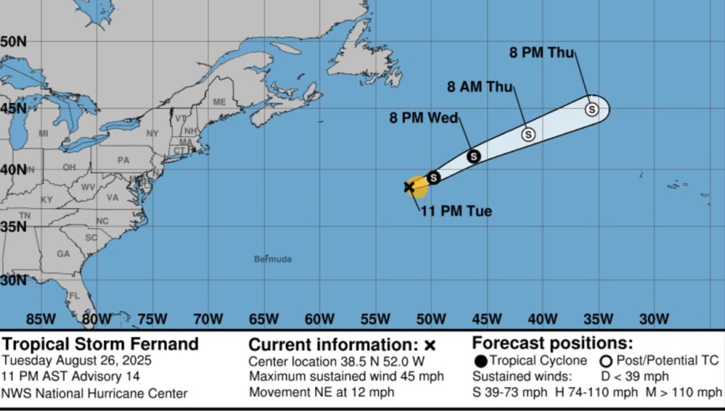
FERNAND is the only show in town. The rest of the tropics are amazingly quite.
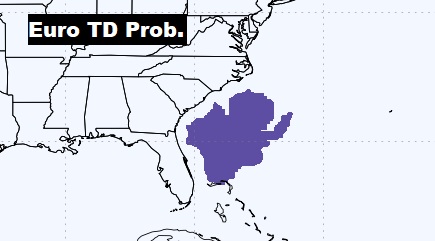
The EURO model suggests we need to monitor off the US SE Coast for possible Depression development next week. Stay tuned…
FALL COUUNTDOWN: The Autumnal Equinox is now just 26 days away.

Thanks for reading the blog. Today everything is normal including LIVE on the Radio of NewsTalk 93.1 WACV. There will be another video forecast discussion and Blog Update in the 4 o’clock hours tomorrow morning. You can always find my forecast updates hourly on the 8 station Bluewater family of stations every day of the year.
–Rich