
Good morning! Yesterday – radar was on fire with showers & storms. Today will be much more routine. Fewer random PM showers and storms will drench a few towns. The trend will be for only isolated to widely scattered storms Friday, through the weekend and early next week. With fewer storms and more sun, expect hotter days. We’ll be in the lower 90’s toady. Likely middle 90s Friday through early next week. Triple digit Heat Index will return. Tropical Storm Erin growing stronger is moving westward in the Tropical Atlantic. Erin could become a Hurricane by Thursday and very likely a Major Hurricane by this weekend. Erin is likely to turn into the open Atlantic and likely miss the United States all together. Here’s my brief video forecast discussion.
TODAY: Sun/cloud mix. High in the lower 90’s. Random scattered showers and storms most numerous in the after and evening hours. Low tonight 74
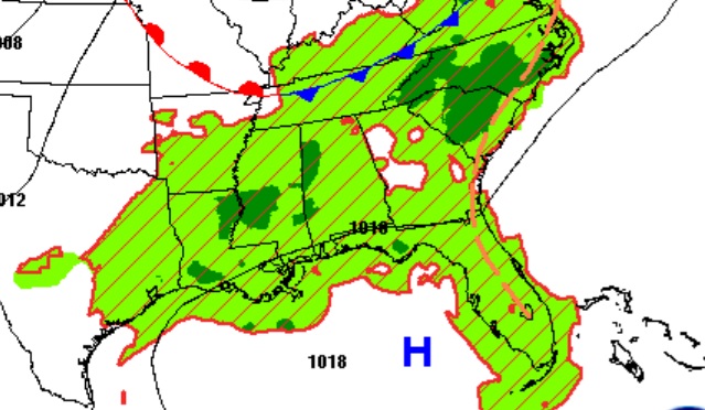
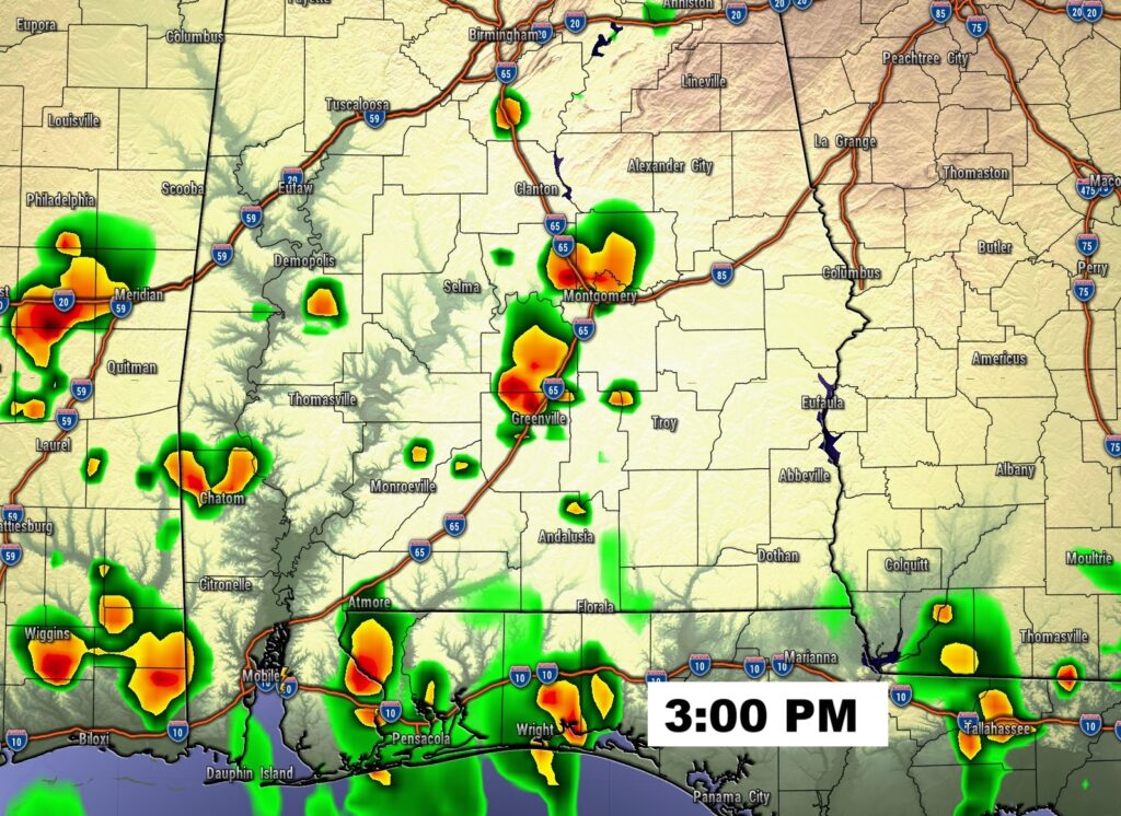
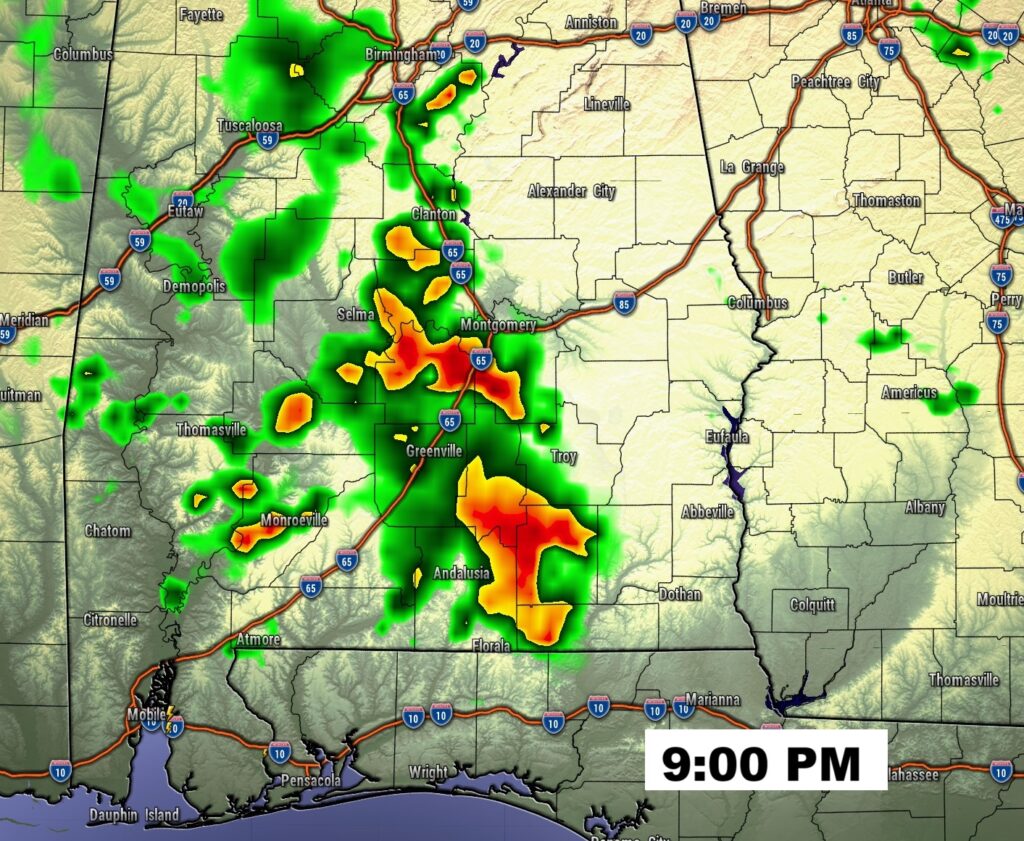
FUTURE RADAR: Radar was packed with showers and storms yesterday. Rainfall was widespread. Today, far fewer random PM showers and storms will populate the radar.
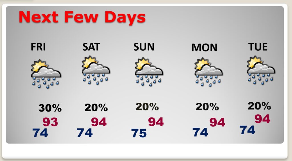
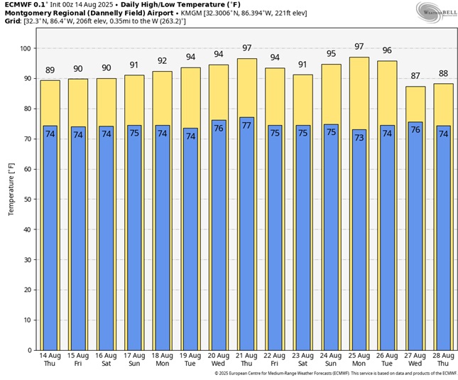
NEXT FEW DAYS: The number of storms will start to thin out, in number Friday through early next week. With fewer storms and more sun, expect hotter days. Expect middle 90s Friday through early next week. Triple digit Heat Index will rear it’s ugly head again Friday through early next week.
.
Here’s the 10 Day Model Blend Temperature Trend. HOTTER days are in our future.
TROPICAL OUTLOOK:
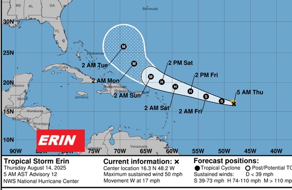
Tropical Storm Erin growing stronger is moving westward in the Tropical Atlantic. Erin could become a Hurricane by Thursday and very likely a Major Hurricane by this weekend. Erin is likely to turn into the open Atlantic and likely miss the United States all together.
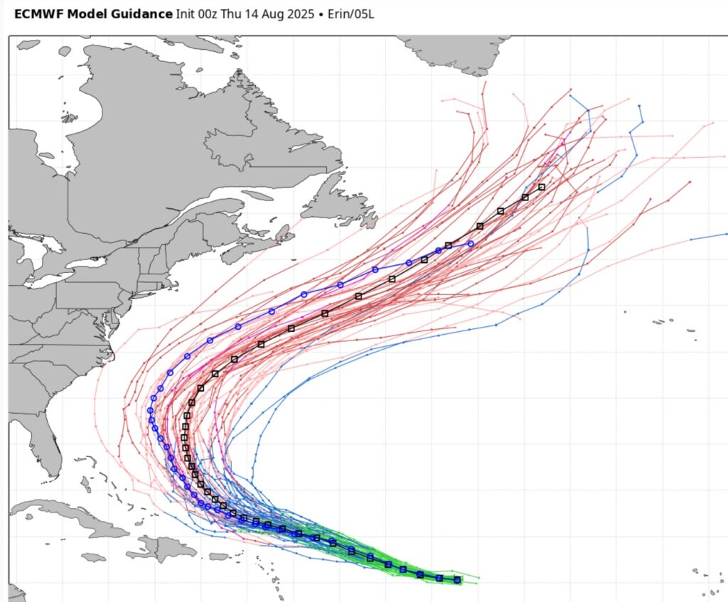
Here’s the EURO Ensembles –all showing Erin will likely miss the US and turn into the open Atlantic.
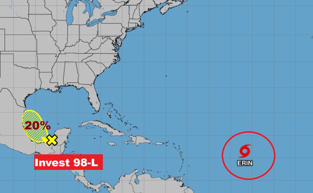
Elsewhere NHC is tracking an Area to Watch, now designated Invest 98-L in the southwest Gulf, with a 20% chance of development. Air Force RECON is scheduled to visit this are today.
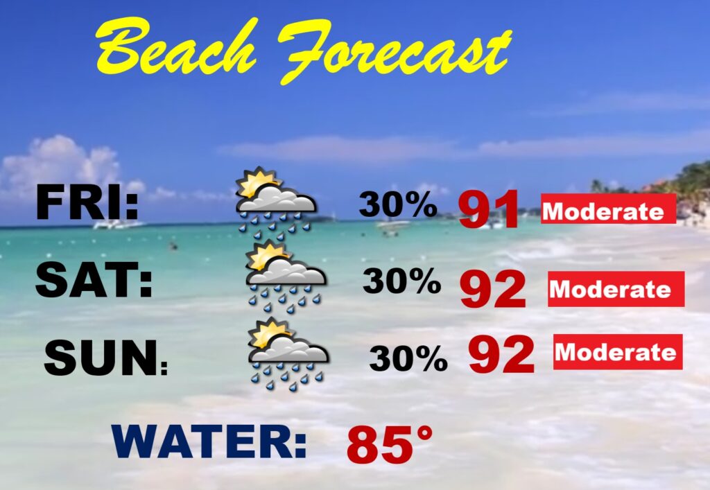
BEACH OUTLOOK: Routine August weekend forecast 30% rain probability is quite normal..
Thanks for reading the blog. Today everything is normal including LIVE on the Radio of NewsTalk 93.1 WACV. There will be another video forecast discussion and Blog Update in the 4 o’clock hours tomorrow morning. You can always find my forecast updates hourly on the 8 station Bluewater family of stations every day of the year.
–Rich