
Good morning! Once again today, Radar will be quite active today. Like yesterday, scattered to numerous, random PM showers and storms, will be around almost anytime, but particularly in the afternoon and evening hours. Storms will thin out a bit Thursday and especially Friday through Saturday. Highs upper 80’s today, and lower 90’s Thursday. Perhaps middle 90s Friday through Monday. Triple digit Heat Index will return over the weekend. Tropical Storm Erin is moving westward in the Tropical Atlantic. Erin could become a Hurricane by Thursday and maybe a Major Hurricane by this weekend. Erin is likely to turn and likely miss the United States. Here’s my brief video forecast discussion.
TODAY: Limited sunshine. High upper 80s to near 90. Random scattered showers to numerous showers and thunderstorms just about anytime, but most numerous in the after and evening hours. More Tropical Downpours. Low tonight 74
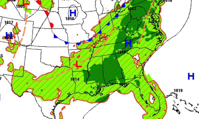
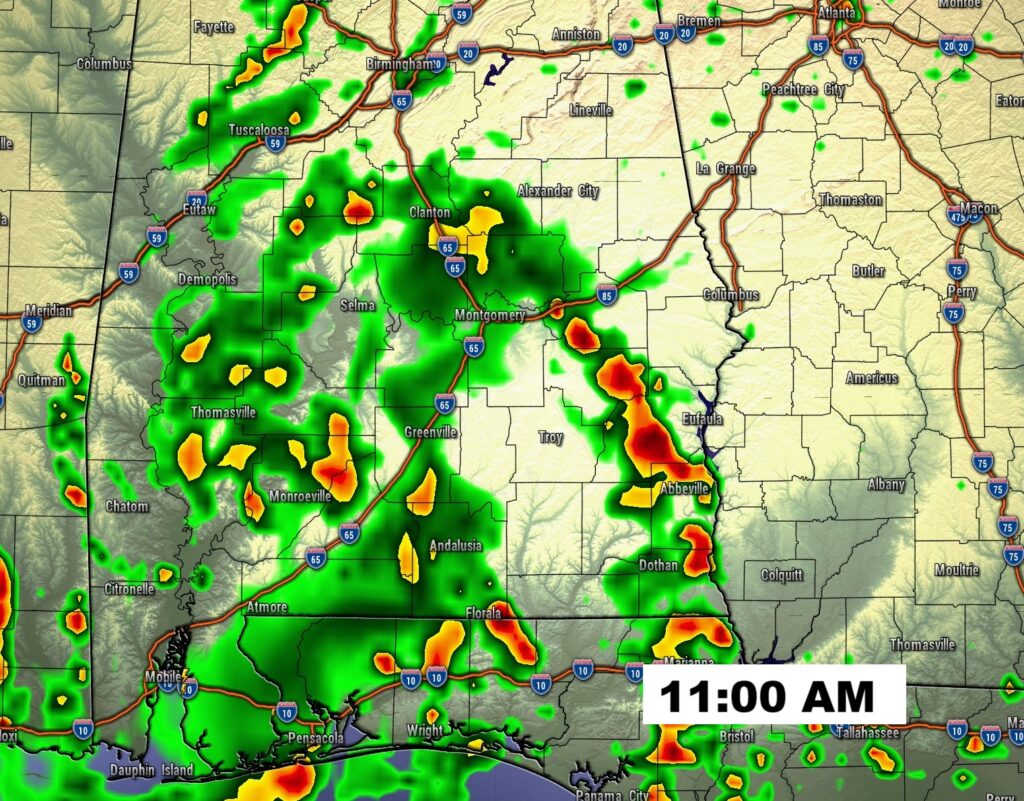
FUTURE RADAR: Once again today,Radar will be very active today and tomorrow. Frequent Tropical Downpours, again.

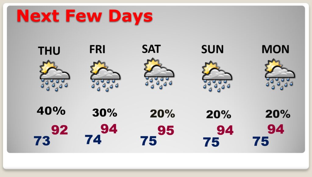
NEXT FEW DAYS: The number of storms will start to thin out, in number by Thursday and especially Friday through Saturday. Highs in the lower 90’s Thursday. Perhaps middle 90s Friday through Monday. Triple digit Heat Index will return over the weekend.
.
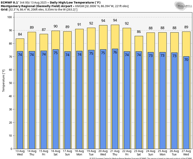
Here’s the 10 Day Model Blend Temperature Trend.
TROPICAL OUTLOOK:
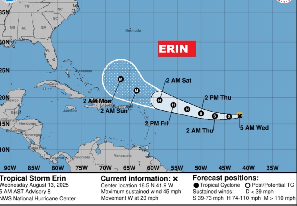
Tropical Storm Erin is moving westward in the Tropical Atlantic. Erin could become a Hurricane by Thursday and maybe a Major Hurricane by this weekend. Erin is likely to turn and likely miss the United States.
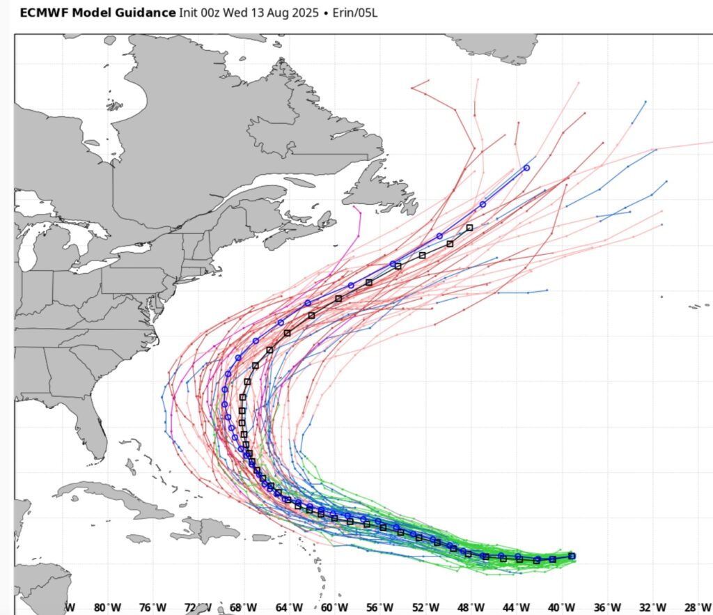
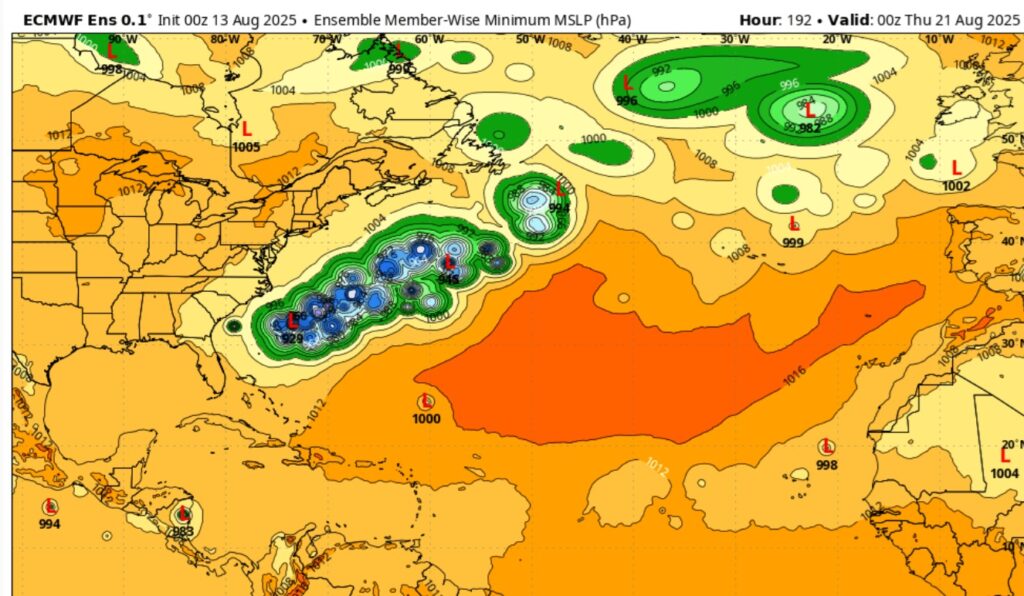
Here’s the EURO Ensembles – now all showing Erin will likely miss the US and turn into the Atlantic.
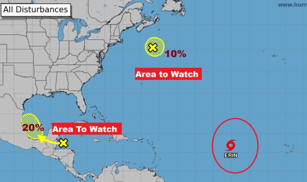
Elsewhere NHC is tracking a new Area to Watch in the southwest Gulf, with a 20% chance of development.
BEACH OUTLOOK: Not a bad forecast. 30% rain probability is very routine.

Thanks for reading the blog. Today everything is normal including LIVE on the Radio of NewsTalk 93.1 WACV. There will be another video forecast discussion and Blog Update in the 4 o’clock hours tomorrow morning. You can always find my forecast updates hourly on the 8 station Bluewater family of stations every day of the year.
–Rich