
Good morning! Our Weekend forecast is fairly routine. Highs will be near 90. Scattered random PM storms will develop each day. Perhaps a little more numerous on Sunday and Monday as tropical moisture increases from the Atlantic and Gulf. Next week will be a little hotter with low to mid 90’s, and the return of triple digit heat indices. The Tropics continue to come alive, especially by the second half of August.
TODAY: Sun/Cloud mix. High near 90. Random Widely Scattered showers and thunderstorms today. Low tonight 72.
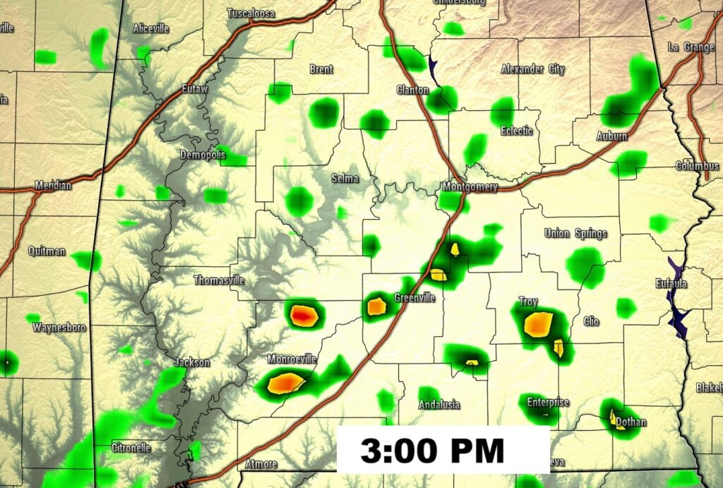
FUTURE RADAR: Not exactly a busy radar today, but more active than the last 3 days. Random showers/storms.
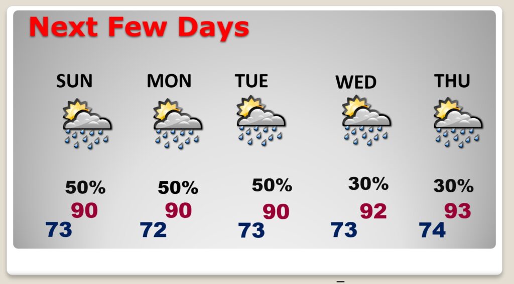
NEXT FEW DAYS: Routine forecast. Scattered mostly PM showers and storms each day, a little more numerous Sunday and Monday. Highs Near 90 Sunday through Tuesday. Then, low to mid 90’s by mid-week.
.
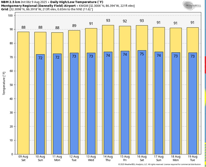
Here’s the 10 Day Model Blend Temperature Trend. There are some hotter days on the horizon.
TROPICAL OUTLOOK:
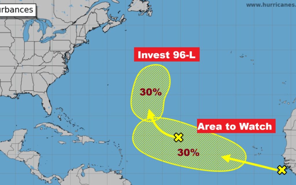
NHC: Invest 96-L, in the Tropical Atlantic now has a 30% chance of development. Farther out, there’s another Area to Watch off the African coast with a 30% chance of development.
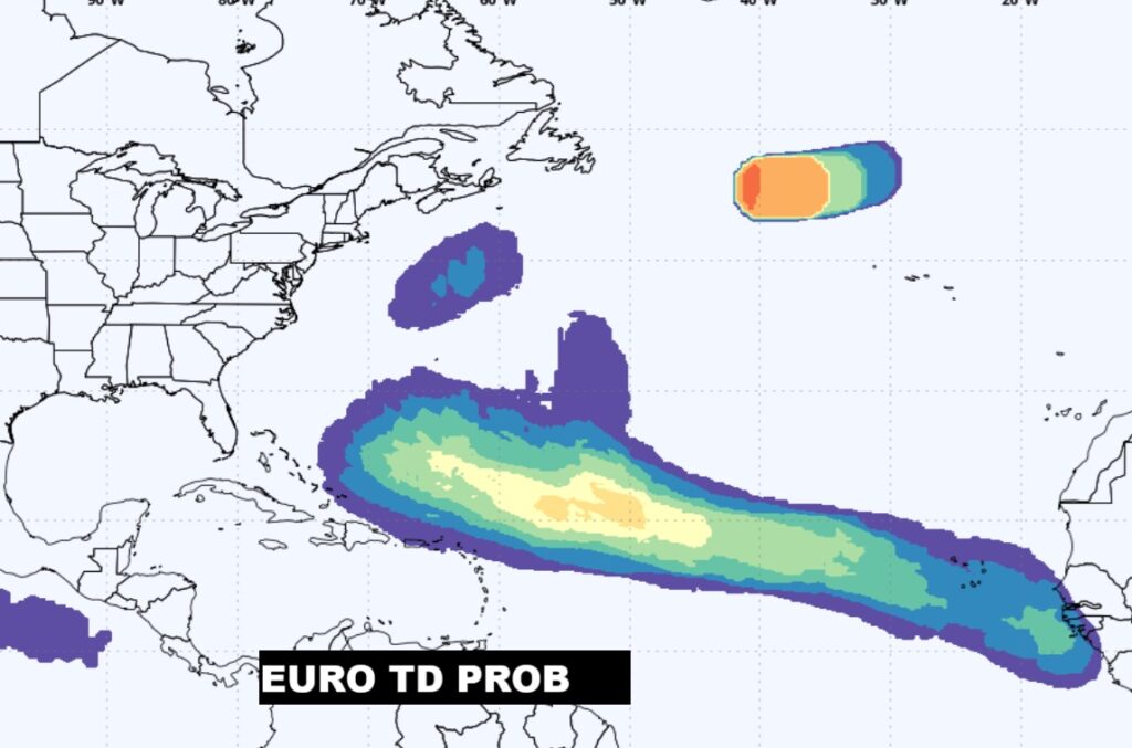
Here’s the EURO Tropical Depression Outlook for the next 7 days.
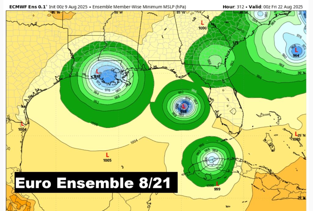
Later in the month, we’ll be closely watching possible tropical trouble close in the US – in the Gulf and off the SE coast. This is a couple of weeks in the future on the Euro.
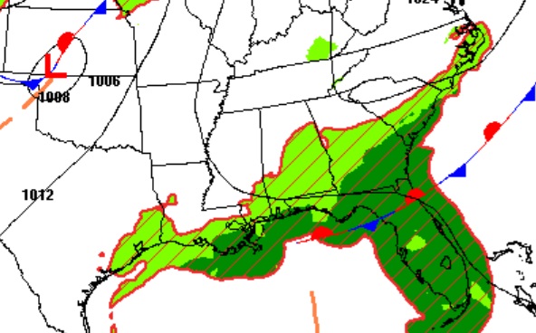
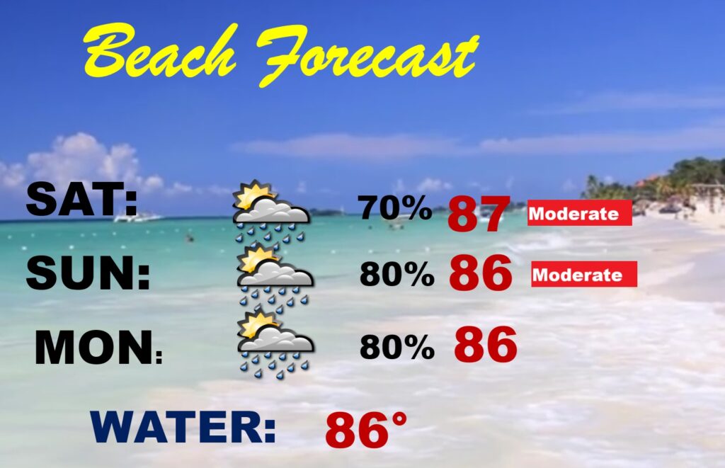
BEACH OUTLOOK: That stalled front continues to haunt the coast. It will continue to the focus for higher than normal rain chances at the Beach this weekend.
FULL MOON: The moon is this morning. In August, the full moon is called the Full Sturgeon Moon.
The next scheduled Blog update and Video Discussion is scheduled for Monday morning in the 4 o’clock hour. Have a nice weekend!
–Rich