
Good morning! Temperatures have returned closer to the August normal. We’ll be back to near 90 today and through the weekend. Next week will be a little hotter. Spotty random PM storms will pop up most days. Perhaps a little more numerous Sunday and Monday as tropical moisture increases. The Tropics continue to come alive, and later in the month, we’ll be closely watching possible tropical trouble close inn the US – perhaps in the Gulf and/or off the SE coast. Here’s my brief video forecast discussion.
CLIMATE: Yesterday hi/lo 89/73. Normal 94/72. No Rain.
TODAY: Mostly sunny. High near 90. Rain chance today is 20% or less. Low tonight 71.
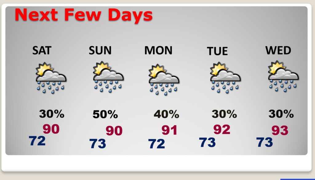
NEXT FEW DAYS: Routine forecast. Spotty random PM storms most days. Perhaps a little more numerous Sunday and Monday. Near 90 through Sunday. Lower 90’s next week.
.
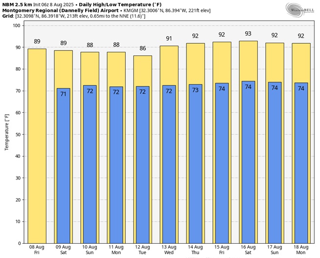
Here’s the 10 Day Model Blend Temperature Trend
TROPICAL OUTLOOK:
NHC: Invest 96-L, in the Tropical Atlantic now has a 60% chance of development. That area off the US east coast, has a low chance of development. The next available name is Erin.
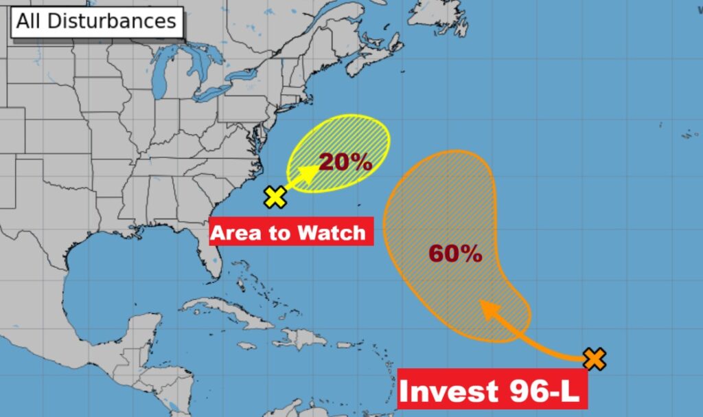
Here’s the EURO Tropical Depression Outlook for the next 7 days. No doubt about it. The Tropics some alive.
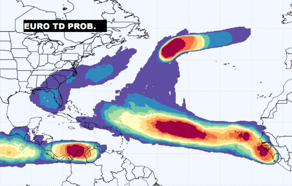
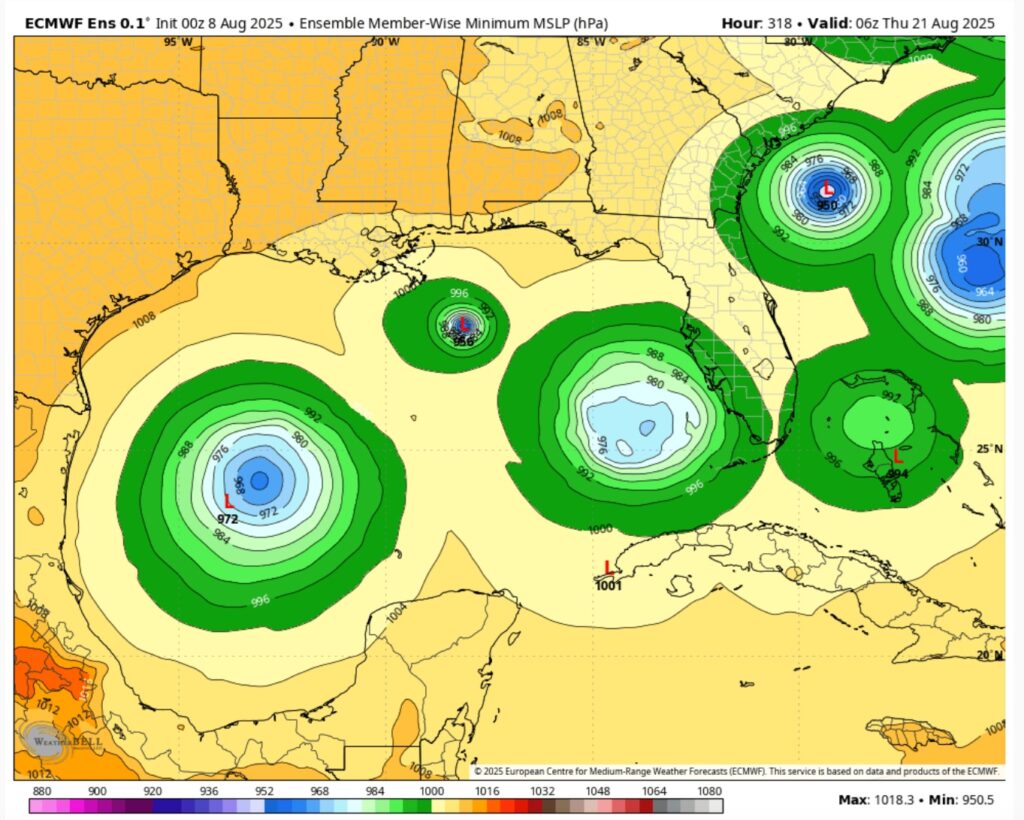
Later in the month, we’ll be closely watching possible tropical trouble close in the US – in the Gulf and off the SE coast. This is a couple of weeks in the future on the Euro.
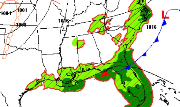
BEACH OUTLOOK: That stalled front will continue to be the focus for higher than normal rain chances at the Beach this weekend. Be flexible.

FULL MOON: The moon will officially be full tonight. In August, the full moon is called the Full Sturgeon Moon.
Thanks for reading the blog. Today everything is normal including LIVE on the Radio of NewsTalk 93.1 WACV. There will be another video forecast discussion and Blog Update in the 4 o’clock hours tomorrow morning. You can always find my forecast updates hourly on the 8 station Bluewater family of stations every day of the year.
–Rich