
Good morning! A Heat Advisory continues in effect today and Thursday. Heat index today and Thursday will be in the dangerous 105-110 range. Radar again will be quite active today through the rest of the week. Scattered to numerous random storms. A frontal system will enter the state Friday. The front will stall somewhere in extreme south Alabama. The risk of scattered storms remains in the forecast this weekend. Temperatures will be a little more reasonable with highs in the 80’s by Sunday through the following Tuesday. Here’s my brief video forecast discussion.
CLIMATE: Yesterday’s High at MGM was 98 with a Heat Index of 113. No rain.
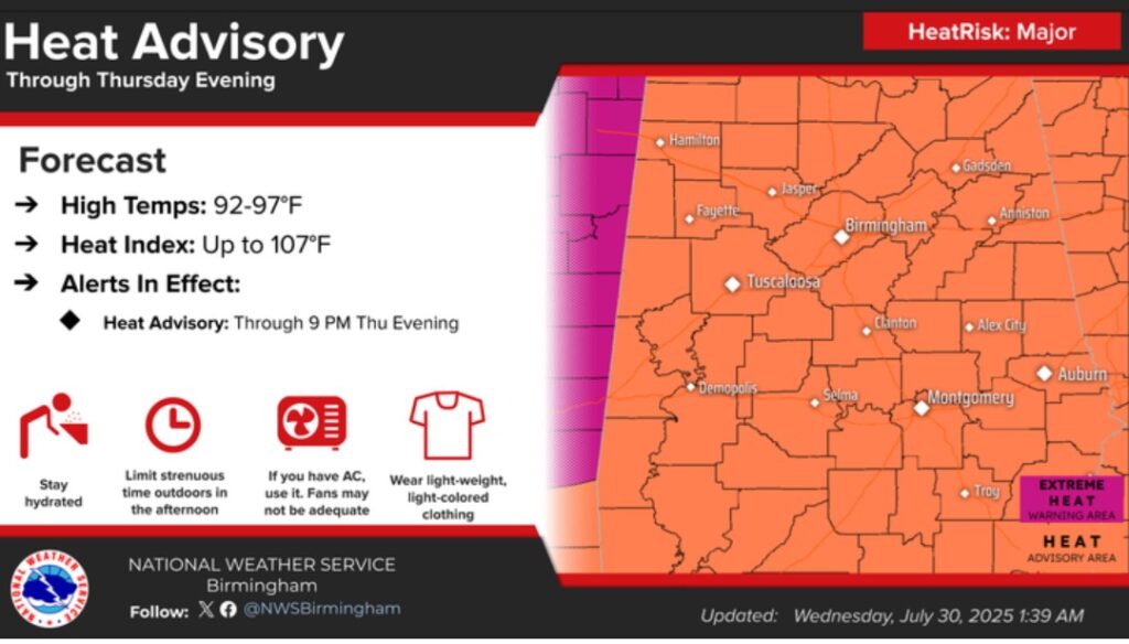
TODAY: HEAT ADVISORY continues. Sun/cloud mix. High near 97. Heat index as high as 105-110. Random Scattered to numerous showers and thunderstorms today. Low tonight 77.
HEAT ADVISORY Continues in effect through Thursday. Heat index today will be in the dangerous 105-110 range. Yesterday the Heat Index reached 113 at MGM.
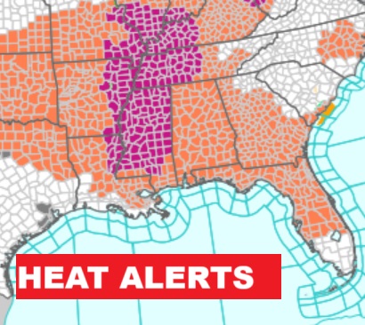
Heat advisory continues through Thursday. Again today, Heat Alerts will cover a multi-state area. Much of MS and TN are under an Extreme Heat Warning.
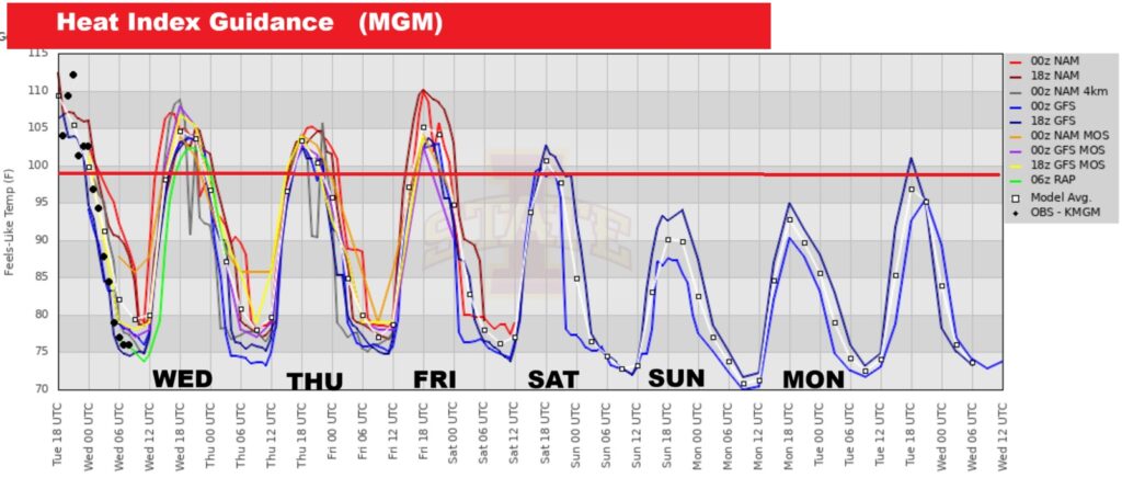
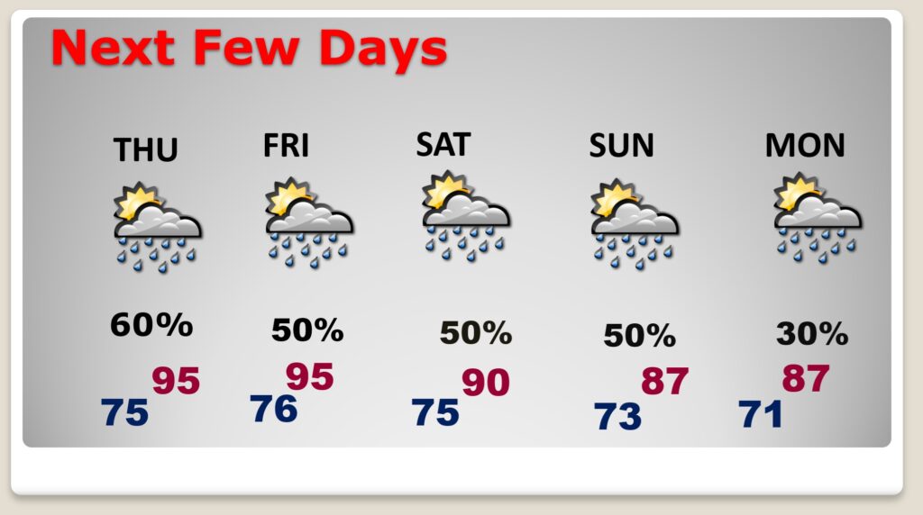
Heat index today and Thursday will be in the dangerous 105-110 range. And near 105 Friday. Expect improvement starting over the weekend.
FUTURE RADAR: Scattered PM storms again today. Sometimes storms can put on quite a show in this kind of heat.
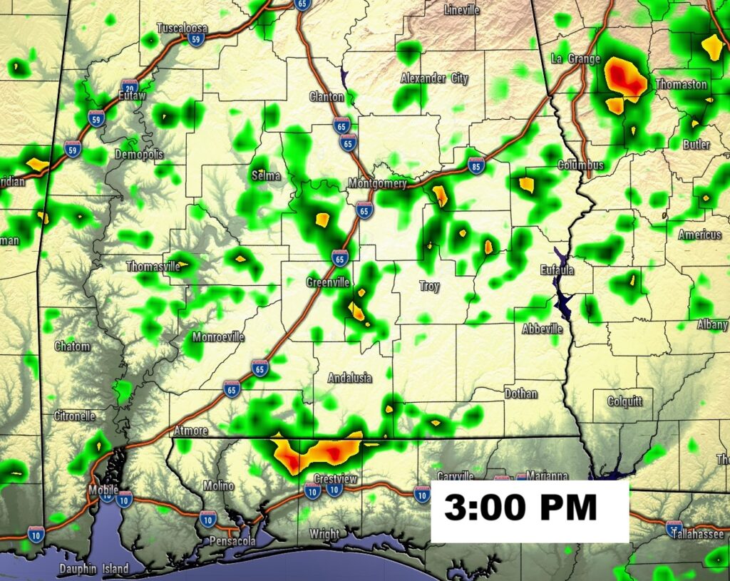
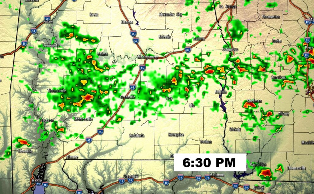
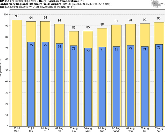
NEXT FEW DAYS: Scattered to numerous random storms are back in forecast each day through the weekend. Expect mid 90’s Wednesday through Friday. Eventually temperatures will be a little more reasonable with highs in the 80’s next Sunday through the following Tuesday.
Here’s the 10 Day Model Blend Temperature Trend. Not as hot Sunday through Tuesday will be in the 80’s.
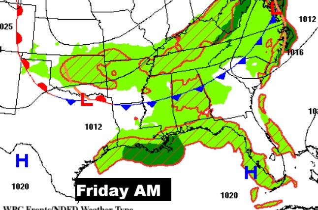
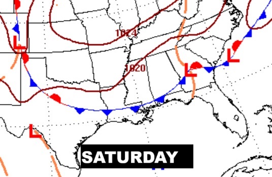
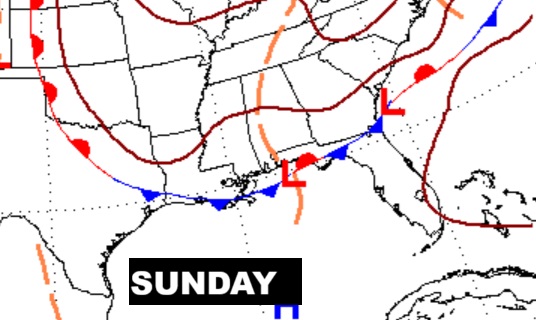
A frontal system will enter the state by Friday night. Then the front stalls somewhere in south Alabama. So, the risk of scattered storms remains in the forecast this weekend.
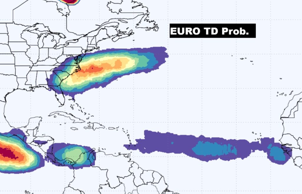
TROPICAL OUTLOOK: NHC is not tracking any systems right now, but the EURO model show multiple areas that need to be monitored in the Atlantic, especially off the US East Coast.
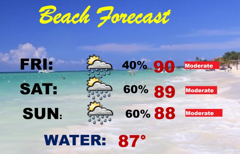
BEACH OUTLOOK: A stalled front near the coast will promote scattered showers and storms.
Thanks for reading the blog. Today everything is normal including LIVE on the Radio of NewsTalk 93.1 WACV. There will be another video forecast discussion and Blog Update in the 4 o’clock hours tomorrow morning. You can always find my forecast updates hourly on the 8 station Bluewater family of stations every day of the year.
–Rich