
Good morning! The big story is dangerous heat. Practically all or most of the state is under a Heat Advisory today through Tuesday. In fact, it is not out of the question that some places could be upgraded to an Extreme Heat Warning tomorrow. We’ll be close to the 110 Heat Index criteria. It’s a dry forecast today, but random scattered storms will be back on the radar starting tomorrow and Wednesday, and through the rest of the week. On the distant horizon, get ready for cooler air especially by Sunday. Here’s my brief video forecast discussion.
TODAY: Abundant sunshine High near 99. Heat index as high as 107. Rain chance 10%. Low tonight 78.
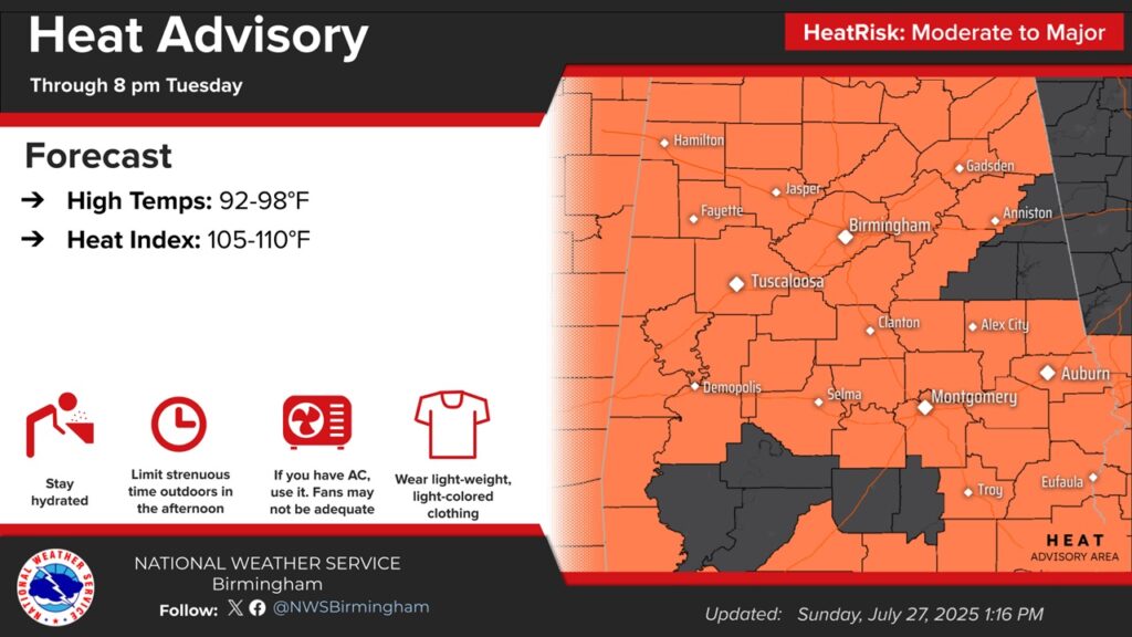
Practically all or most of the state is under a HEAT ADVISORY today through Tuesday. In fact, it is not out of the question that some places could be upgraded to an Extreme Heat Warning. We’ll be close to the 110 Heat Index criteria.
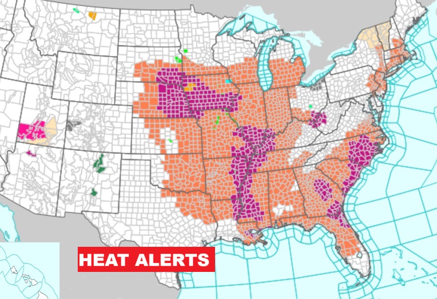
Widespread Heat Alerts cover a multi-state area under a Massive Upper Heat Dome.
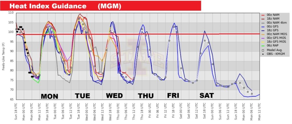
The Heat Index will be in very dangerous territory especially through Tuesday. But, all this week will be very hot through Friday.
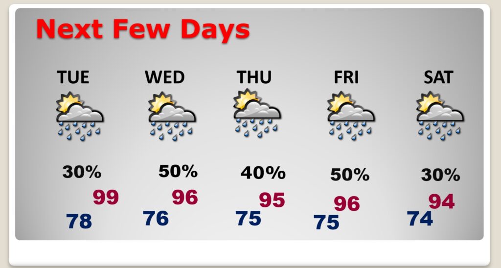
NEXT FEW DAYS: Heat Advisory through Tuesday. HOT all week. Random scattered storms will be back on the radar starting tomorrow and Wednesday, and through the rest of the week. On the distant horizon, get ready for cooler air especially by Sunday.
Here’s the 10 Day Model Blend Temperature Trend. Extremely hot this week. But check out the cooling trend which begins Sunday. Highs in the 80’s! Also less humid.
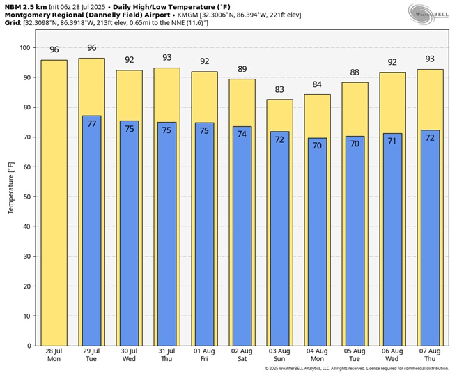
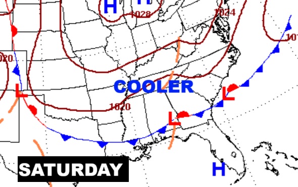
Fingers crossed. Looks like a rare summer cool front this weekend. Cooler, less humid air, we hope.
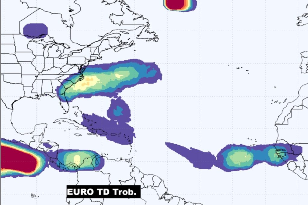
TROPICAL OUTLOOK: NHC is not tracking any systems right now, but the EURO model show multiple areas that need to be monitored in the Atlantic.
Thanks for reading the blog. Today everything is normal including LIVE on the Radio of NewsTalk 93.1 WACV. There will be another video forecast discussion and Blog Update in the 4 o’clock hours tomorrow morning. You can always find my forecast updates hourly on the 8 station Bluewater family of stations every day of the year.
–Rich