
Good morning! The intense, relentless, dangerous heat continues. Yesterday was the hottest day of the year so far. Today’s high will be in the middle 90’s with triple digits on the Heat Index again. A massive Heat Dome remains in control. Radar will be little more active today and tomorrow. We’re monitoring the northern Gulf later this week for potential tropical development. A trough of low pressure off the NE Florida coast will track west-southwestward. Right now it looks like the heaviest rainfall will stay near and south of the coast. Here’s my brief forecast discussion.
CLIMATE: Yesterday (Tuesday) was the hottest day of the year so far with 98 with a Heat Index of 108. (Morning low 74). No rain.
TODAY: Sun/cloud mix. High near 94. Heat index102-107. Random Scattered PM showers & Storms. Low tonight 75.
A massive Heat Dome remains in control.
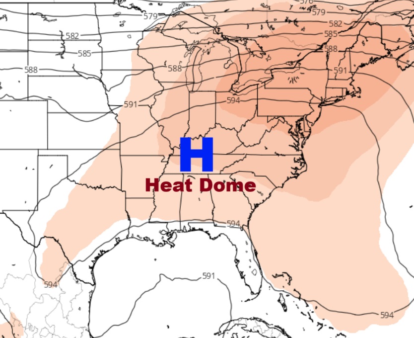
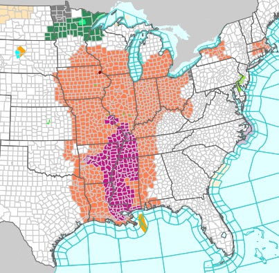
Heat Advisories and Extreme Heat Warnings from the Gulf Coast to the Great Lakes. Much of west Alabama is under a Heat Advisory again today.
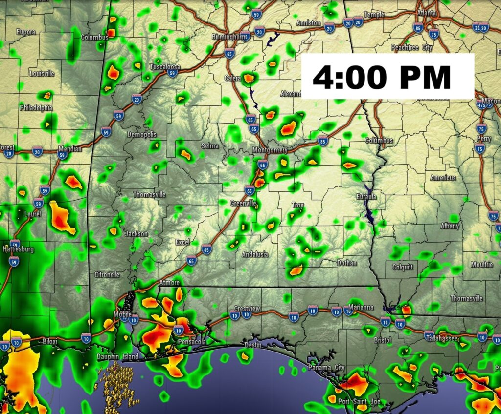
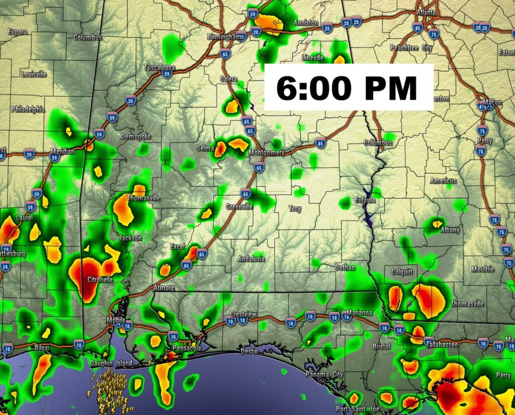
FUTURE RADAR: Radar will be little more active today. Yesterday there were a couple of Severe Thunderstorm Warnings.
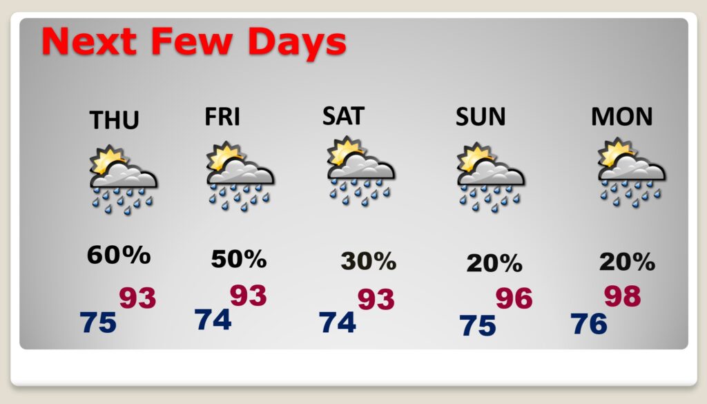
NEXT FEW DAYS. Expect low to mid 90’s Thursday through Sunday and upper 90’s Monday and Tuesday. Low at night in the muggy mid 70’s. Very little day to day change. Scattered random mostly afternoon and evening storms. Storms will become widely scattered Sunday through Tuesday.
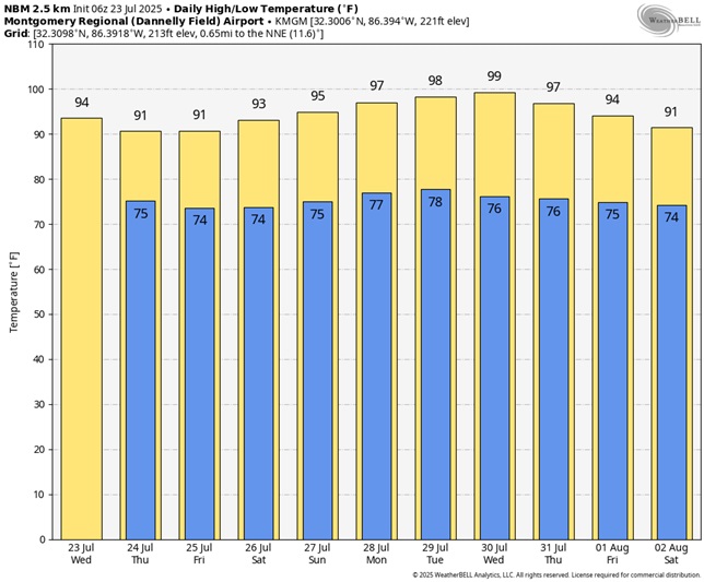
Here’s the 10 Day Model Blend Temperature Trend. HOT!
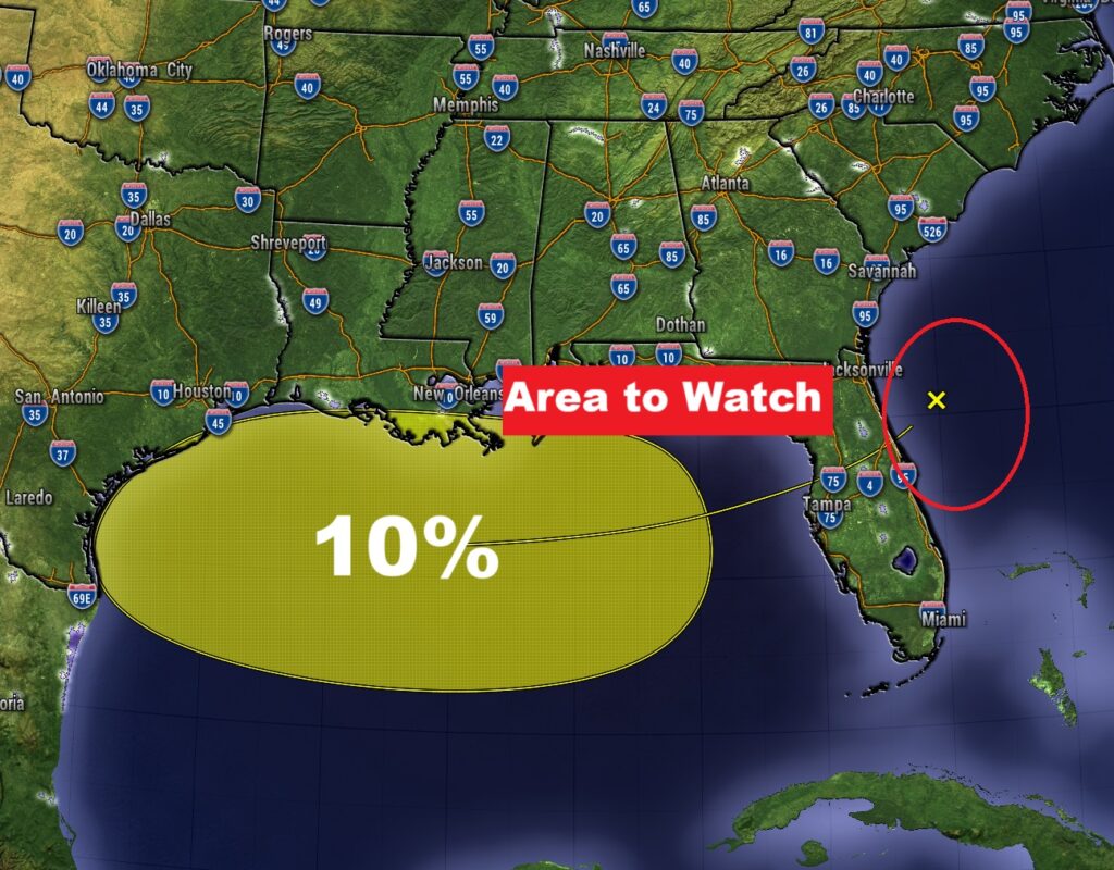
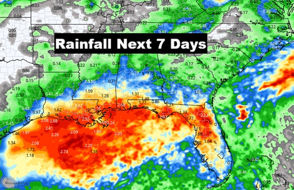
TROPICAL OUTLOOK: NHC is monitoring the northern Gulf later this week for potential tropical development. A trough of low pressure off the NE Florida coast will track west-southwestward. Currently NHC has a very low probability of development.
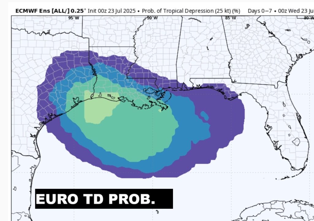
The EURO model shows a 40-50% chance of this system becoming a Depression over the NW Gulf.
Right now it looks like the heaviest rainfall will stay near and south of the coast.
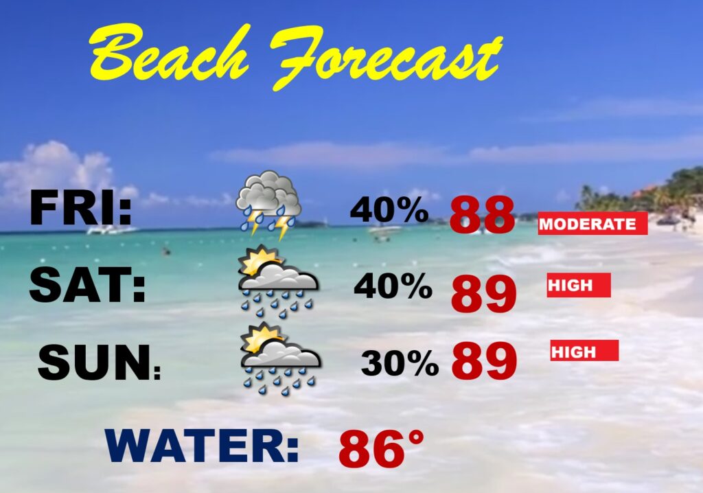
BEACH OUTLOOK:
Thanks for reading the blog. Today everything is normal including LIVE on the Radio of NewsTalk 93.1 WACV. There will be another video forecast discussion and Blog Update in the 4 o’clock hours tomorrow morning. You can always find my forecast updates hourly on the 8 station Bluewater family of stations every day of the year.
–Rich