
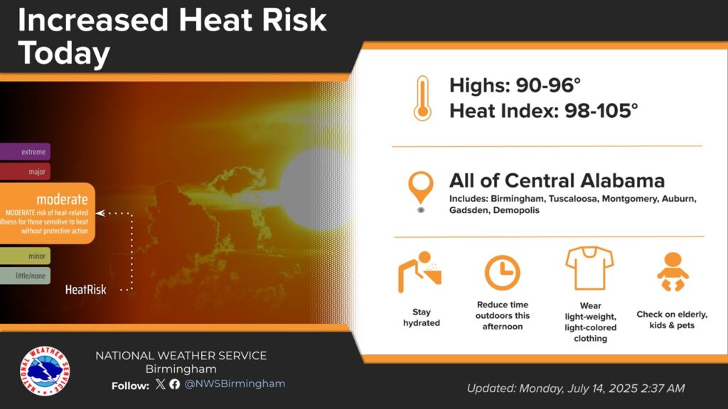
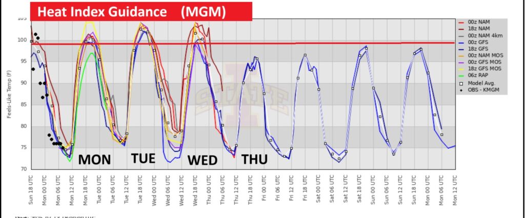
Good morning! Today and tomorrow could potentially be the hottest days of the year so far. Highs in the upper 90’s. Dangerous Heat index near or above 105. Any random PM storms will be few and far between. Meanwhile, we’ll be monitoring Future Tropical Trouble in the Gulf this week. Although the system will probably stay south of Alabama, increasing the tropical moisture flowing into our state will increase the rain chance. Here’s my brief video forecast discussion.
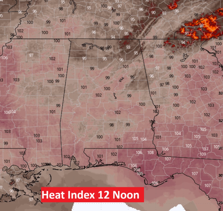
TODAY: Sun/cloud mix. High upper 90’s. Heat index 105+. Random Isolated PM showers & storms. Low tonight 74. Light wind.
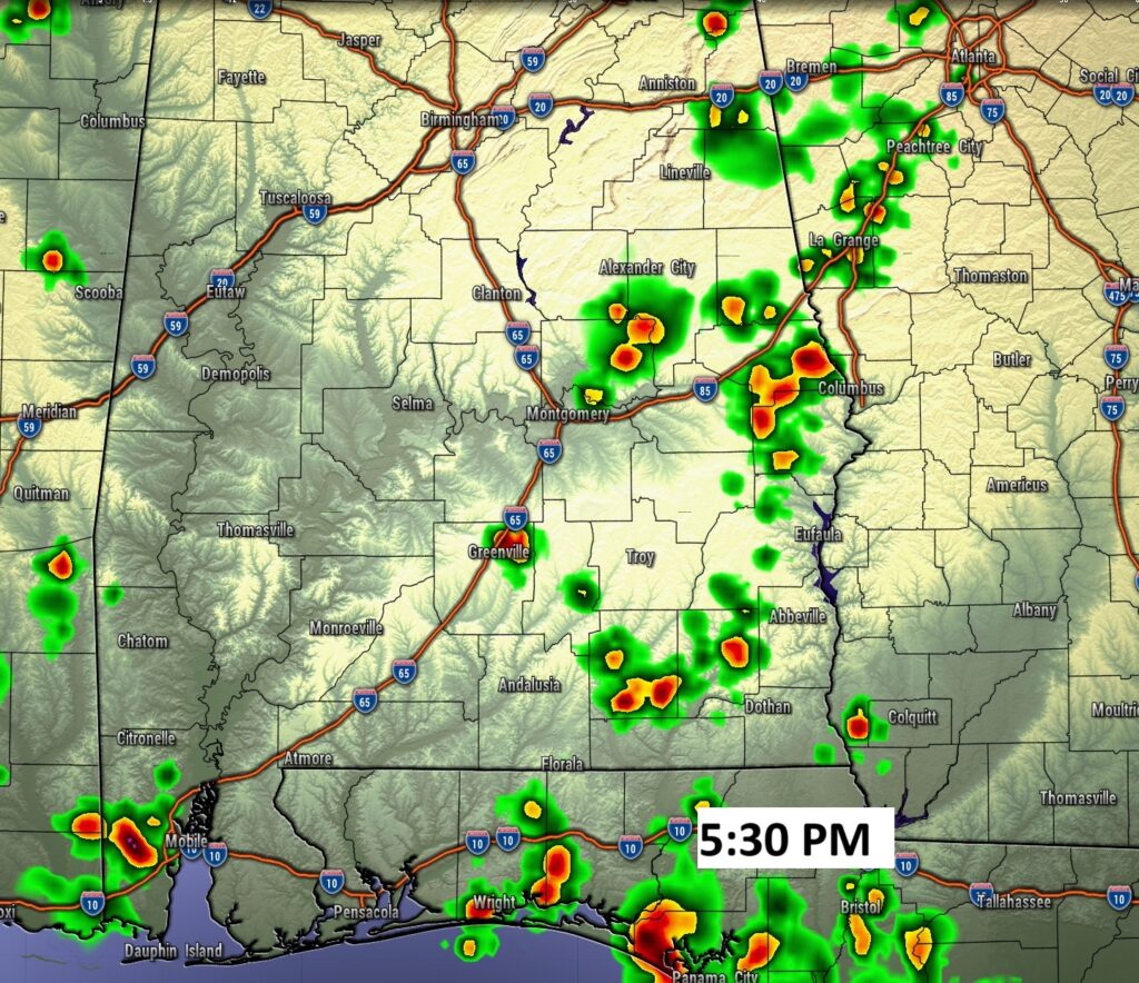
FUTURE RADAR: Storms will be extremely isolated. The best chance will be in eastern and SE Alabama.
NEXT FEW DAYS: The Heat Index will be near or above the 105 Danger Level. Expect upper 90’s Tuesday. Lows in the muggy 70’s at night. We’ll be monitoring Future Tropical; Trouble in the Gulf this week.
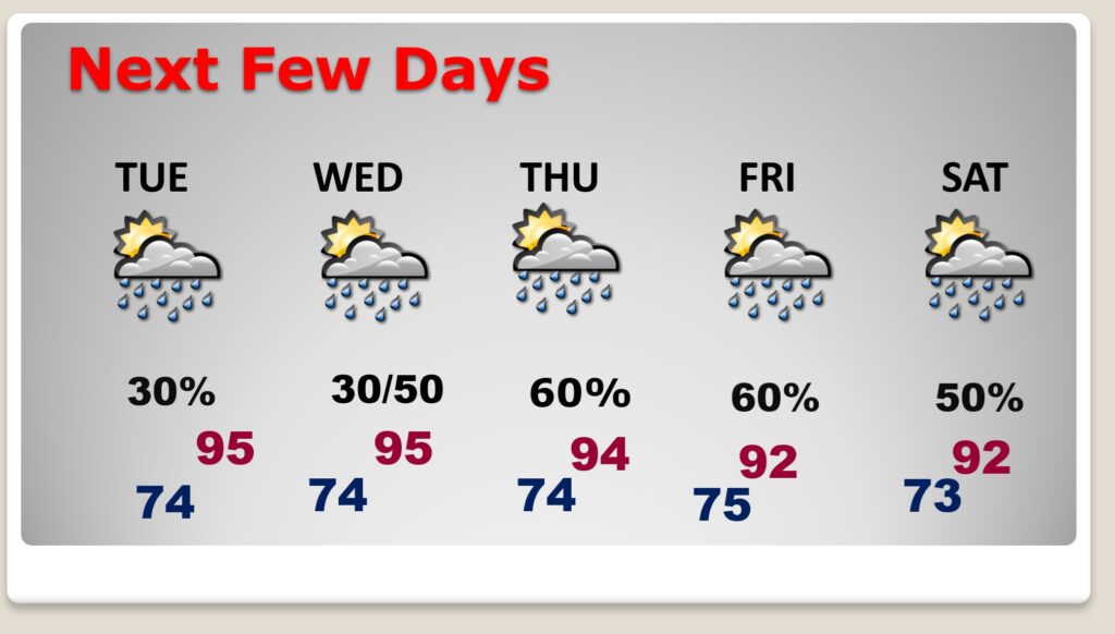
The Heat Index will be near the 105 danger level, especially in the first half of the week.
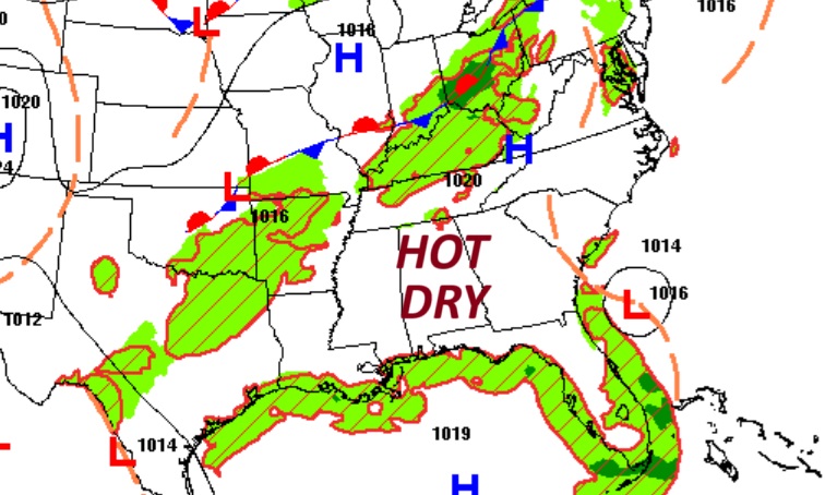
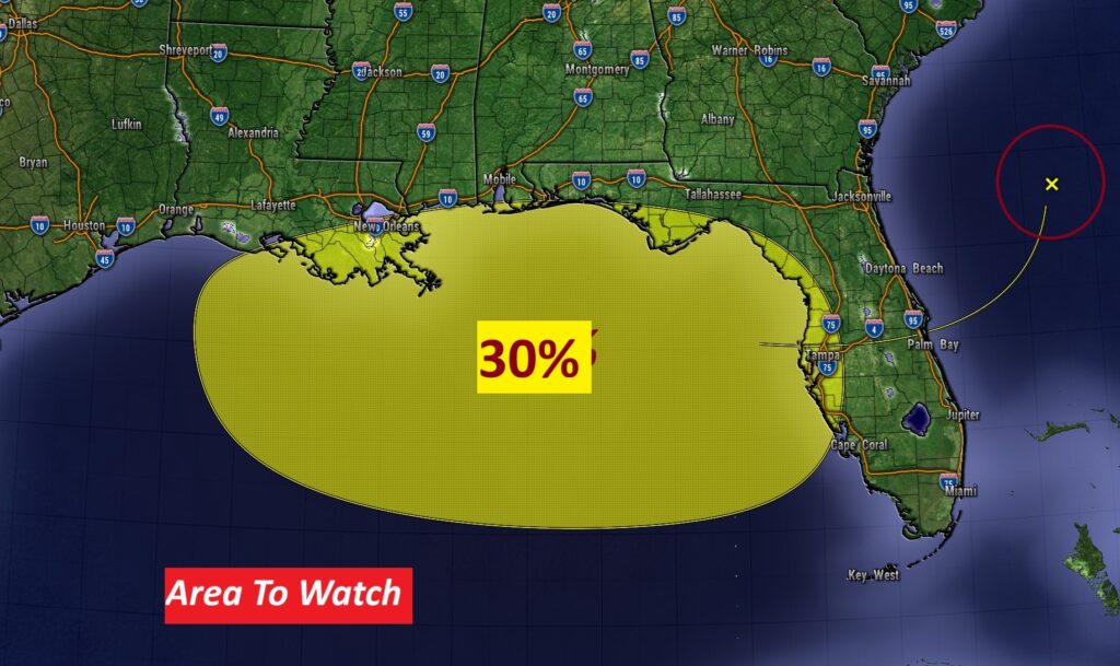
TROPICAL OUTLOOK: We’ll be monitoring Future Tropical; Trouble in the Gulf this week. NHC has a low 30% chance of development so far, as a trough of low pressure in the Bahamas migrates westward across Florida into the northern Gulf. By the way, the next available name is Dexter.
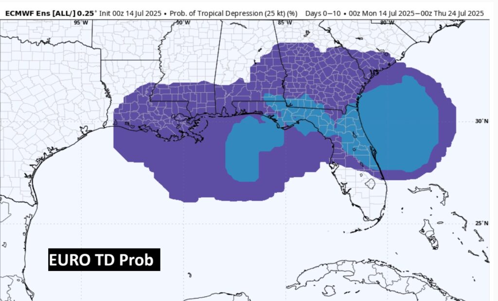
The EURO shows a chance of Tropical Depression development in the northern Gulf.
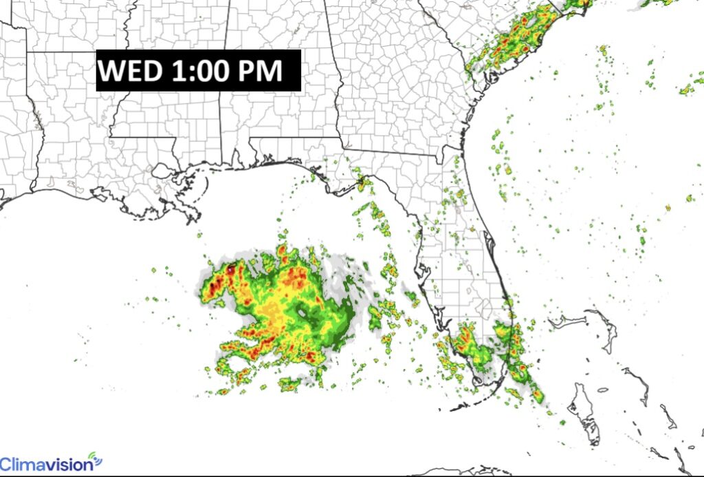
Here’s a Hi-res model showing a system in the Gulf mid-day Wednesday. Although the system will probably stay south of Alabama, increasing the tropical moisture flowing into our state will increase the rain chance especially by Thursday.
Here’s the hi-res ICON model suggesting that Tropical Disturbance that will cross Florida into the Gulf may become a Depression and eventually possibly Tropical Storm Dexter by late week into perhaps Louisiana . We’ll see!
Thanks for reading the blog. Today everything is normal including LIVE on the Radio of NewsTalk 93.1 WACV. There will be another video forecast discussion and Blog Update in the 4 o’clock hours tomorrow morning. You can always find my forecast updates hourly on the 8 station Bluewater family of stations every day of the year.
–Rich