
Good morning! Each day gets a little hotter. We are heading closer to the danger level on the heat index today. Scattered Random downpours will continue to be around each day. But, the number of PM storms will tend to be more numerous by Thursday through Saturday, most numerous in the afternoon and evening hours. Locally heavy rainfall in spots. Meanwhile, there’s no “big ticket” weather ahead. The Tropical Atlantic basin is quiet for now. Here’s a brief video forecast discussion.
CLIMATE: Yesterday’s high in MGM was 94, Heat index 103. No rain at the airport. Yesterday in BHM they broke their daily rainfall record for July 8th with 1.70″ at the airport.
TODAY: Lots of sunshine. Very hot and humid. High94. Heat index 103-105. Random scattered mostly afternoon and evening storms. Low tonight 74.
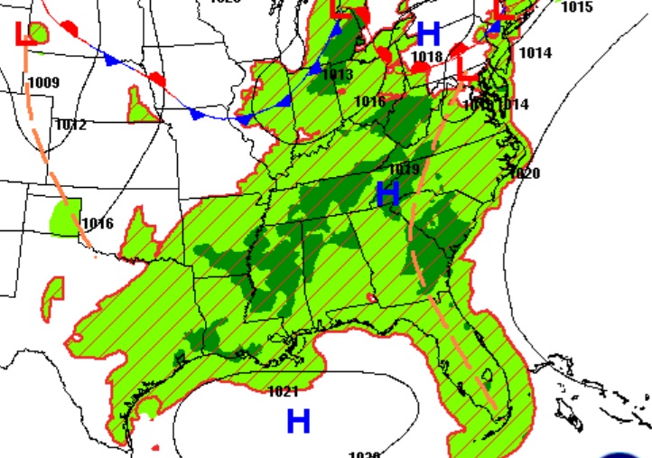
FUTURE RADAR: Looks like a fairly routine July day on the radar today.
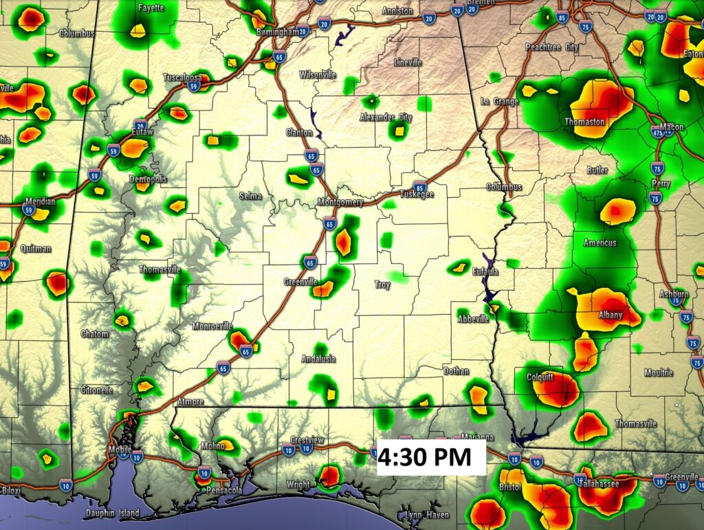
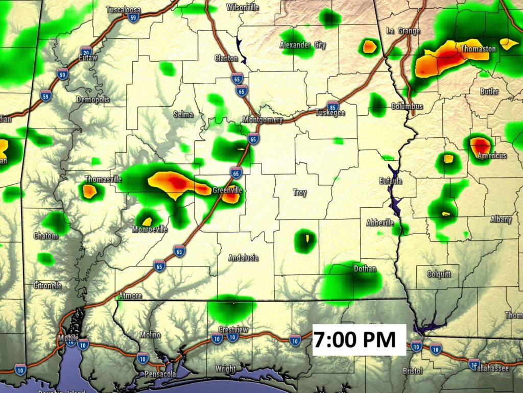
NEXT FEW DAYS: Scattered random mostly afternoon and evening storm, perhaps more numerous by Thursday, Friday and Saturday . Highs most days will be in the low to mid 90’s. Heat index near or above 100. Lows at night in the low to mid 70’s.
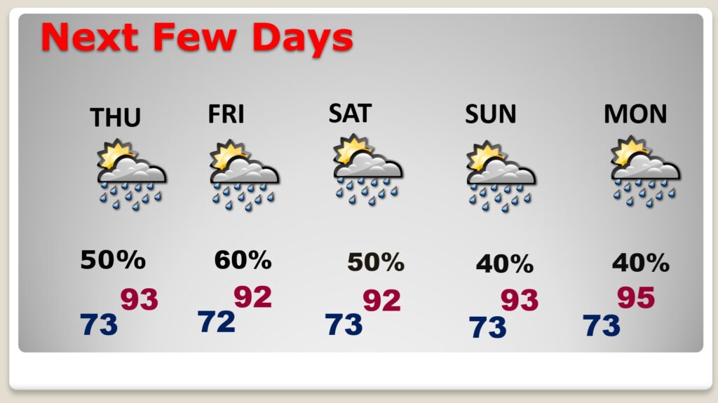
The heat index will be very close to Dangerous territory again today and quite high for the next several day. Very little day to day change.
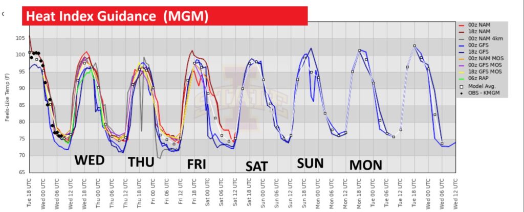
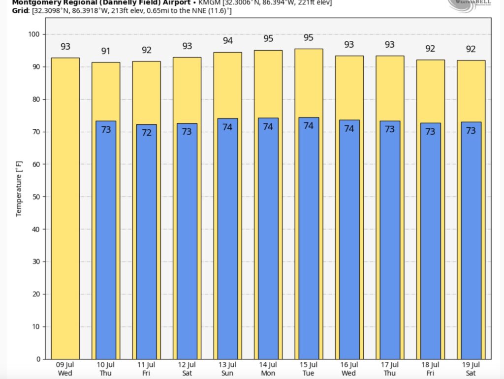
10 Day Model Blend Temperature trend. Intense heat will continue.
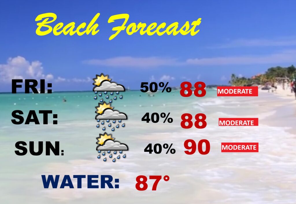
BEACH OUTLOOK: The forecast is about as routine as you can get for a weekend in July. Spotty random storms. Dry most of the time. Moderate rip current risk. Water temperature in the upper 80’s.
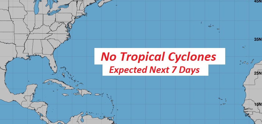
TROPICAL OUTLOOK: The Tropical Atlantic basin continues to look quiet for now. Hostile atmospheric dynamics continue to stifle tropical development.
Thanks for reading the blog. Today everything is normal including LIVE on the Radio of NewsTalk 93.1 WACV. There will be another video forecast discussion and Blog Update in the 4 o’clock hours tomorrow morning. You can always find my forecast updates hourly on the 8 station Bluewater family of stations every day of the year.
BATH DAY for Chase yesterday! Thank you Gypsy Poodle.
–Rich