
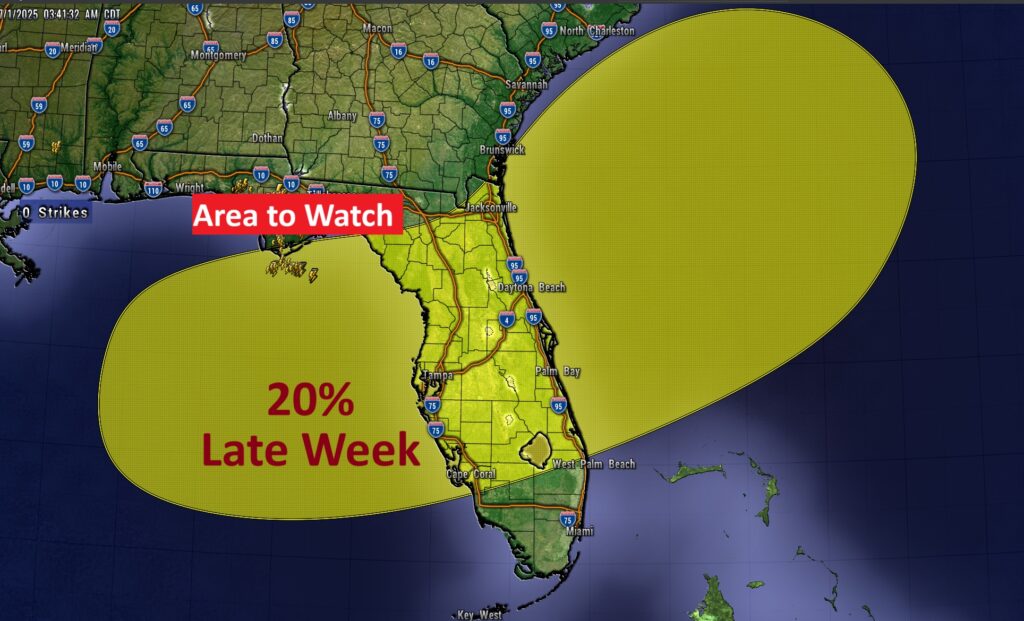
Good morning! Welcome to July. Radar will be rather active again today especially in the afternoon and evening hours (80% chance). This is ahead of a southward moving front that will bring big changes, including somewhat lower humidity. Starting Tomorrow through the end of the week Friday (4th of July) and over the weekend, the number of PM storms will thin out dramatically. Days will be getting hotter. Just in time for the holiday weekend, highs will edge into the mid 90’s by the weekend, with triple digit Heat Index. Meanwhile, NHC is monitoring that Area to Watch in the NE Gulf into the Atlantic. Here’s my Video Forecast Discussion.
YESTERDAY: MGM high 91. Low 72. Rainfall: 2.32” EAST MONTGOMNERY rainfall: 3.88” at my house!
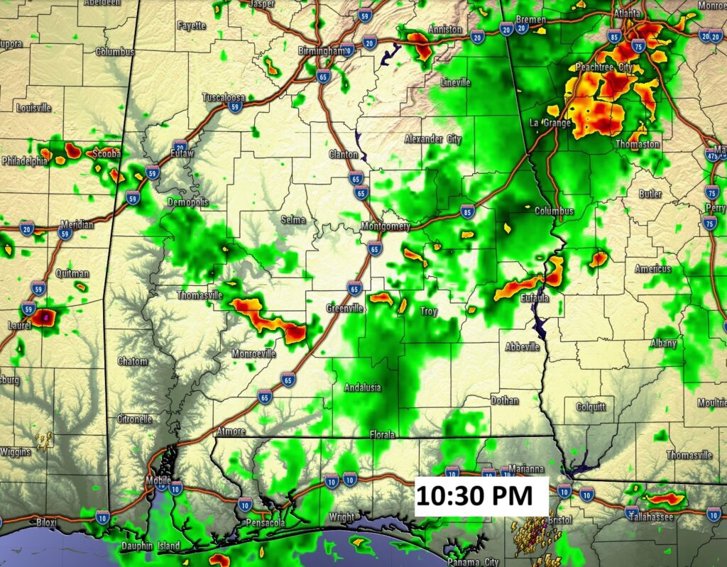
TODAY: Sun/Clouds. Hi 90. Widespread, random showers and storms will be rather numerous especially in the afternoon/evening. Low tonight 72.
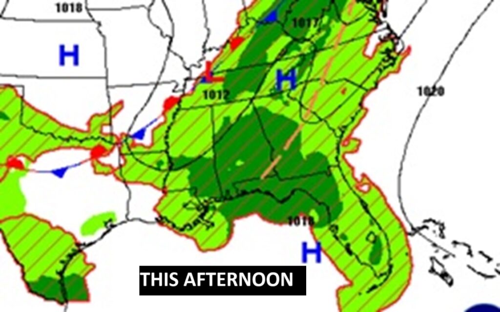
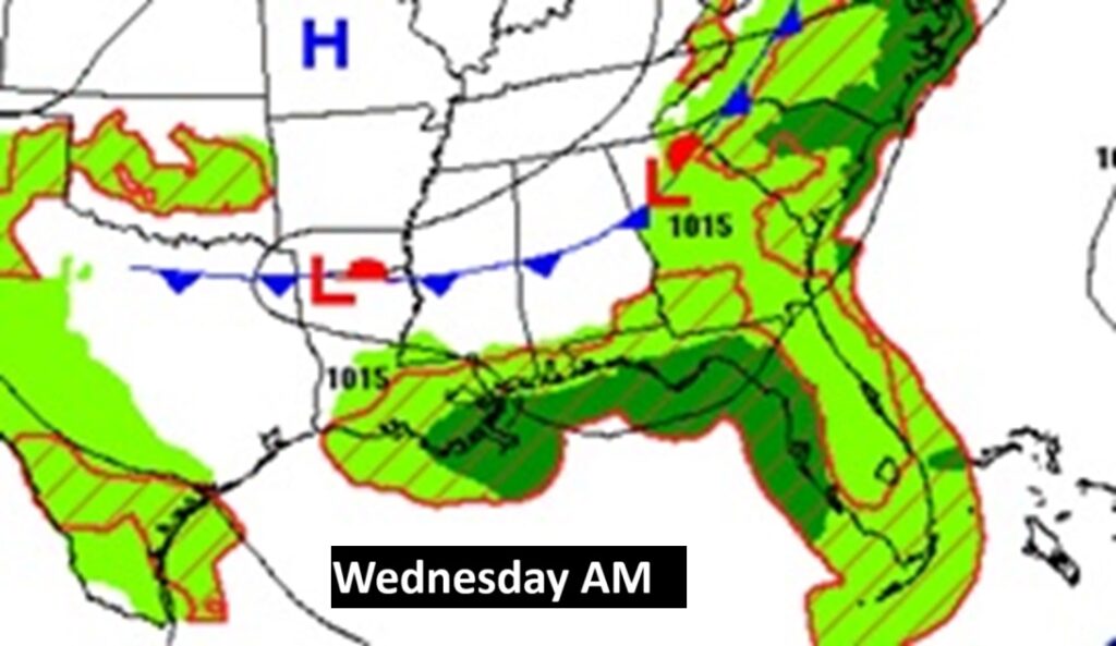
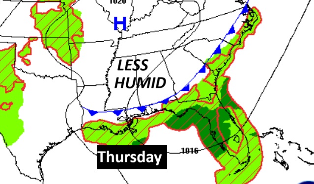
Here’s the front that will bring changes to our pattern. Showers and storms ahead of it today. Then somewhat drier air with fewer storms tomorrow and late week.
FUTURE RADAR: Looks like afternoon storms will reach a peak by early evening ahead of a southward moving front.
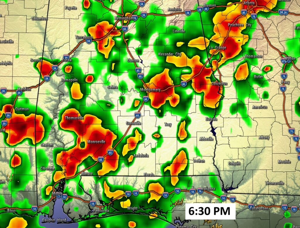
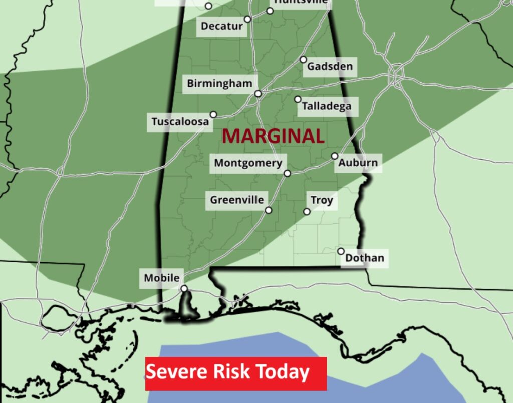
SPC says some storms could reach Severe limits with damaging wind gusts. Level 1 Marginal Severe Risk.
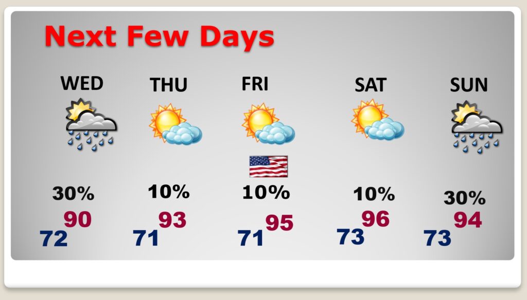
NEXT FEW DAYS: Numerous Random storms Tuesday. But, starting Wednesday through the end of the week Friday (4th of July) and Saturday, the number of PM storms will thin out dramatically. Days will be getting hotter. Just in time for the holiday weekend, highs will edge into the mid 90’s by the weekend.
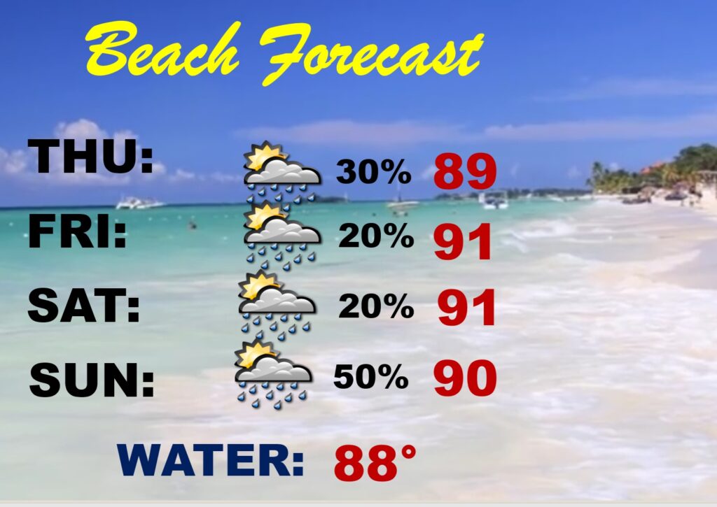
BEACH FORECAST: Pretty routine weekend forecast. Spotty scattered storms. Highs near 90. Gulf water 88.
TROPICAL: There is an Area to Watch in the eastern coast into the Atlantic. A stalled front may promote possible tropical development by late this week. 20% chance of development.
Thanks for reading the blog. Today everything is normal including LIVE on the Radio of NewsTalk 93.1 WACV. There will be another video forecast discussion and Blog Update in the 4 o’clock hours tomorrow morning. You can always find my forecast updates hourly on the 8 station Bluewater family of stations every day of the year.
–Rich