
Good morning! Radar will be rather active today and tomorrow, especially in the afternoon and evening hours (70-80% chance). Otherwise, this last day of June and first day of July will be rather sun/cloud mix. But, starting Wednesday through the end of the week Friday (4th of July) and Saturday, the number of PM storms will thin out dramatically. Days will be getting hotter. Just in time for the holiday weekend, highs will edge into the mid 90’s by the weekend, with triple digit Heat Index. Meanwhile, the tropics are starting to come alive. Barry was named yesterday in the SW Gulf. And there’s a new Area to Watch in the NE Gulf. Here’s my Video Forecast Discussion.
TODAY: Sun/Clouds. Hi 91. Random Showers and Storms will be rather numerous especially in the afternoon/evening. Low tonight 71.
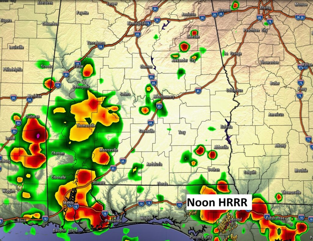
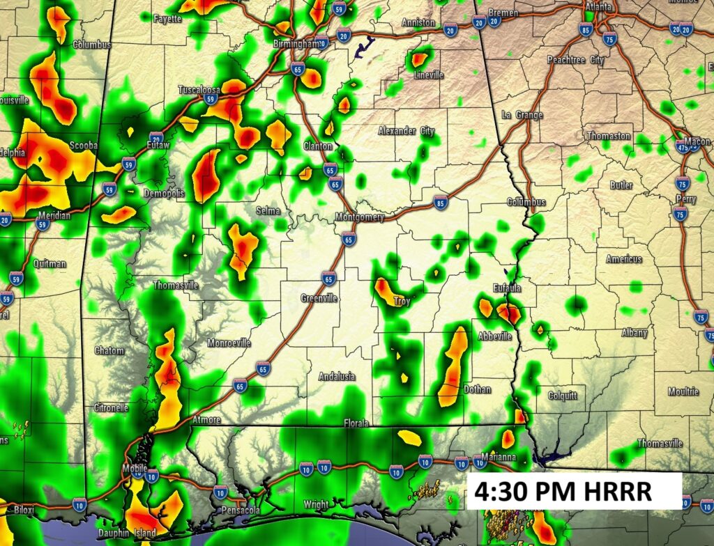
FUTURE RADAR: Random but numerous PM showers/storms.
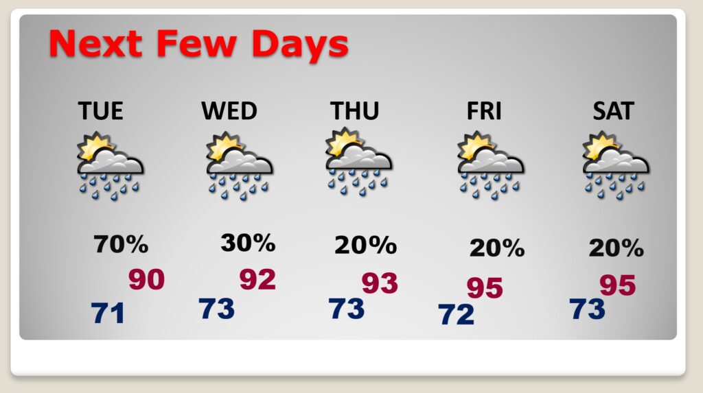
NEXT FEW DAYS: Numerous Random storms Tuesday. But, starting Wednesday through the end of the week Friday (4th of July) and Saturday, the number of PM storms will thin out dramatically. Days will be getting hotter. Just in time for the holiday weekend, highs will edge into the mid 90’s by the weekend, with triple digit Heat Index.
Here’s the Mid week front that will cause PM storms to thin out by late week.

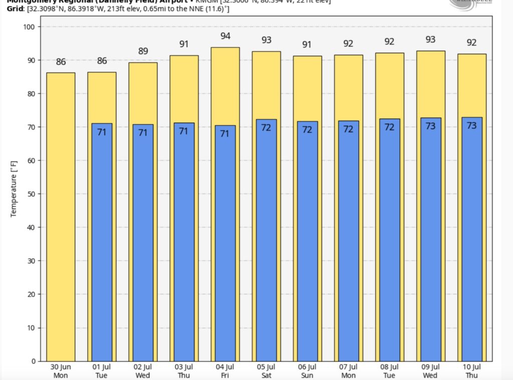
Here’s the 10 Day Temperature Trend. It won’t be long until we ease into some much hotter days, especially over the Holiday Weekend and beyond.
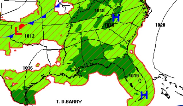
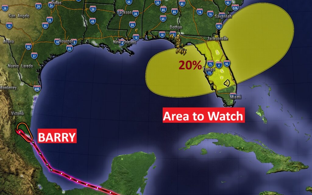
TROPICAL: Barry in now a Tropical Depression, having crossed into Mexico from the SW Gulf. There is an Area to Watch near the NE Gulf coast into the Atlantic. A stalled front may promote possible tropical development late this week. 20% chance.
Thanks for reading the blog. Today everything is normal including LIVE on the Radio of NewsTalk 93.1 WACV. There will be another video forecast discussion and Blog Update in the 4 o’clock hours tomorrow morning. You can always find my forecast updates hourly on the 8 station Bluewater family of stations every day of the year.
–Rich