
Good morning! Summer officially begins tonight. We are easing into a pattern with fewer storms on the radar. FINALLY. Widely scattered. Many towns will stay dry. Meanwhile, as a huge mound of upper level high pressure builds, it’s getting hotter and hotter. Highs will be easing closer to the middle 90’s. The heat index will be approaching the 105 danger level. We will be in this pattern for several days. Here’s my brief forecast discussion.
TODAY: Good bit of sun. Hot and humid. Fewer storms. Widely scattered. Most towns stay dry. High low to mid 90’s. Triple digit Heat Index. Low tonight 73.
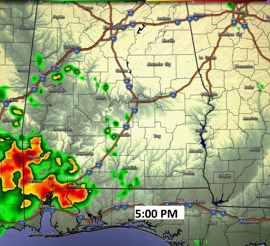
FUTURE RADAR: FINALLY today. Radar should be relatively quiet, except, perhaps in SW Alabama.
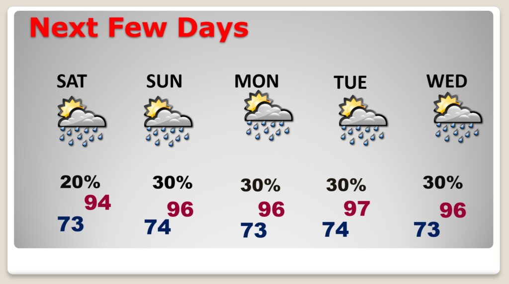
NEXT FEW DAYS: Storms will be few and far between. Close to the AVERAGE Summer Day rain chance. 30% many days. Exactly normal. Extremely hot. Mid 90’s daytime. Heat index near the 105 danger range. Nighttime lows in the extremely humid low to mid 70’s.
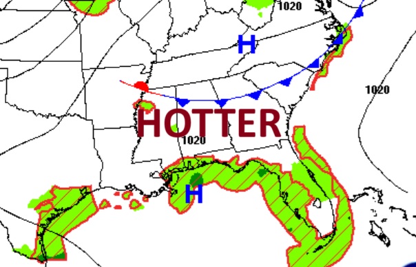
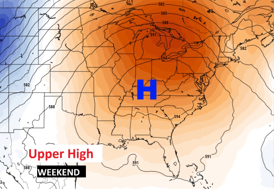
A building massive upper high will be responsible for fewer PM storms and Dangerous Heat Indices this first weekend of summer.
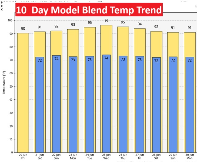
10 Day temperature trend. Get ready. Looks like some blistering heat in our future by the weekend with Dangerous Heat Indices 105 or higher.
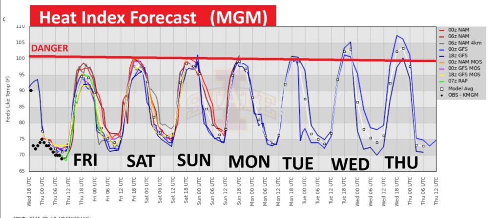
The heat index is edging closer to the DANGER RANGE. Slow down. Take it easy. Stay hydrated.
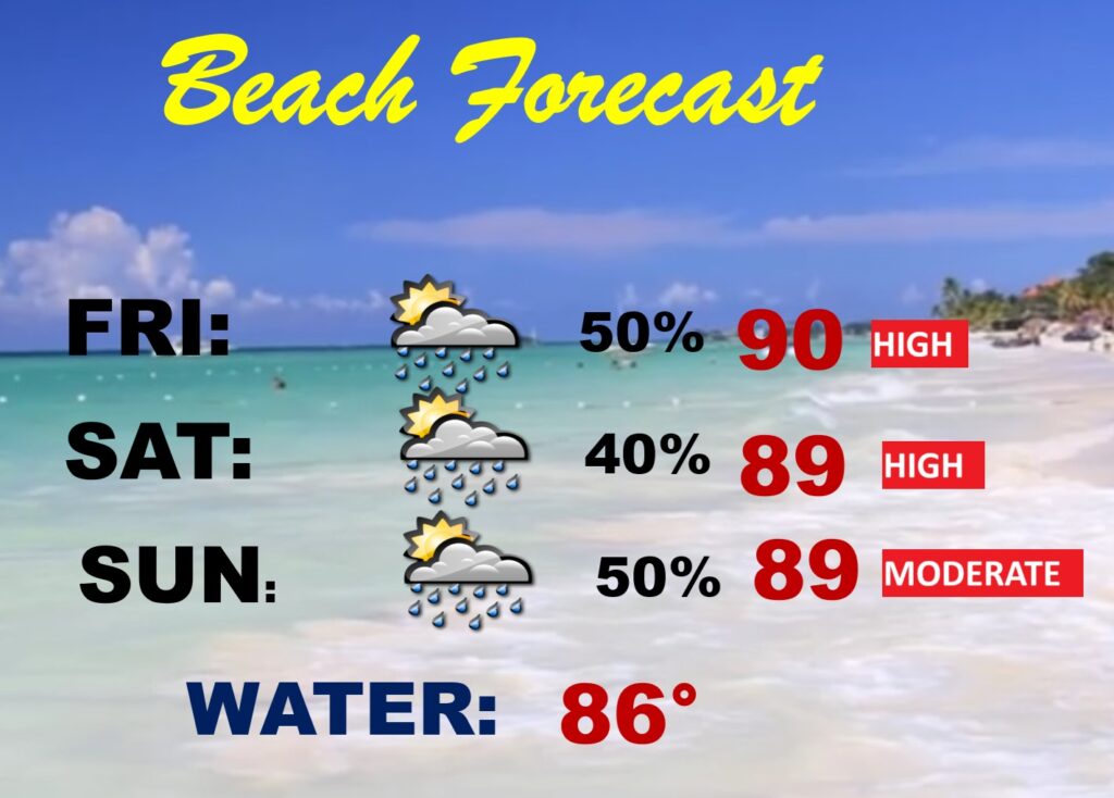
BEACH FORECAST: Much better than the last 3 weekends. Routine. Scattered spotty random mostly PM storms. High rip current risk. Gulf water at a season high 86.
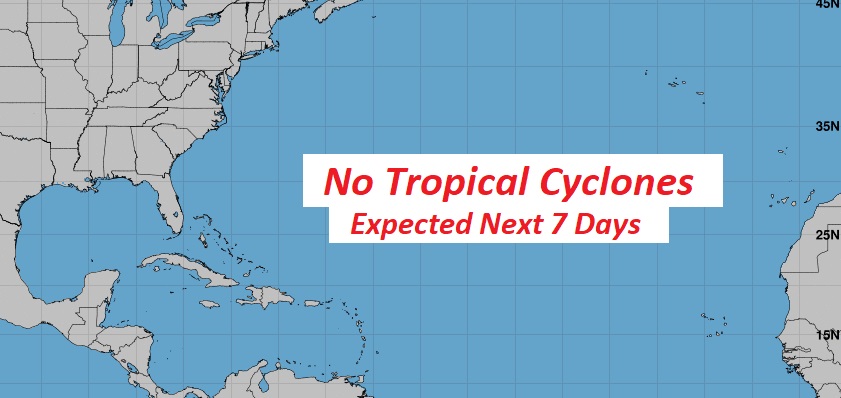
TROPICAL UPDATE: NHC says the Atlantic Basin is quiet for the next 7 days, and very likely for much of the rest of June.
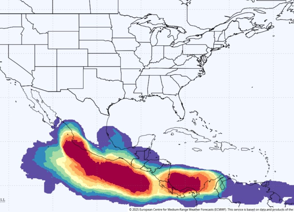
While the Atlantic is quiet, the EURO model shows the East Pacific is still on FIRE over the next 10 days. Erik came ashore yesterday.
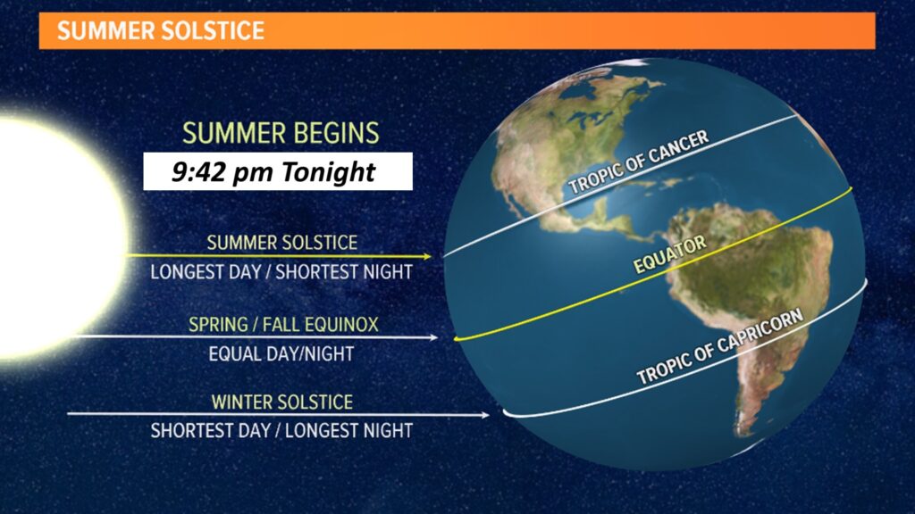
SUMMER SOLSTICE : Longest day of the year today. 14 hours 16 minutes and 36 seconds. Summer officially begins at 9:42 PM CDT. Sunrise at 5:37 AM. Sunset 7:56 PM. Tomorrow will be one second shorter. Shortest day is December 21st. Ten hours 1 minute and 33 seconds. The winter solstice.
Thanks for reading the blog. Today everything is normal including LIVE on the Radio of NewsTalk 93.1 WACV. There will be another video forecast discussion and Blog Update in the 4 o’clock hours tomorrow morning. You can always find my forecast updates hourly on the 8 station Bluewater family of stations every day of the year.
–Rich