
Good morning! We’ll be tracking some strong storms in our state today, as a band of potent storms migrate southward into central Alabama by mid to late afternoon. But, the trend will be for fewer storms on the radar starting tomorrow and into the weekend. So, your probability of running into a heavy tropical downpour will be lower. The other side of the coin is this. Expect some hotter afternoon temperatures, especially by the end of the week and over the upcoming weekend. Unfortunately, that will most likely lead to heat indices into the 105+ danger range. Today is the last full day of Spring. The summer solstice is 9:42 PM Friday night, which means Saturday is the first full day of summer with blistering heat this season. Here’s my brief forecast discussion.
TODAY: Sun/cloud mix. Scattered showers and storms most likely in the afternoon and evening hours. Some storms could produce damaging wind gusts to 60 mph. Hot and humid. High near 92. Low tonight 72.
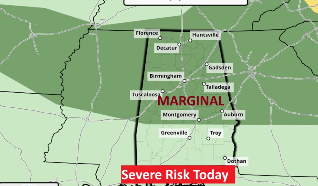
SPC has much of the state in a Level 1 Marginal Severe Risk for much of the state as far south as I-85. Some storms could produce damaging wind gusts to 60 mph.
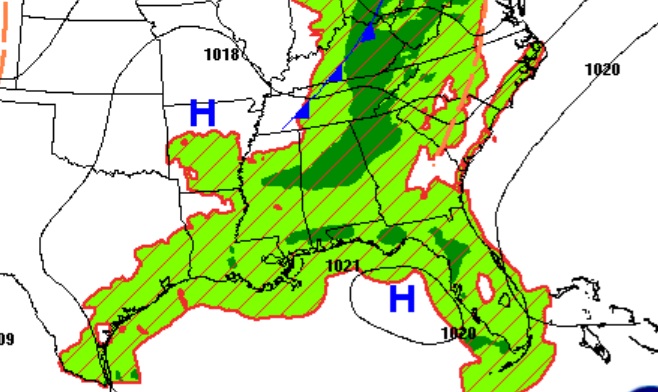
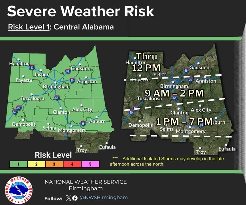
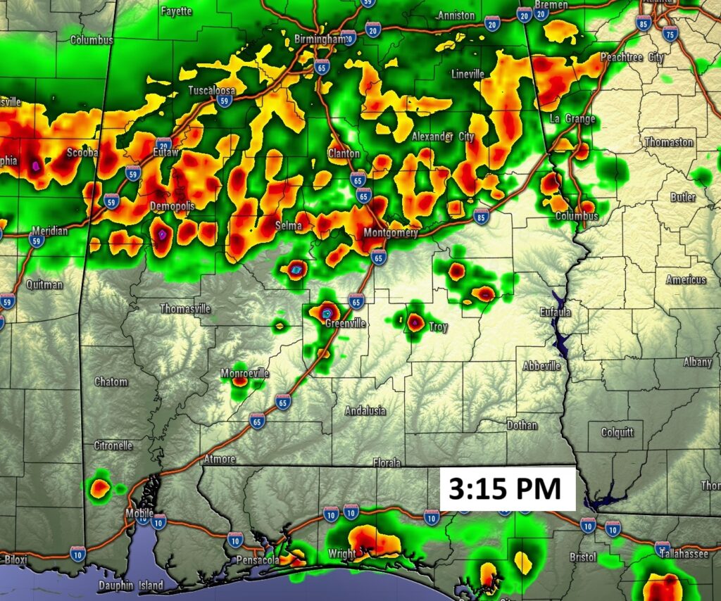
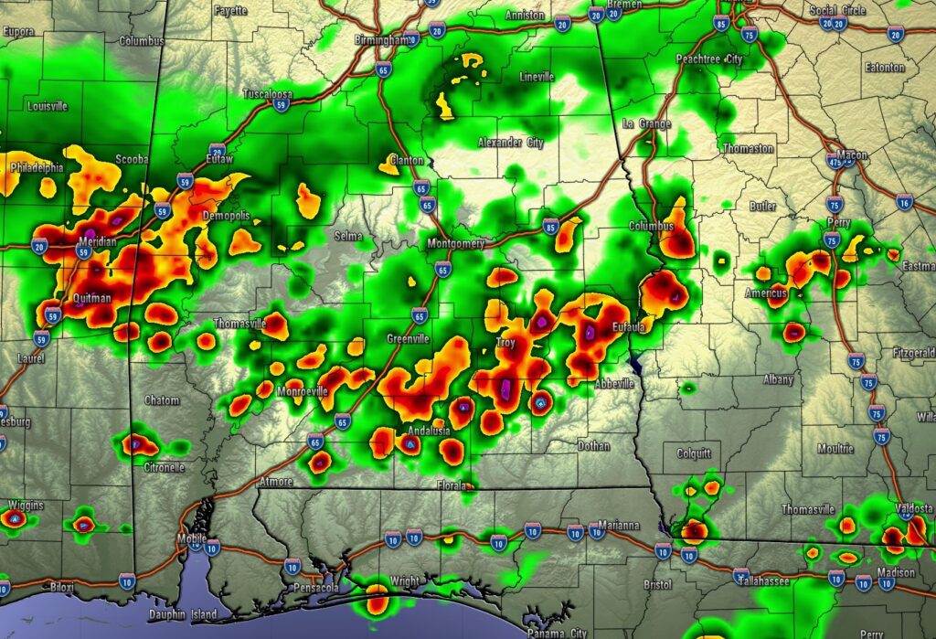
FUTURE RADAR: Watch as a prominent band of strong storms migrate southward this after afternoon and into the evening. Some storms could produce damaging wind gusts.
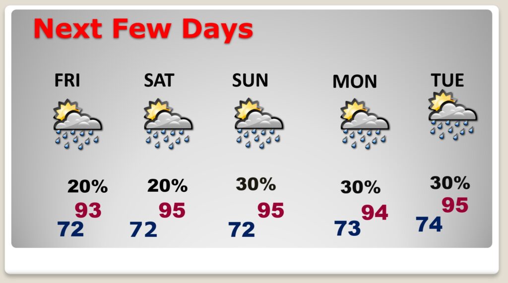
NEXT FEW DAYS: Gradually, the number of afternoon and evening storms will start to thin out a bit. Not as many storms on the radar. But, get ready. We are going to start to heat up by late week and into the weekend as upper level high pressure builds. Storms will not be as numerous. But, Triple Digit Heat indices the 105+ danger range will become common.
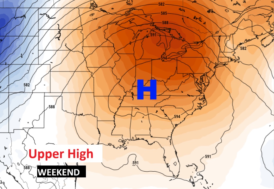
A building massive upper high will be responsible for fewer PM storms and Dangerous Heat Indices by the weekend.
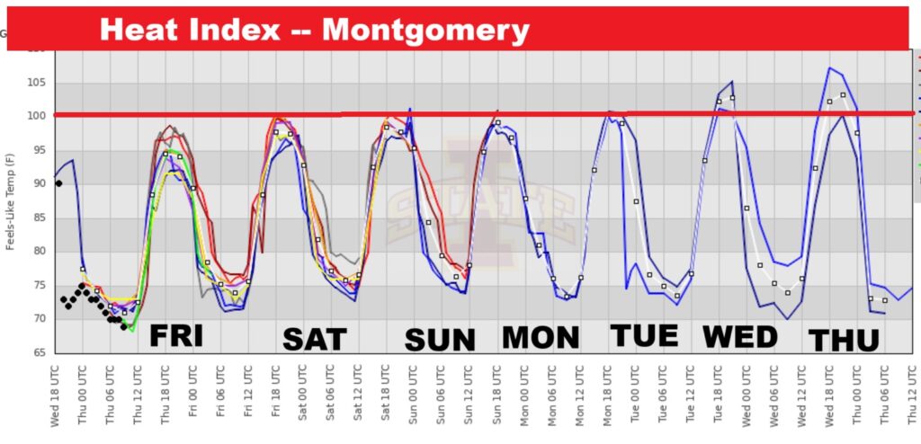
10 Day temperature trend. Get ready. Looks like some blistering heat in our future by the weekend with Dangerous Heat Indices 105 or higher.
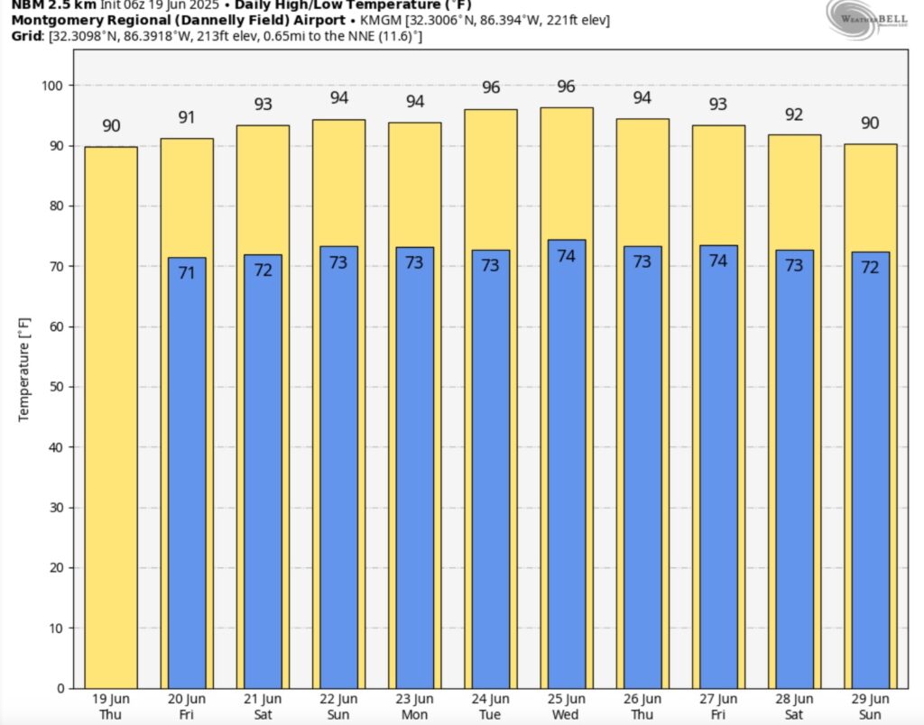
Ouch. Check out the Heat Index for the next several days. Triple digits. 105 is the Danger Range. Oh boy….
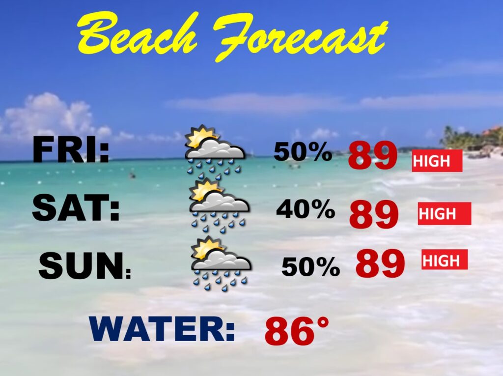
BEACH FORECAST: Better than last weekend. Scattered spotty random mostly PM storms. Pretty routine. High rip current risk. Gulf water at a season high 86.
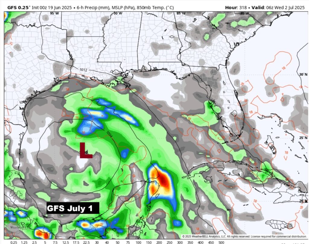
TROPICAL UPDATE: NHC says the Atlantic Basin is quiet for the next 7 days, and very likely for much of the rest of June.
However, this is interesting. The American GFS shows a tropical Low in the west Gulf on the first of July. We do not always trust the GFS. Stay tuned
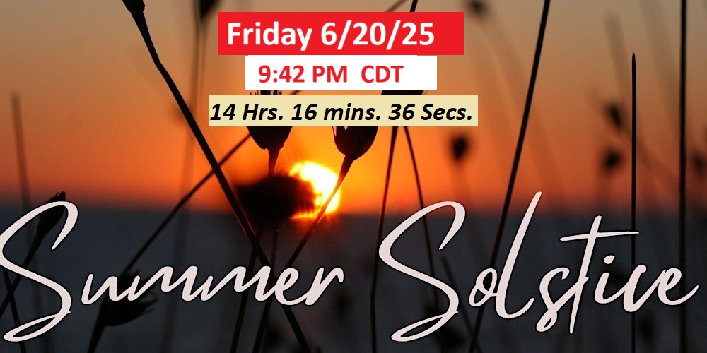
SUMMER SOLSTICE FRIDAY: Today is the last full day of Spring. The official first day of summer, Friday at 9:42 pm CDT. Longest day of the year. 14 hours 16 minutes and 36 seconds.
Thanks for reading the blog. Today everything is normal including LIVE on the Radio of NewsTalk 93.1 WACV. There will be another video forecast discussion and Blog Update in the 4 o’clock hours tomorrow morning. You can always find my forecast updates hourly on the 8 station Bluewater family of stations every day of the year.
–Rich